cartography
-
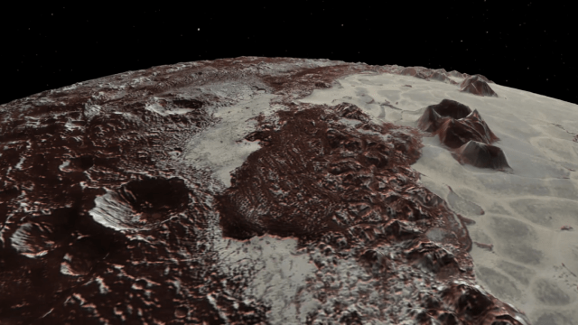
These New Maps Of Pluto And Its Moon Charon Are The Most Detailed Yet

By meticulously stitching together photos taken from two cameras aboard the New Horizons spacecraft, a team of scientists has compiled the most accurate maps of Pluto and Charon to date.
-
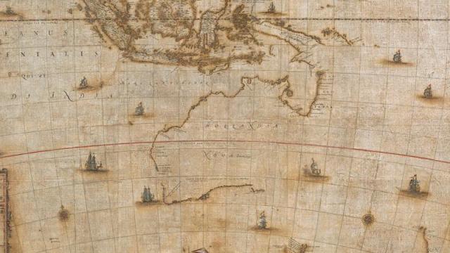
350-Year-Old Map Of Australia Restored To Its Former Glory

Lost for hundreds of years, a recently recovered map of Australia dating back to the 17th century has finally been restored and put on display at a museum in Canberra. The document chronicles the mapping efforts of explorers a full 100 years before Captain James Cook set sail for the Pacific.
-
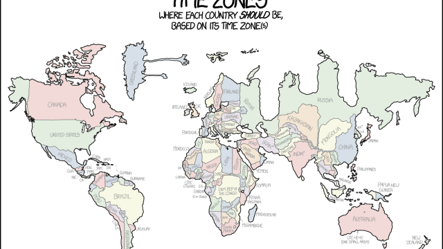
Distorted Map Shows Each Country Forced Into Its Time Zone
A new map from XKCD’s Randal Monroe offers a glimpse into a bizarre alternate world where each country is forcibly squeezed into its respective time zone(s).
-
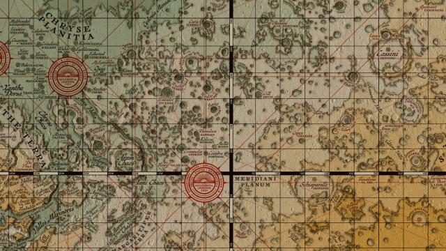
What Mars Would Look Like Mapped By Medieval Cartographers
What can one expect to find out on the dusty plains of Mars? This new map shows you through the eyes of a medieval cartographer.