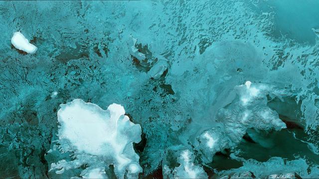
Image Cache: The European Space Agency launched its latest satellite at the start of the week, and it’s already beaming back beautiful images like this one.
Browse through the cool photos, animations and diagrams in Gizmodo’s Image Cache here.
The Sentinel-1B satellite was launched aboard a Soyuz rocket from Europe’s Spaceport in French Guiana on April 25. Once in orbit, it had to unfurl a 12m radar system and a pair of 10m solar wings. Then, finally, it could get to business.
Just yesterday it sent this first image back to Earth. The picture shows 250km of the Barents Sea across its width. At the bottom, you can see the Norwegian archipelago of Svalbard.
Sentinel-1B joins its sibling Sentinel-1A in orbit. Over time, 1B will align its orbit so that it’s on the exact other side of Earth to 1A. The pair will image the environment — whether its vegetation health or natural disasters — on the surface of the planet.
[ESA]