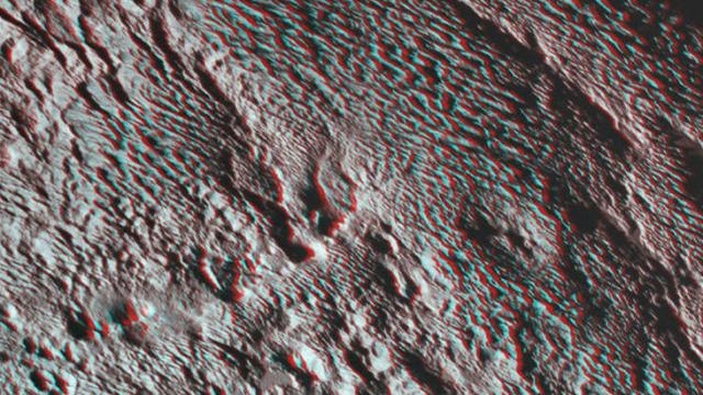
NASA has released a new image of Pluto’s Tartarus Dorsa, the ‘bladed’ region to the east of the heart-shaped formation known as the Tombaugh Region. The 3D image reminds us of how weird the dwarf planet is.
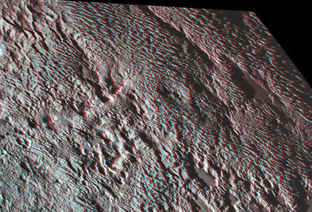
Photo: NASA/JHUAPL/SwRI
You can use regular 3D glasses to take a look at the image, which shows off terrain unlike anything we’ve found in all of our exploration of the solar system:
The blades are the dominant feature of a broad area informally named Tartarus Dorsa. They align from north to south, reach hundreds of feet high and are typically spaced a few miles apart. This remarkable landform, unlike any other seen in our solar system, is perched on a much broader set of rounded ridges that are separated by flat valley floors.
The Bladed Terrain of Tartarus Dorsa. Photo: NASA/JHUAPL/SwRI
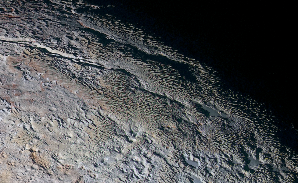
Pluto’s ‘snakeskin’ terrain has baffled astronomers ever since we first got a good glimpse of it back in September. A couple of weeks ago, astronomer Orkan Umurhan theorised in a blog post that the methane ice could be responsible for the steep structures:
The answer is a meek “maybe.” To date, there are only two known published studies examining the rheological properties (i.e., how much a material deforms when stresses are applied to it) of methane ice in the extreme temperature range of Pluto — a bitterly cold -300 to -400 degrees Fahrenheit [-184C to -240C]. According to one study, the answer is a definite ‘no,’ because methane ice of those dimensions would flatten out in a matter of decades. Yet in another study, methane ice may maintain such a steepened structure if the individual CH4 ice grains constituting the collective ice are large enough. Which study is right? Or is there a way to reconcile them? This is something we simply do not know at the moment.
The 3D picture was taken at a distance of 1.6 million kilometres and combines two images from New Horizon’s Ralph/Multispectral Visible Imaging Camera.
[NASA]