When you launch a new satellite, how do you know for sure that its measurements are accurate? It’s a lot harder than you’d think — and NASA is heading to the Pacific Northwest to do it. Pack animals are involved.
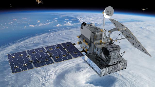
Last year, NASA launched a new satellite called GPM that aims to measure snow and rainfall over the entire globe, every three hours. It’s next generation technology, but it also needs to be tested — and calibrating a satellite in space is very, very complicated. Starting yesterday and ending in December, scientists will use the super-rainy, super-snowy, super-diverse-in-general Pacific Northwest winter to help do just that, on a mission called Olympex.
The first part of the experiment is relatively simple, though daunting: The team is trekking into the wilds of the Olympic Mountains to set up and maintain sensors for precipitation in areas that range from light rainfall to extremely heavy rainfall to heavy snowfall. Some of these areas are so remote, they’re using mules to cart the technology into the mountains, as KoMo News reports:
There will also be a plane flying through storm clouds above, taking accurate measurements of things like water droplets and ice formation — plus radar set up specifically to study cloud formation from these remote, rainy areas.
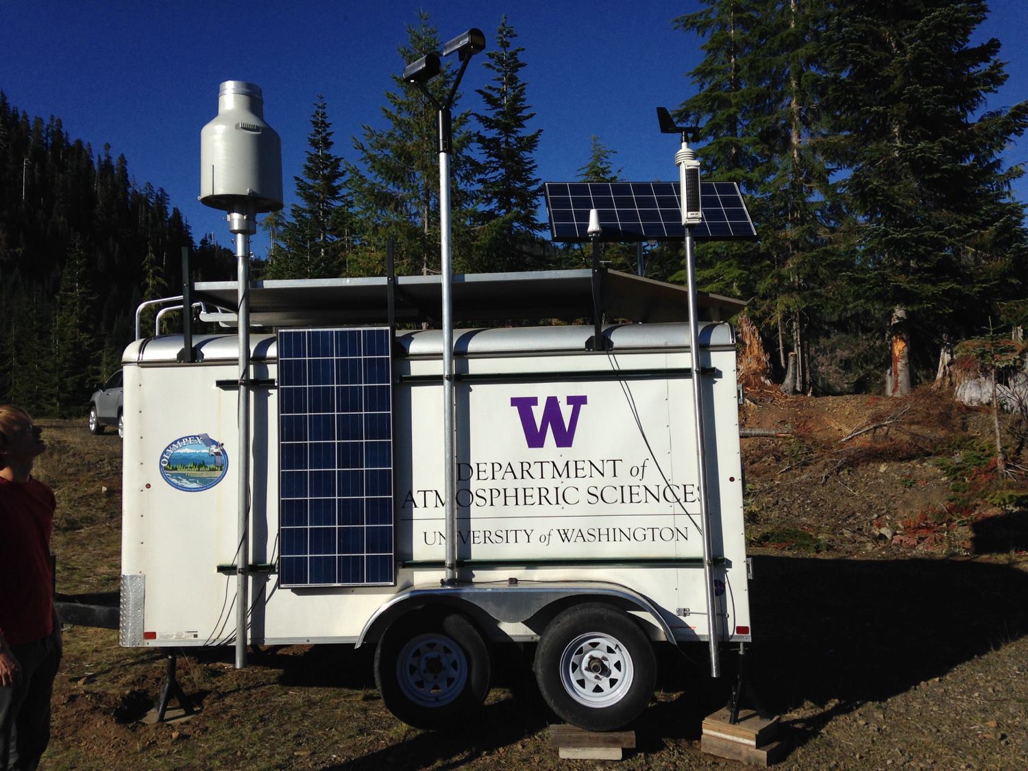
University of Washington
All of that will give scientists from NASA and the University of Washington a baseline for how much snow and rain is really falling.
But what comes next is really fascinating: NASA is, in essence, recreating the GPM satellite using ordinary planes. They’re installing sensors and hardware that are like those onboard the GPM satellite on two different planes — one flying at 11,000m and one flying at 20,000m — to record the kind of data that the satellite would over the Olympic region. That way, they will have satellite-style data to compare to the baseline data coming from the ground and the clouds.
The idea is to build a stand-in for the satellite here on Earth — and then see just how accurate it really is. The project’s leader, University of Washington Scientist Bob Houze, put it this way: “All of these measurements are aimed at determining if the assumptions that we’re making about interpreting the satellite measurements are correct.”
In a new video about the project, the scientists describe why they picked the Pacific Northwest: This corner of the world has an extraordinarily diverse and dramatic number of weather events, ranging from coastal systems to intense rainfall in the mountains:
The Olympex project isn’t just about calibrating the GPM satellite either: It’s also going to give these scientists an unprecedented 3D look at the clouds and weather patterns from above and below.
We tend to think of satellite data as the gold standard. But in reality, it’s just as fallible — perhaps even moreso — as what any sensors record. To tell whether what we see from space matches up with what we see from the surface of the Earth is almost as complicated as getting to space in the first place. We’ll be watching to find out what Olympex observes over the next few months.
Lead image: NASA