Beneath all its nostalgia and fantasy, Disneyland is a space that carefully orchestrates the visitor’s visual experience. Forced perspective, an old trick of Hollywood set designers, makes the fairy-tale castle appear bigger than it actually is. Walking paths guide visitors through a three-dimensional story, told through themed buildings and landscaping. An earthen berm encircles the park and shrouds the outside world from the visitor’s eye, preserving Disney’s elaborate illusion.
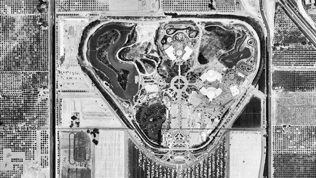
But from 60m up, that illusion breaks down. Instead, the park looks like a sort of alien landscape, a collection of odd patterns on the land organised around a central hub and bounded by a rounded, inverted triangle. It looks especially strange in the black-and-white photograph in the above GIF, taken on Disneyland’s opening day in 1955. Then, the surrounding grid of orange groves and country roads ends abruptly at the railroad tracks that enclose the park.
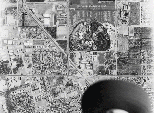
By 2014, the surrounding tourist infrastructure makes the transition look less jarring, but Disneyland — designed by a team of motion picture animators and art directors — still looks unlike anything we see in traditional cities designed by hundreds of architects and planners working independently. And yet, with it rounded edges and its defiance of the orthogonal grid, Disneyland from the air does bear a striking resemblance to the Southland’s master-planned suburbs, like nearby Irvine or Mission Viejo.
Comparing the two images also reveals how the park has grown. Large sound stages outside the park’s original western perimeter now house the Haunted Mansion, Pirates of the Caribbean, and Indiana Jones rides. Expansion has also altered the route of the Disneyland Railroad along the park’s northern boundary. And to the south, a new theme park — Disney California Adventure — occupies Disneyland’s former parking lots.
The GIF comparison below features a black-and-white photograph from circa 1965 and shows more of the surrounding city. Note that north is down, and south is up:
What changes strike you most? Leave your observations in the comments below.
Pictures: 1955 aerial photo courtesy of the Orange County Archives; circa 1965 aerial photo courtesy of the USC Libraries — Dick Whittington Photography Collection; 2014 imagery from Google Earth.