The work of photographer Mark Willis combines advanced imaging and fabrication technologies with archaeological exploration, often producing breathtaking images, 3D models and highly accurate virtual environments from ancient sites in the US southwest.
His blog — sadly, not updated since 2011 — includes references to polynomial texture mapping for reconstructing abandoned villages, an exhaustive step-by-step guide for using point clouds in landscape models, a how-to guide for making 3D-printed replicas of ancient artefacts, and even using Structure-from-Motion analyses for measuring the deterioration of rock art over time.
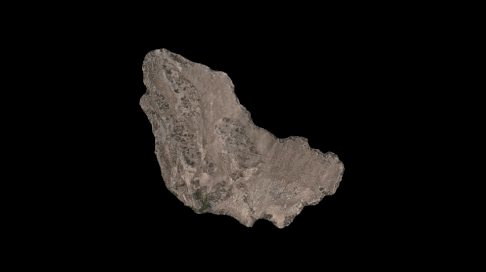
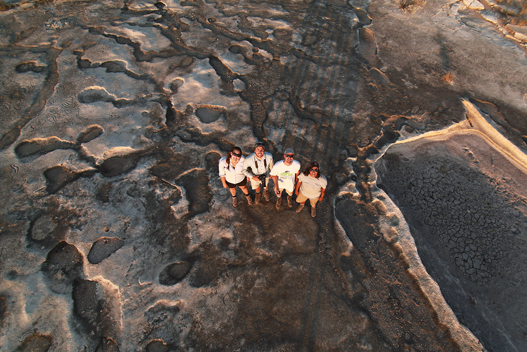
But the state of his blog is no indication of his ongoing activity. Willis, working with the Shumla School in west Texas — it describes itself as a “nonprofit archaeological research and education centre” — Willis recently released an astonishing 35.32 gigapixel aerial image documenting petroglyphs in the remote Lewis Canyon, also in Texas.
There, Willis explains, “Hundreds or maybe thousands of prehistoric petroglyphs were carved into the rock. Some of the designs appear to resemble atl atls (a dart throwing weapon), human-like figures, animals, and animal tracks but the most common elements are abstract circles, lines and dots.” Some of them also look remarkably phallic.
Capturing in all required more than 2400 separate photographs.
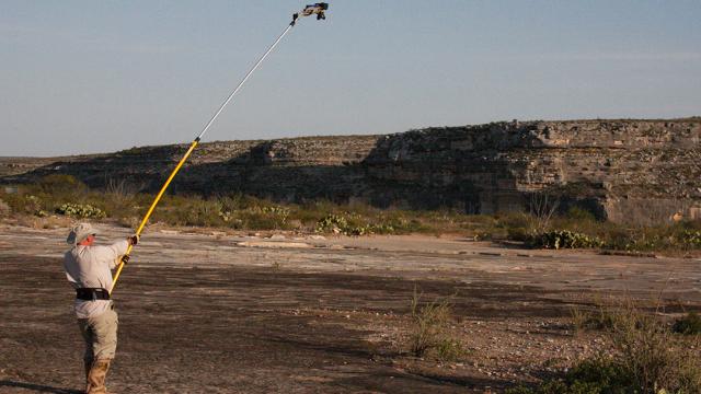
So how was it made? Willis writes: “A group of five archaeologists walked a series of transects across the site holding a Canon digital SLR camera on the end of painter’s pole, taking photos straight down at about every 2.5 mnetres across the entire site. The surface of the sites is more than 175 metres east/west by 160 metres north/south.”
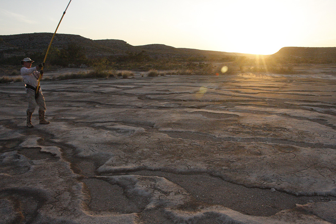
Even the time of day was carefully considered, to allow for the best possible shadows cast by the petroglyphs to be read from above.
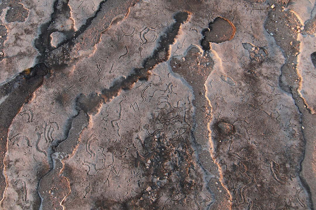
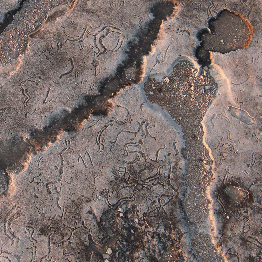
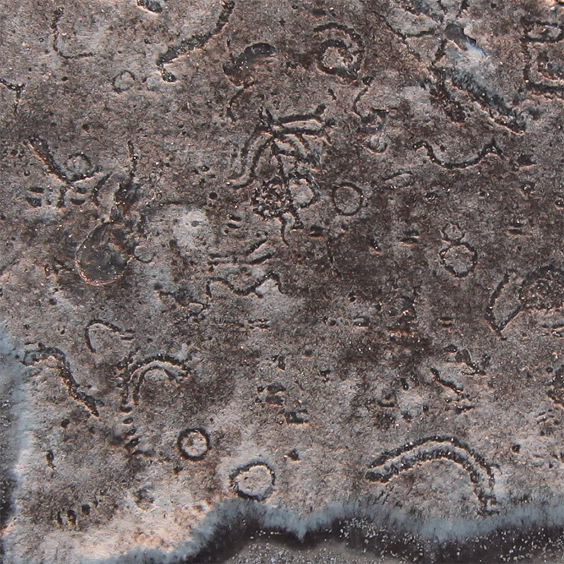
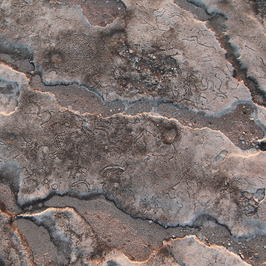
Willis sent Gizmodo a series of individual shots taken by “polecam” at the site, prior to their being stitched into the 36-gigapixel whole. In them, the petroglyphs are barely visible amidst the natural weathering of the rocks.
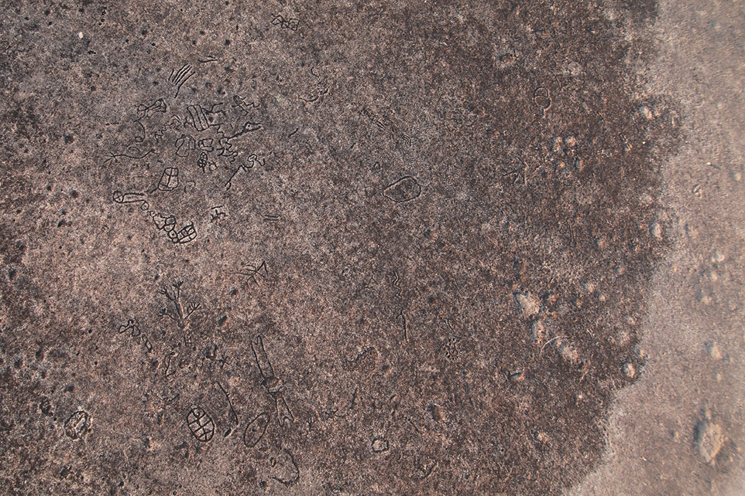
But cut in just a little, and the signs, sigils, and symbols become clear, like hallucinations written into the earth.
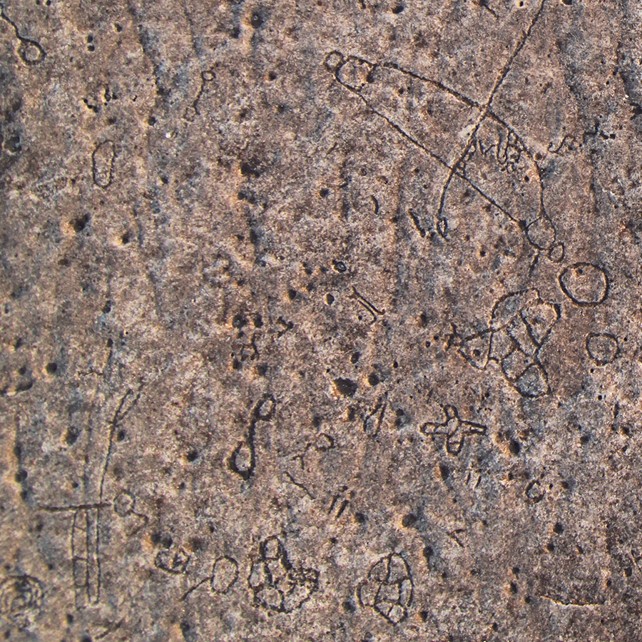
Indeed, anthropologist Solveig A. Turpin, writing in the Plains Anthropologist, describes many of the “grids, parallel lines, dots, zigzags, nested curves, meandering lines, and vortices” seen in the elaborate site as “all elemental forms associated with altered states of consciousness.”
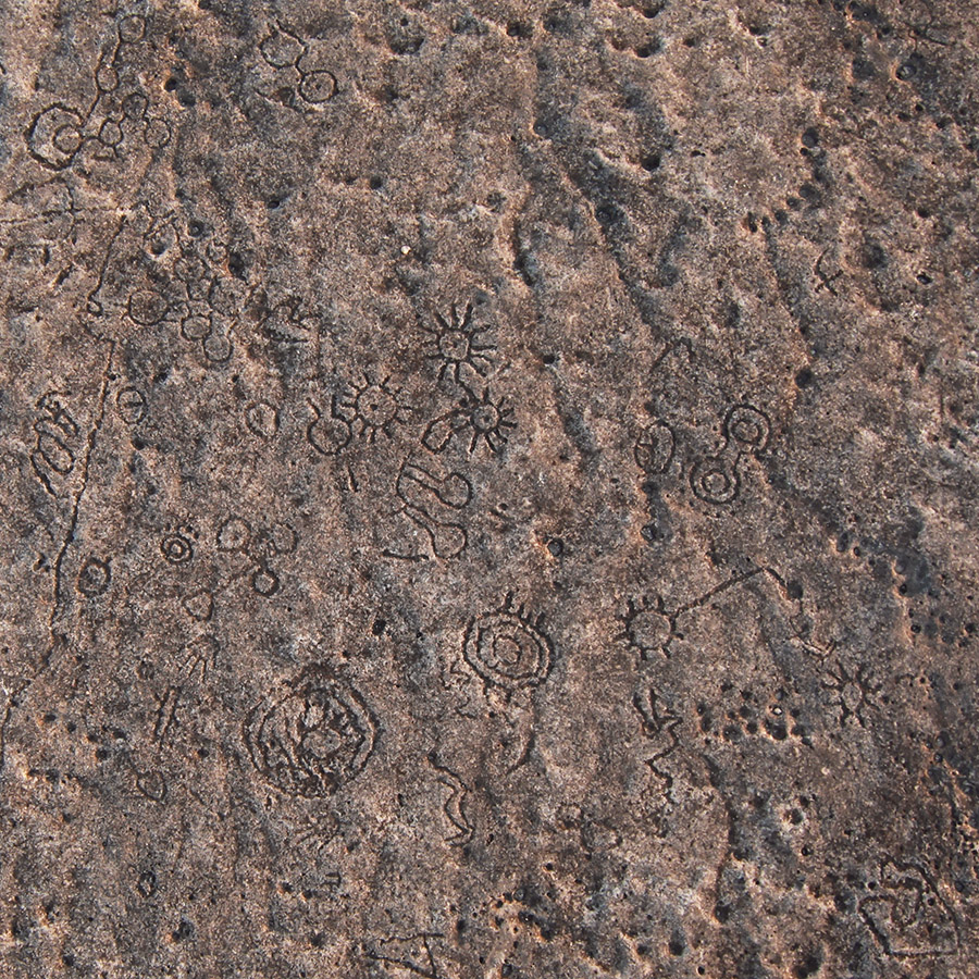
The glyphs themselves have been actively studied since at least the 1930s, but a vast, previously unseen expanse of inscriptions was found buried under sediment from the surrounding floodplains. The majority of the shots you see here show those glyphs.
The sheer scope of the site becomes clear if you look at Willis’s complete Gigapan image, zooming in at multiple locations and examining the limestone surface for marks.
The team is not done, however, with future collaboration still in the works. We’ll check back in on them here on Gizmodo in the season to come.
Pictures: Mark Willis/Shumla School. Landscape GIF by Nicholas Stango