Although he never actually crossed it, the Greek mathematician Pythagoras is sometimes credited with having first conceived of the Equator, calculating its location on the Earth’s sphere more than four centuries before the birth of Christ. Aristotle, who never stepped over it either and knew nothing about the landscape surrounding it, pictured the equatorial region as a land so hot that no one could survive there: the ‘Torrid Zone’.
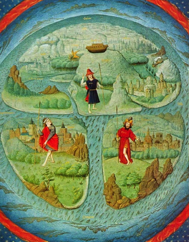
Medieval Christian mapmakers, familiar only with a small corner of the planet, worked within strict horizons that were fixed by the Church’s interpretation of the Bible. Their Earth was flat. First created in the 7th century, the Christian orbis terrarum (circle of the Earth) maps, known for visual reasons as ‘T-and-O’ maps, included only the northern hemisphere.
This medieval argument was still rumbling on when Columbus first sailed southwest from Spain to the ‘Indies’ in 1492. Columbus, who had seen sub-Saharans in Portuguese ports in west Africa, disagreed with the Church: he claimed that the Torrid Zone was ‘not uninhabitable’. Columbus’s eventual ‘discovery’ of America stretched the horizons of the European mind. The Equator was gradually reimagined: no longer the extreme limit of humanity, a geographical hell on Earth, it became simply the middle of the Earth.
Busloads of tourists flock to the place to witness firsthand the ‘unique forces at play’ on the Equator, which is indicated by a red line that cuts through the middle of the museum.
What ‘unique forces’ are at play, then? The velocity of the Earth’s rotation varies depending on where you stand: 1600km/h at the Equator versus almost zero at the poles. That means that the fastest sunrises and sunsets on the planet occur on the Equator, and centrifugal and inertial forces are also much greater there. Together, they produce what is known as the Coriolis effect, which largely determines the direction of weather systems, ocean currents, the east-west path of hurricanes, and the fact that tornados spin in opposite directions on each side of the Equator (it is not enough, however, to alter the equilibrium of eggs on a nail or the spiral of a gallon of water in a sink).
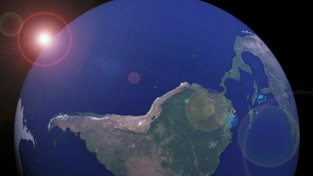
Because of these same centrifugal forces, the Earth’s diameter at the Equator is approximately 43km greater than from pole to pole. Instead of a sphere, our planet is shaped like an M&M (or, asNew Scientist claimed in 2011, like a lumpy potato). The extra distance from the Earth’s core means that gravity is weaker at the Equator: about 0.6 per cent weaker than at the poles. And the equatorial bulge means that the Earth’s highest point, when measured by the distance from its core (rather than sea level), is not the peak of Mount Everest but that of Mount Chimborazo in Ecuador.
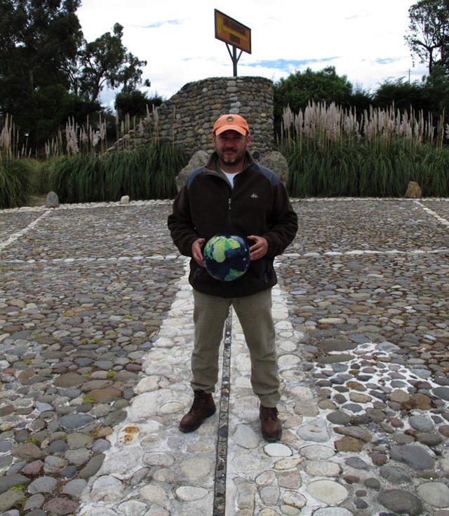
Cobo on the line of the Equator at the giant Quitsato sundial. Photo by Kurt Hollander
Cristóbal Cobo, a deep-voiced outdoorsman in his late 40s and self-taught Ecuadorian astronomer, anthropologist and geographer, used to make frequent visits from his native Quito to the mountain range 16km to the north to go hang-gliding. His solo flights gave him a bird’s-eye-view of the area, while his use of GPS technology, GoogleEarth and Stellarium helped him to track the line of the Equator throughout the region.
In particular, Cobo has problems with the direction that mapmaking has taken. In 150AD, Ptolemy drew the first world map with north placed firmly at the top. This orientation has become the standard one for maps everywhere. The preeminence of north derives from the use of Polaris, also known as the North Star, as the guiding light for sailors. Yet Polaris, or any other star for that matter, is not a fixed point. Because of the Sun and Moon’s gravitational attraction, the Earth actually moves like a wobbling top. This wobble, known to astronomers as the precession of the Equator, represents a cyclical shift in the Earth’s axis of rotation. It makes the stars seem to migrate across the sky at the rate of about one degree every 72 years. This gradual shift means that Polaris will eventually cease to be viewed as the North Star, and sailors will have to orient themselves by other means.
According to Cobo, the best point that we can use to orient ourselves is the Sun rising in the east above the Equator. As he points out, the very word orientation comes from the Latin oriens, which means east, or sunrise, while ‘disorient’ means losing direction, losing one’s way or, literally, losing the east. In Western culture, north is used to determine all other directions, yet the origin of the word itself comes from the Proto-Indo-European prefix ner-, which means down or under, but also left, and was commonly used as ‘left when facing the rising sun’. Thus, in order to determine north, one needs to know the direction east.
In 1569, the Flemish cartographer Gerardus Mercator, the first to mass-produce Earth and star globes, devised a system for projecting the round Earth onto a flat sheet of paper. His ‘new and augmented description of Earth corrected for the use of sailors’ made the Earth the same width at the Equator and the poles, thus distorting the size of the continents. Although Mercator created his projection (still used today in almost all world maps) for navigation purposes, his scheme led to a bloated sense of self for the northern countries, located at the top of the map, while diminishing the southern hemisphere’s sense of size and importance.
The positioning of the northern above the southern hemisphere, and the distortion of their true size on most maps, has divided the globe into simplistic binary oppositions: First versus Third World; civilised versus primitive; developed versus underdeveloped countries. In fact, it would make more sense to divide the world into Aristotle’s Temperate, Torrid and Frigid zones, for it is not the southern hemisphere that has the greatest concentration of poverty, but rather the equatorial region.
From the beginning, more than being purely representations of the physical world, maps have been projections of man’s sense of self-importance onto the space around him. They have often been influenced by imperial or religious interests, props to the privileged status of certain cultures. Cobo believes that many of the geopolitical, ideological and economic hierarchies that shape our vision of the world would ‘disappear’ if the globe were laid on its side and all maps were rotated 90 degrees counterclockwise, putting the east on top of the world and north with south spread out on either side of the Equator.
It is true that in space, directions don’t exist. On Earth, however, east is our most universal orientation. One loses sight of the southern celestial hemisphere when facing north, and it is only by gazing east that one can see both the northern and southern constellations simultaneously as the stars pass by overhead. As our planet hurtles through space, whipping around on its axis, the wind, the sun and the stars, but also time and the future, approach us from the east. There is nowhere we can better appreciate the movement of the skies, better understand our place in the universe, than when we stand on the line that wraps around the middle of the Earth and watch the heavens streaming towards us.
Aeon is a new digital magazine of ideas and culture, publishing an original essay every weekday. It sets out to invigorate conversations about worldviews, commissioning fine writers in a range of genres, including memoir, science and social reportage. This article has been excerpted with permission from Aeon Magazine. To read in its entirety, head here.