cartography
-
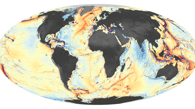
Here’s The Most Complete Ocean Floor Map Ever Made

What lies beneath the deep blue sea? So much more than you might think.
-
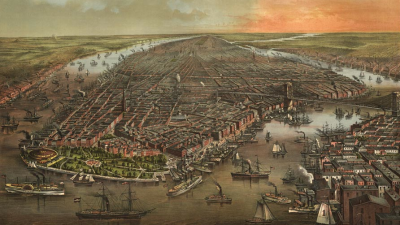
What Every Block Of New York City Looked Like 400 Years Ago

Where the Chrysler Building stands, there may have been grey wolves and hoary bats. Chinatown was home to a long tidal creek and salty marsh. A Lenape trail wound through the entrance to the Brooklyn Bridge.

-
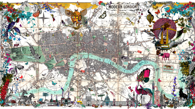
These Richly Detailed Maps Give The Modern World A Victorian Twist
Wouldn’t we all love to live in a city where floating dirigibles shared the horizon alongside the glass towers of our modern skylines? Such is the wild world featured in the highly complex, geographically accurate illustrations of Icelandic artist Kristjana S. Williams, whose maps are part of an exhibition for the London Design Festival that…
-
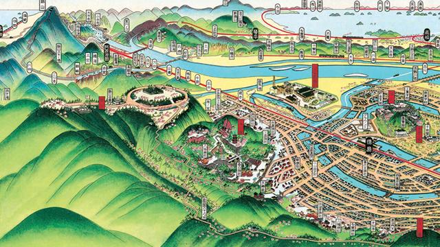
These Amazing Illustrations Are Like Google Maps For 1900s Japan
Many decades before satellites even existed, a Japanese cartographer named Hatsusaburo Yoshida was drawing cities as though he was floating thousands of feet above them. His vivid, colourful drawings are almost 100 years old now — but they’re just as exciting as they were in 1914.