
Google’s slew of apps includes some real bangers, from Google Docs to Google Calendar, all tuned to work across devices and in tandem through a Google account. But one of the coolest apps is Google Earth.
Google Earth feels like a mixture between a mapping application and an educational tool, letting you pull off some really neat things with a render of the globe.
What can you do with Google’s 3D world exploration tool, I hear you ask? Well, let’s explain.
What is Google Earth?
Google Earth is a 3D program for visualising Earth through satellite imagery. It can be used on a browser, through a smartphone app or through a computer application.
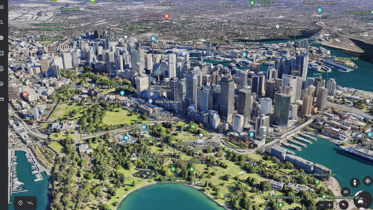
It’s a fairly advanced program that has snapped most of the planet, giving you the entire Earth to explore based on satellite and aerial photography, superimposed onto a 3D model.
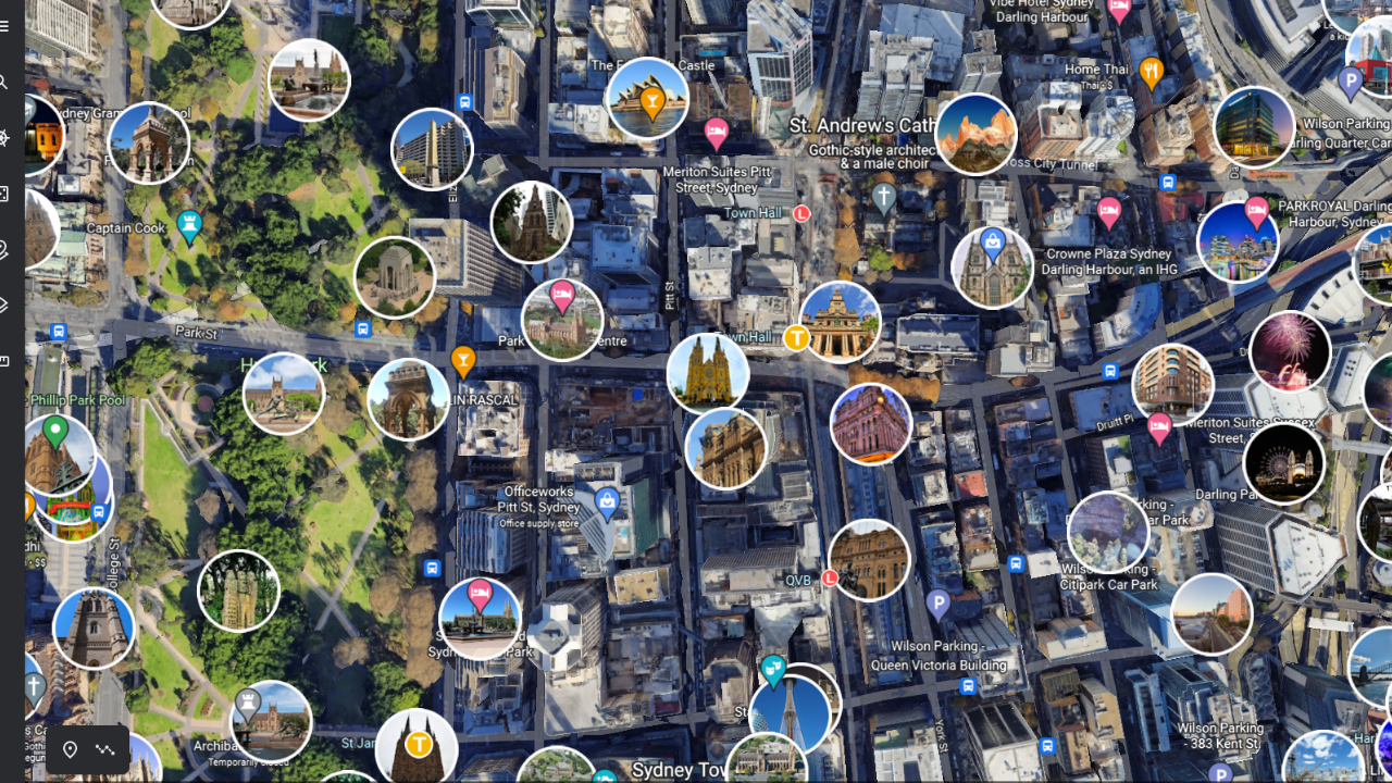
Today, the application is particularly advanced, showing 3D renders of some buildings and displaying clickable landmark pins.
What about Google Street View?
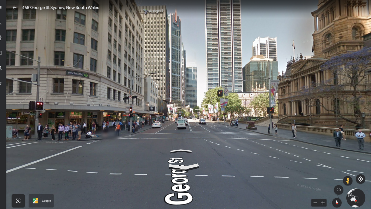
One of the key features of the app is Google Street View, which is technically a separate application. Google Street View brings you down to a street-level view of the world, letting you trek up and down roads where a 360-degree camera has been. Functionally, it fits into the Earth/Maps ecosystem quite well.
It’s really good for if you want to scope out a location before going somewhere, but it’s also good for a bit of a giggle.
How do I use Google Earth?
If you want to play with Google Earth, all you need to do is go to the website. An interactive globe will load that you can spin around and rotate. If you zoom in, locations will become much more clear.
If you zoom in close enough, you can click ‘3D’ in the bottom right corner to view the world on a slant and see 3D buildings. If you click the pedestrian icon in the bottom right, you enter Street View, bringing you down to a street level to look around.
If you want to search for a specific location, all you need to do is click the looking glass icon in the tabs to the left and type your chosen location. You can also click the Ferris Wheel icon to enable ‘Voyager’, which lets you view time-lapses of the Earth, view curated exotic locations or play games.
The Dice button in the tabs to the left will take you to a random location on Earth, the layered squares button lets you select map filters (such as animated clouds and roads or country borders), and the ruler button lets you measure distances on the Earth.
It’s a very intuitive app.
Can I use Google Earth without downloading it?
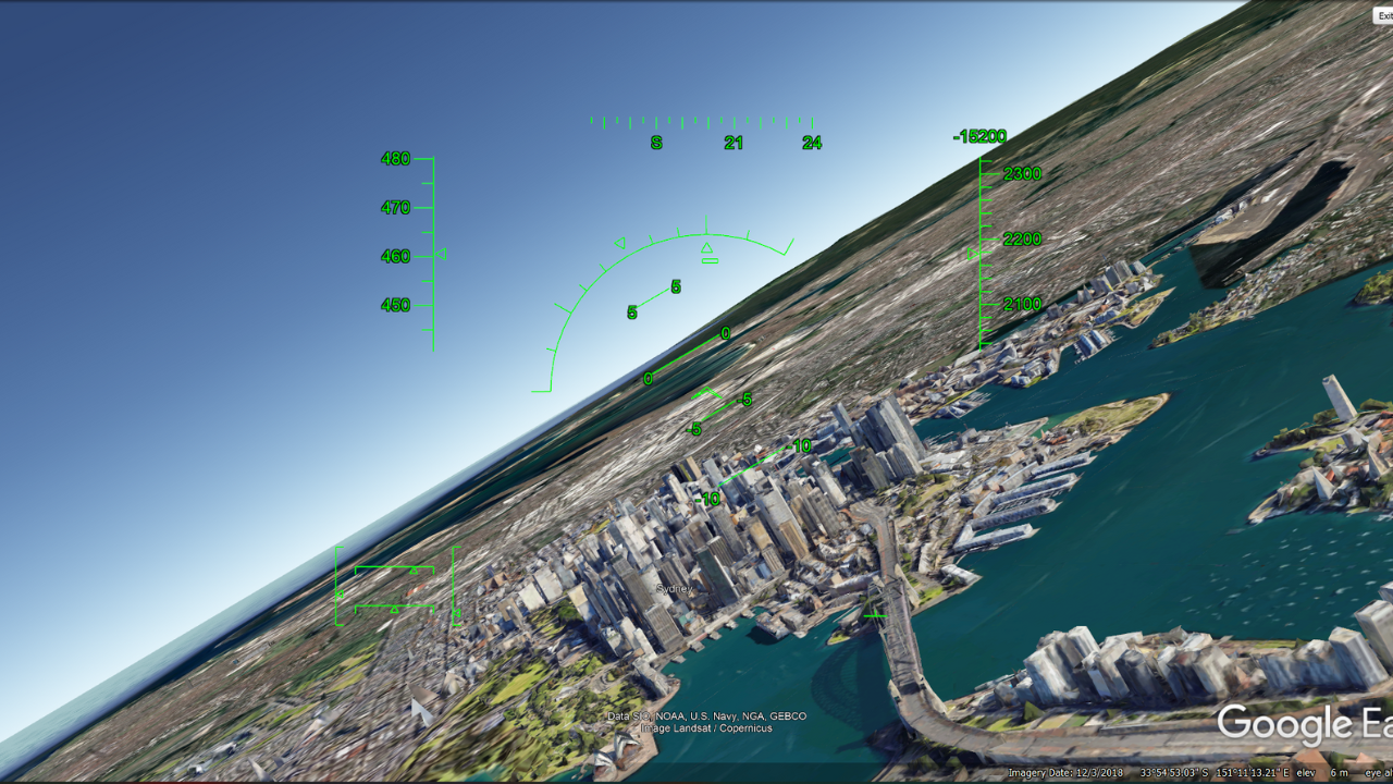
Since 2017, the app has been perfectly useable through a browser, however, the professional desktop version leverages more system resources than a browser, and has more features (like the flight simulator).
What are some cool things Google Earth can do?
At the most basic level, Google Earth lets you enter an address and travel to it on a 3D model. Although I’ve described it like that, it’s little different from Google Maps. For one, unlike Google Maps, it’s not meant to be a navigation tool.
Google Earth is more of a discovery tool, with features built around highlighting and showcasing areas of the world.
From above, like with Google Maps, there are tags for landmarks such as museums and town halls, however, you can turn it into a photo discovery tool by enabling the “Photos” setting, collating user-snapped photos.
Additionally, you can click the “Voyager” button to check out highlights from the app (or play through some quizzes), or click the “I’m feeling lucky” dice button to be taken somewhere random.
If you have Google Earth Pro, the desktop version, you can play with the inbuilt flight simulator by clicking through Tools > Enter Flight Simulator.
Are Google Earth and Google Maps the same thing?
No, they’re not the same. As we said earlier, Google Earth is more of an educational tool, meant for if you’d like to tour and explore an area from a satellite view. Google Maps, on the other hand, is a navigation tool, intended to help you get from one place to another.
Is Google Earth Live?
No, it’s not live. It’s made up of satellite and aerial imagery snapped overtime, dating back several years. Some images are older than others, which explains why some Street View images will be Autumn on one street and Summer on another.
Can I see a live satellite view of my house on Google Earth?
While you can likely see your house on the app, you can’t see it live. The shot of your home is probably a few years old, and if it’s a new property, it’s probably not even snapped yet.
Go waste some time.
This article has been updated since it was originally published.