Satellite images of Louisiana taken before and after Hurricane Ida show a dramatically altered coastline, with many low-lying areas still inundated with water. Scientists are carefully monitoring the landscape to see how it evolves over time, and whether some changes are permanent.
Hurricane Ida made landfall on August 29 — the 16th anniversary of Hurricane Katrina. The category 4 storm made a mess of Louisiana, battering the state with strong winds, heavy rain, and storm surges. Ida was one of the strongest storms to hit the state, causing mass power outages, wrecking homes and businesses, damaging roads and bridges, and causing 26 deaths in the state.
It also reshaped the landscape, though for how long we do not know. Ida swept through the Mississippi Delta, a region already vulnerable to the steady encroachment of the Atlantic Ocean. Levees, upstream dams, and rising sea levels due to human-instigated climate change are causing wetland regions to slowly shrink and even vanish. Other human activities, such as the pumping of groundwater and oil, are also contributing to this process, as is the natural sinking and settling of new delta sediment, according to NASA’s Earth Observatory.
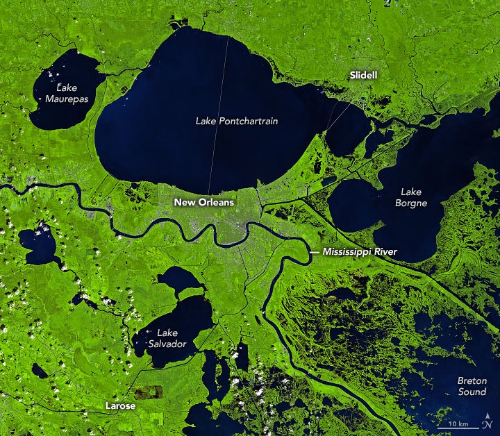
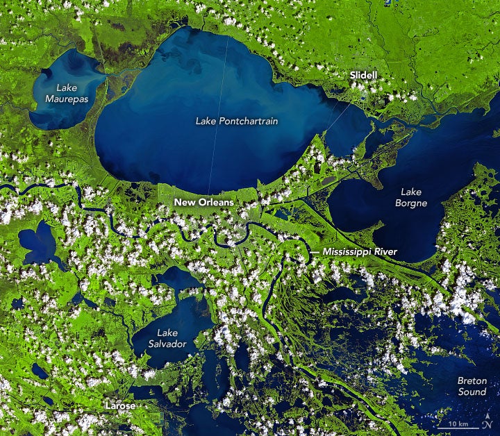
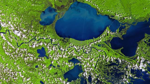
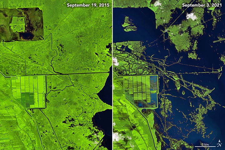
Images from space taken before and after the hurricane show an altered river delta. A Landsat 8 satellite photo shows the New Orleans region as it was on September 19, 2015, and then as it looked on September 3, 2021, five days after Ida hit the region.
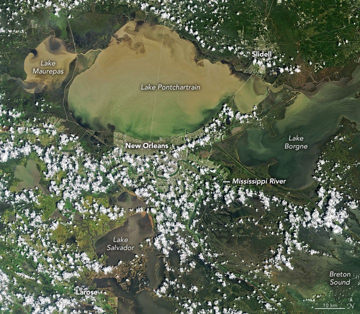
Water teeming with sediments appears light blue in these false-colour images. A natural colour image of the same region (below) shows these sediment-filled waters in an unsightly brownish hue, particularly Lake Maurepas, Lake Pontchartrain, and the northwest coast of Lake Borgne.
The floodwaters were still present five days after the storm. Rivers, coastlines, lakes, and marshes in the Lafourche, Jefferson, and Plaquemines parishes are barely recognisable. A sobering satellite image of area in Lafourche Parish near Larose shows the soggy landscape near a low-lying farm.
“A combination of flooding, erosion, and defoliation during Ida likely created many of the new patches of open water visible in the Landsat image,” Marc Simard, principal investigator for NASA’s Delta-X mission, told Earth Observatory.
The Delta-X field campaign along the Mississippi Delta is currently tracking changes to sediment and marsh dynamics as a result of Hurricane Ida. Later this month, when the waters have receded further, the team will conduct ground visits and use boats to inspect the area, in addition to using aerial radar.
“One of the interesting things to watch will be to see if the stark changes you see in this Landsat image prove to be temporary or long lasting,” Simard said. “Some of the losses may have been floating plants that washed away or plants that simply lost their seasonal leaves and will probably grow back. Others were uprooted and will no longer offer the coastal protection they once did.”
The Delta-X team plans to track salinity levels to see if saltwater marshes might supplant freshwater marshes. They’re also hoping for an influx of river sediment, which could replenish eroded coastal areas and give plants a place to live.
“I think we’ll see that healthy wetlands with plenty of incoming sediment will be far more resilient than wetlands which receive little or no sediment from river discharge,” Simard said. “Our hope is that the models being developed by Delta-X scientists will provide a realistic insight into the vulnerability and resilience of wetlands in this region in the long-term.”
Realistic being the key word. Human-caused climate change means the Mississippi Delta is now under assault from the environment, and it may never bounce back. And of course, there’s always the next hurricane to dread.