On their own, each of the numerous weather calamities that befell the world in 2020 would be a crisis. But hurricane, floods, and wildfires intersected with the pandemic in ways that tested emergency response systems in ways they haven’t before. Piling the climate crisis on top of a public health crisis not only put evacuees in danger of contracting covid-19 while simultaneously losing everything they owned, but it also strained disaster response resources and almost certainly contributed to ongoing disaster fatigue already plaguing first responders.
This year will leave indelible scars on the landscape for years or even decades to come. The impacts will linger even longer in the atmosphere, where carbon dioxide released from fires will stay for a century or more.
To be sure, the human toll of the weather disasters that befell us this year is very real, but the best way to truly grasp the monumental scope of what’s happening to the planet is from space. As we prepare to bid good riddance to 2020, these are the moments that stood out for the damage they’ve done to society and the biosphere.
Australia’s Bushfires
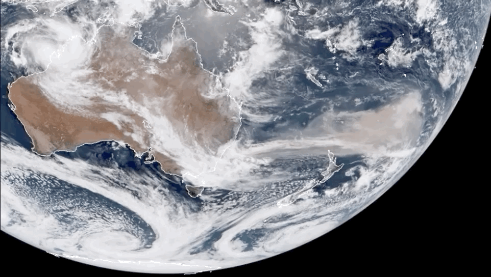
From January to December, the story of 2020 is one of fire. We rang in the New Year with Australia ablaze amid a record-setting fire season. The satellite image above shows smoke streaming off the continent thousands of miles out to sea. At one point, it encircled the entire Southern Hemisphere.
The list of maladies tied to the fires and smoke is long. They include more than 3 billion animals dead, an area as large as Washington state burned, smoke-stained snow in New Zealand, the most toxic air on Earth in Sydney, a $US1.5 ($2)-billion medical bill, and double the annual average of Australia’s carbon pollution pumped into the atmosphere. About the only positive — if you can even call it that — to come of the bushfires was a whole new style of fundraising to help those in need tailor-made for the digital age.
Scientists have suggested Australia’s previous climate is no more as the continent rapidly warms, and the bushfire season from hell was a flammable showcase of what the future holds.
Siberia and the Arctic Burn, Too
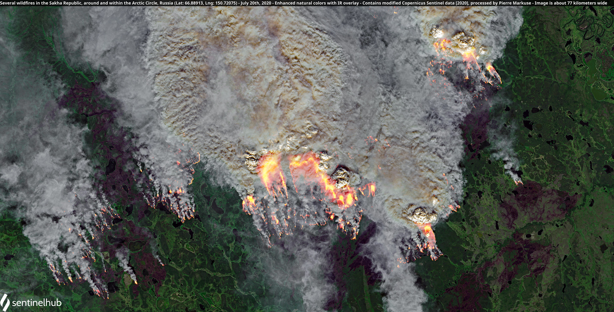
It wasn’t just the Southern Hemisphere facing weird fires. The Northern Hemisphere got in on the action, including the far north. Siberia and points above the Arctic Circle also had a record fire season after a winter that wasn’t and freakish spring and summer heat. We’re talking 100 degrees Fahrenheit (37.8 degrees Celsius) in Siberia freakish.
Stop me if you’ve heard this before but the fires released a record amount of carbon dioxide. They also were made up to 600 times more likely (not a typo) by climate change. In addition to fires, the tundra also decided to explode due to a likely massive methane belch. The unprecedented changes happening in the Arctic right now might feel remote, but the impacts on the atmosphere can’t be overstated nor can the ways in which the shifts affect the people who do live there. A major report released in December put it in terms that are extreme for scientists, noting the Arctic is “warmer, less frozen, and biologically changed in ways that are scarcely imaginable even a generation ago.”
West Coast Wildfires
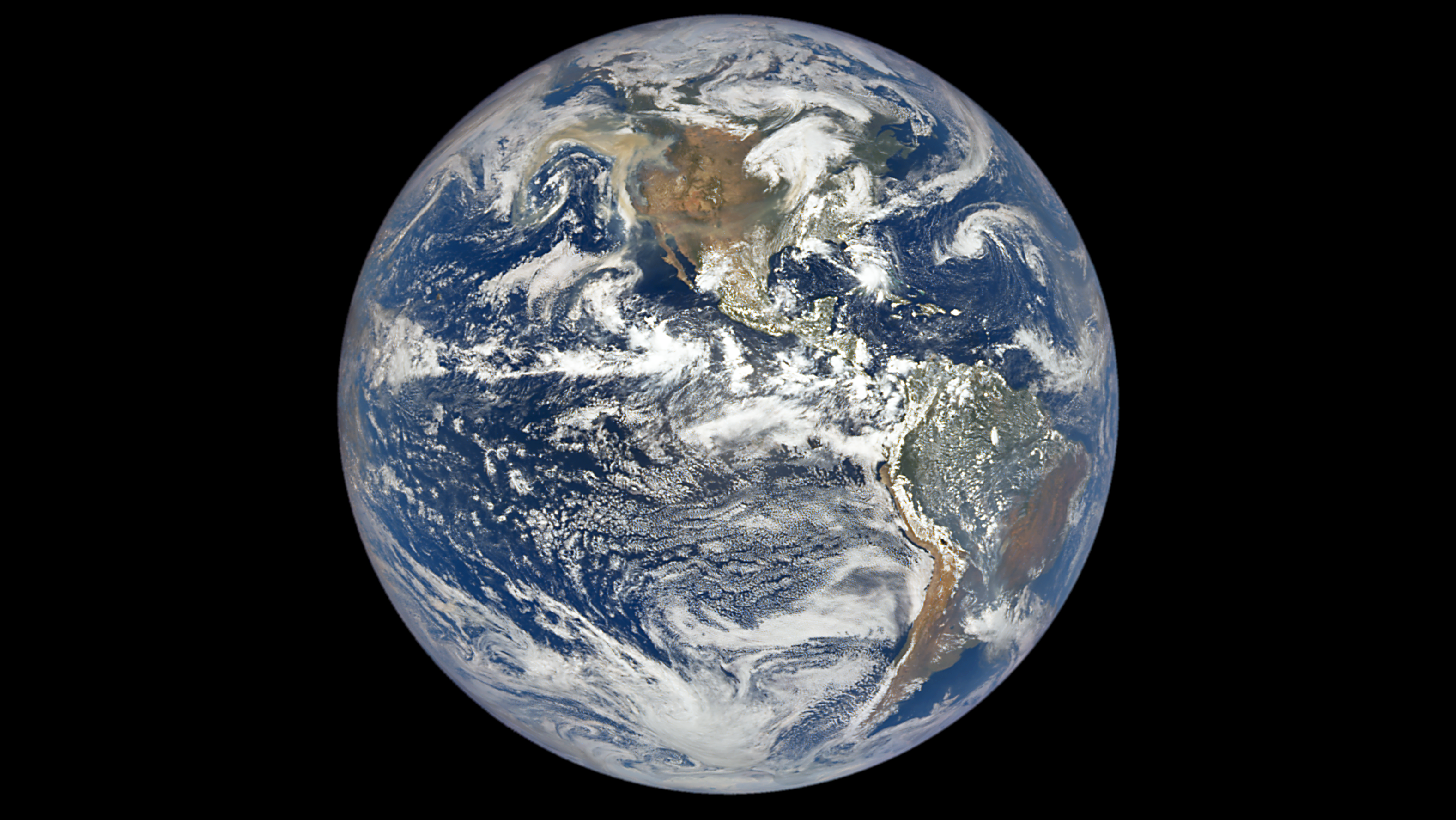
The image above may appear your standard Blue Marble shot. But look closer, and you can see smoke from the peak of the western U.S. firestorm. Reminder this image was taken from hundreds of thousands of miles away.
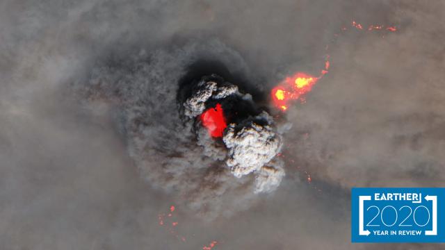
To round out the fiery hell that was this year, we look the western U.S. California had an unfortunately banner year for fires, including the most acres ever burned and its first “gigafire” in modern history. The fires were so intense, they created their own weather that could be seen from space and wiped out a chunk of a vital wildfire monitoring network on the ground. The first image in this story also shows an unnerving pyrocumulus cloud from this year. Particularly intense fires essentially create their own weather, and we saw that all too often in 2020.
The wall of flames also engulfed Washington, Oregon, and Colorado. In Oregon, an entire town was wiped off the map and right-wing extremists used the fires to spread conspiracy theories about antifa lighting the fires and push the boundaries of what’s permissible. Colorado saw two of its three largest fires ever recorded, including one that jumped the Continental Divide. These types of large, destructive fires are becoming the norm due to rising heat. It’s incumbent on policymakers to both prepare forests and those that live in or near them for a hotter, drier future. If 2020 is any indication, part of that will also involve combatting extremism as well.
Too Many Hurricanes
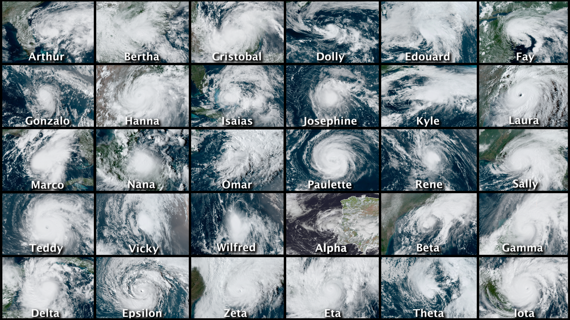
Honestly, we could do a full slideshow on hurricanes alone. But it would take approximately 14 hours to get through and frankly, the image above drives home just how out of control this year was. Atlantic hurricane season set a slew of records from most storms to ever form to most landfalls in the U.S. to some of the most destructive storms to ever make landfall in November.
We’re going to be dealing with the fallout of the 2020 Atlantic hurricane season for years to come, particularly the damage it did to countries in Central America after back-to-back major hurricanes in Eta and Iota. The season is a reminder that we don’t just need to shore up our forests for the impacts of climate change. Coastal areas are vulnerable and when massive storms do hit, the poorest among us suffer the most.
A Derecho Crushes the Midwest
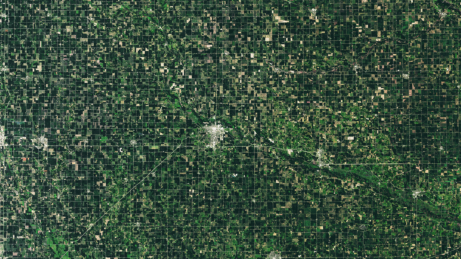
Though it received far less media attention than any of the hurricanes to hit the Gulf Coast, the derecho that ploughed through the Midwest in August did massive damage. Packing winds of up to 100 mph (161 kph), the storm screamed through the Corn Belt that’s just a year removed from record flooding.
It resulted in $US10 ($13) billion damage and has left farmers reeling. The timing meant there was no opportunity to replant and many fields were wiped out while grain bins were torn apart like sheets of paper. While there’s little research into how climate change is influencing these types of powerful storms that send winds roaring across the Midwest and sometimes even the East Coast, they’re still a facet of life we need to learn to live with.
Big ‘berg
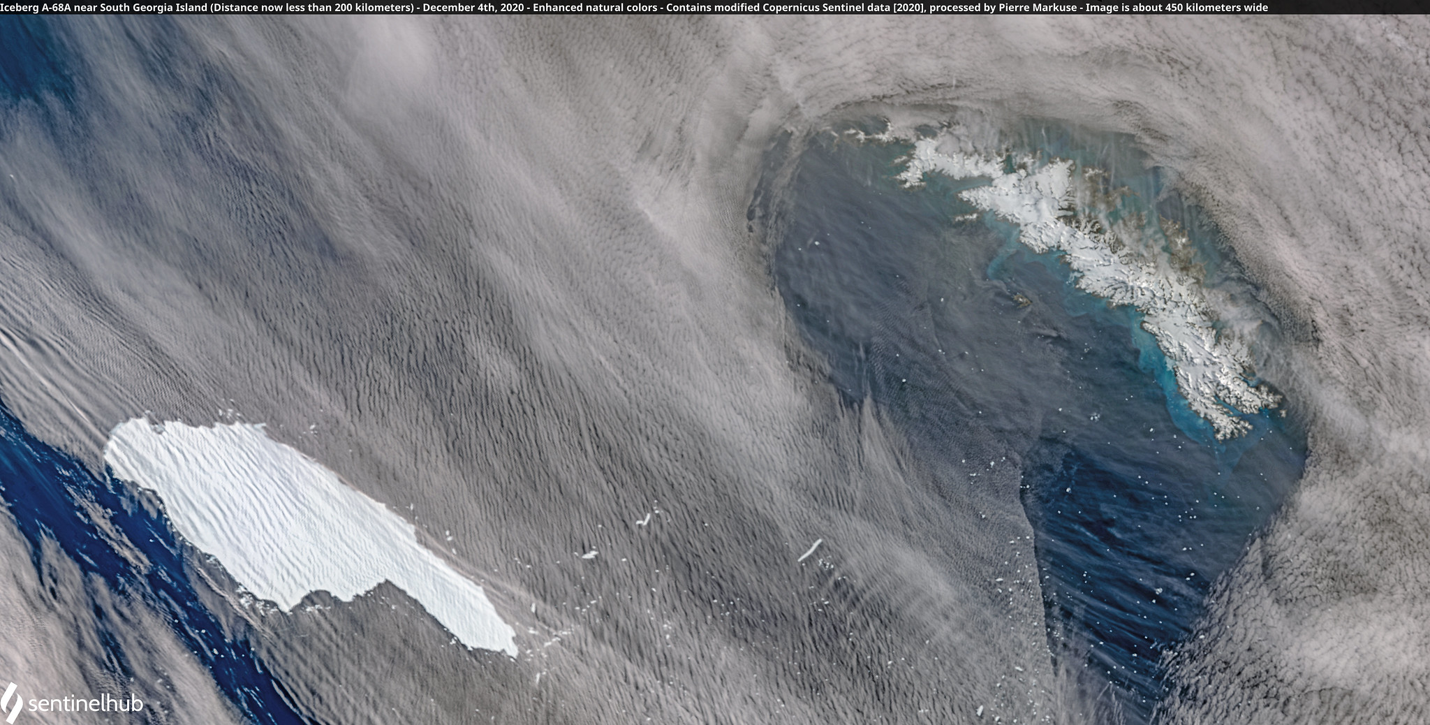
Alright, so an iceberg isn’t exactly “weather,” but the weather (via ocean currents) affect their motion so we’re including one here. Yes, we know it is a stretch, but just work with us here, OK?
Iceberg A68a has been closely monitored by scientists in the three years since it broke off the Larsen C ice shelf on the Antarctic Peninsula. After puttering around near its ancestral home, it finally began a journey away from the Antarctic and into the open waters of the Southern Ocean. The Antarctic Circumpolar Current whisked it northward…and toward an ecologically sensitive island teeming with wildlife.
The will it or won’t it smash into a penguin rookery or mow over a pack of unsuspecting seal pups has keep ecologists on the edge of their seats for months. Iceberg A68a’s ponderous size that appeared spelled doom for the island’s fragile ecosystems may end up being its saving grace. The ‘berg extends far enough below the water that it appears to have snagged on the island’s shallow shelf. A piece three times the size of Manhattan fractured off and may still be an issue, but it appears it and the main iceberg are likely to skirt the southern end of the island. In year light on weather wins, we’re calling this one.
Big Snow
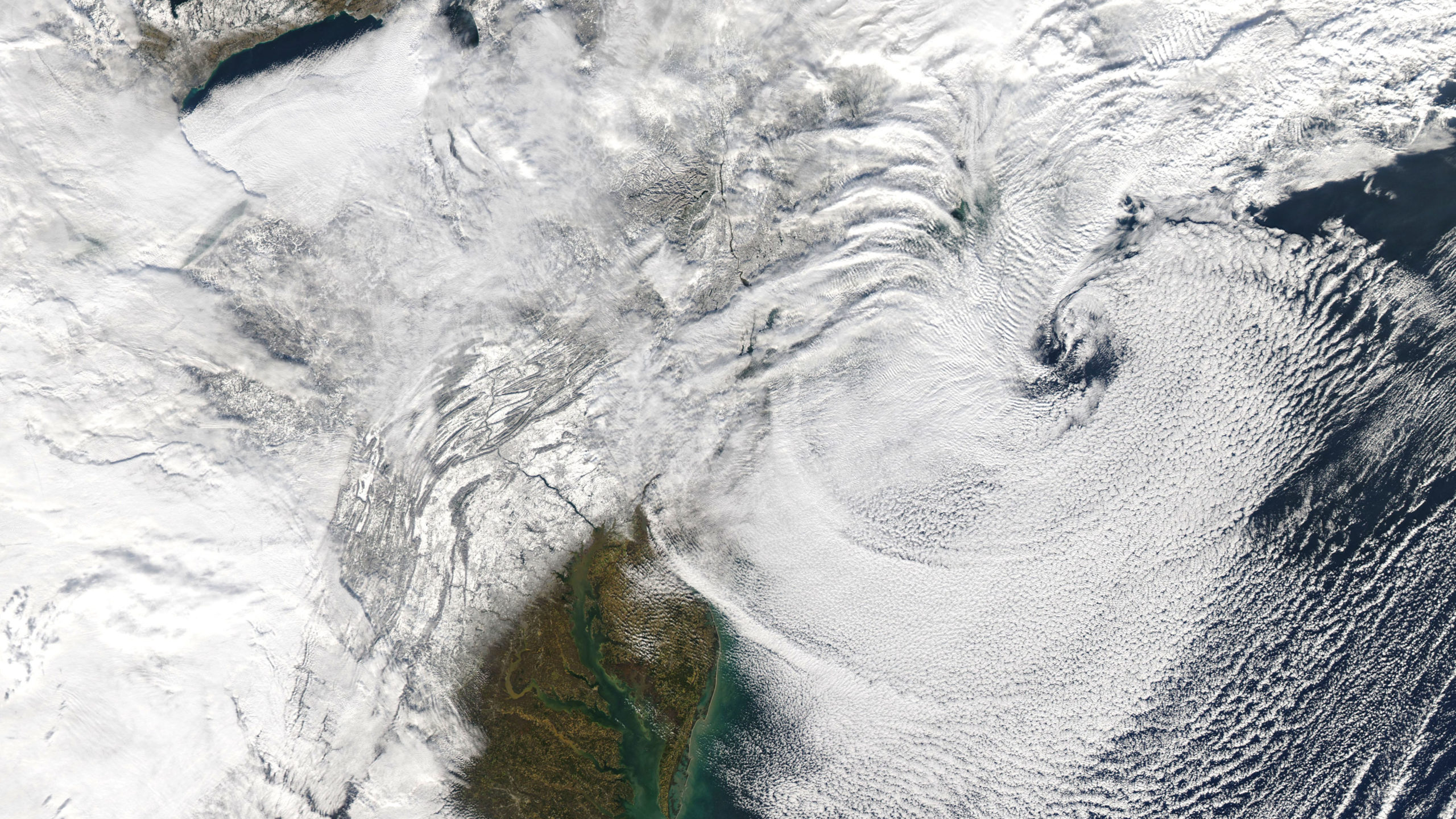
It was nice to end the year with snow on the East Coast. After last year’s winter without much of a winter, December started with a nor’easter cruising up the coast. Though it was a pretty garden variety storm, it left some serious snow on the ground in parts of Pennsylvania and New York to the west of the Catskills as well as Vermont and New Hampshire. Up to 45 inches (114 centimetres) of snow fell in those locations, and the small town of Alba, Pennsylvania may have set the state’s 24-hour snowfall record with 43.3 (110 centimetres).
While the storm itself was pretty raggedy looking, it ended up delivering such massive snowfall totals thanks to temperatures in the snowfall sweet spot and extremely saturated air (your regular climate change reminder that a warmer atmosphere can hold more water, leading to more heavy frozen and liquid precipitation). While close-to-freezing temperatures can lead to goopy snow that pancakes in on itself, temperatures in the mid-teens and 20s primed things for the record-setting snowfall totals. Washington Post’s Capital Weather Gang has a deep explainer on why that’s a must-read for nerds on snowflakes themselves as well as the structure of the storm that led to a persistent band of snow that delivered the goods (or bads if you’re not a fan of shovelling).