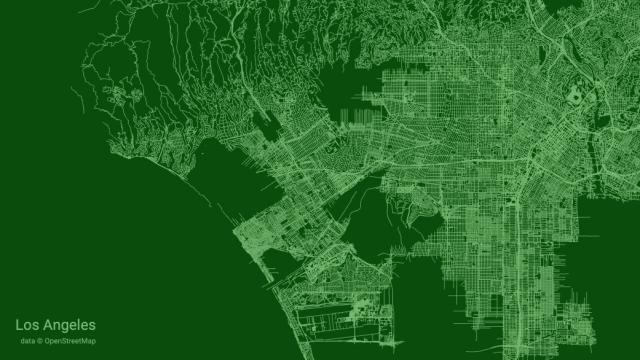
The aptly named City Roads project is simple: Just go to the site, enter the name of your city, and software creates a map that exclusively shows roads. With no text or topography at all, the results are really quite beautiful.
Check out City Roads today if you’re looking to kill a few minutes. I was turned on to it this morning by Mike McPhate’s California Sun newsletter, which is a daily California-centric news aggregation email that’s also free and quite good.
McPhate reports that City Roads is the brainchild of software engineer Andrei Kashcha, but did not get into the engineering aspect of how the site works. Neither will I. The source code is public if you’re into that kind of thing.
If you find these maps as pretty and interesting as I do, City Roads gives you the option to download them as a vector or raster image. That gives you a much nicer copy to keep than a simple screenshot. I think I’m going to see about printing the Los Angeles one in a fun colour. If I do that, I’ll send Mr. Kashcha a few bucks.