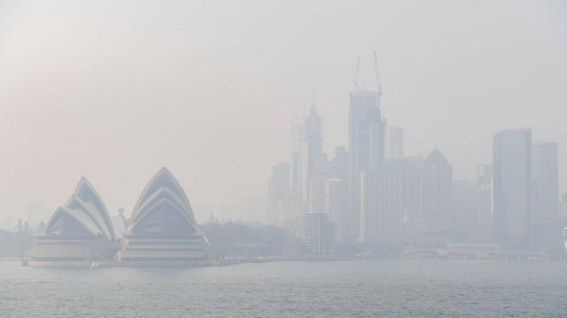
The NSW Department of Planning, Industry and Environment recently told Gizmodo that the poor air quality being experienced across the state is the longest and most widespread in history.
As fires continues to rage and the thick blanket of smoke remains, experts have predicted that this could last throughout the summer. It can’t be ignored, so we have pulled together some of the best apps so you can keep a digital eye on the fires, smoke and the air quality near you.
[referenced url=”https://gizmodo.com.au/2019/12/sydneys-bushfire-smoke-pollution-is-now-the-worst-in-nsws-history/” thumb=”https://gizmodo.com.au/wp-content/uploads/2019/12/sydharbour-410×231.jpg” title=”Sydney’s Bushfire Smoke Pollution Is Now The Worst In NSW’s History” excerpt=”Sydney has once again found itself facing some of the worst air pollution in the world due to bushfire smoke drifting in from one of the worst bushfire seasons Australia has ever faced.”]
AirVisual
If you’re asthmatic, have respiratory problems or just generally care about what you’re putting into your lungs, AirVisual offers detailed data around the air quality in your area.
Not only can it monitor your immediate vicinity, you can add ‘places’ you want to track, such as work or home.
You can set up push notifications to alert you to the air quality every day, which will also offer recommendations. It may tell you to keep your windows closed or not do any outdoor exercise.
It also includes a 7-day forecast for weather, temperature wind and air pollution, which is exceptionally handy.
It also provides data around the level and type of pollutants in the air, if that’s something you need to track for respiratory purposes.
This app is genuinely great, and I particularly like how easy it is to keep an eye on the air both in the city and where my parents live.
[clear]
Air Matters
While not as robust as AirVisual, Air Matters is another good app for tracking air pollution.
You can search for cities and towns, or use your location to get information on air quality. It will provide the AQI, pollutants in the air and temperature, as well as offer recommendations for health. It will tell you if you should consider using a mask, an air purifier or whether outdoor exercise is suitable.
You can also look at air pollution rankings around the world, which sure is depressing.
One interesting point of difference is that this app can connect to air purifiers and air quality monitors in your house. This means you can check the air in your home or office anytime, anywhere. It provides recommendations based off its readings and can send updates whenever the air quality changes.
[clear]
Fires Near Me NSW
As the name suggests, this app uses location data to track any fires near you. It’s also powered by the NSW RFS.
It’s a very clean and easy app to navigate, giving you the option to view via a map or a list. The latter will name impacted areas in order of which are closest to you.
Tapping on a fire will give you more information about a fire – how far it is from you, size (in hectares), whether it is under control and the latest updates.
One new app feature is ‘Watch Zones’. This allows you to monitor a specific area for fire activity. You need push notifications turned on to use this so you can be sent alerts if one of your watch zones has been affected by fire.
[clear]
Fires Near Me Aus
If you’re not in NSW this app will do the same as above, but across Australia.
Live Traffic NSW
A less obvious choice, but potentially essential if you need to get out of an area.
Live traffic will keep you abreast of any congestion or traffic hazards in case you need to alter your route. It also includes information on where bush fires, smoke and back burning are occurring so you can avoid those areas if possible.
[clear]
Bom Weather
If you just want to be informed about the general weather and temperature (especially since those numbers are predicted to sky rocket), the Bureau of Meteorology (BOM) app is a simple one to keep on hand.
It will let you know the high and low temperatures for the day, when the last rainfall was, the humidity and wind speed.
All of this is useful when it comes to decision making throughout the day – especially if you have kids, elderly family members and pets to look after.
[clear]
[referenced url=”https://gizmodo.com.au/2019/12/how-to-donate-bush-fire/” thumb=”https://gizmodo.com.au/wp-content/uploads/2015/03/Koala-410×231.jpg” title=”How To Help Australian Bush Fire Victims (Including Wildlife)” excerpt=”Large parts of eastern Australia are now in catastrophic fire danger. With over 100 fires burning and 850,000 already hectares destroyed you may be wondering how you can help. We’ve rounded up some of the best charities and organisations.”]