Over the past few days, NASA’s Curiosity rover has been making a steady climb towards a strange Martian ridge that’s captivated scientists since before the mission even started. Known as Vera Ridge after the pioneering astrophysicist Vera Rubin, the durable outcrop could shed new light on the environment and potential habitability of ancient Mars. Although the climb has proven a challenging one, Curiosity has managed to capture some spectacular photos along the way.
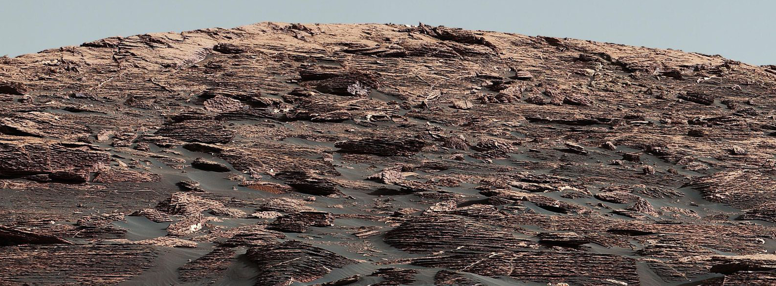
Curiosity Mastcam image showing details of the sedimentary rocks that make up Vera Ridge. (NASA/JPL-Caltech/MSSS)
The Curiosity rover’s explorations have already shown that this region of Mars once hosted an ancient lake, which is seen as a potential sign of habitability, and a possible example of what Earth looked like in its primordial days. The iron-oxide-bearing Vera Ridge, which also contains clay and sulfate minerals, was named a “go-to target” by NASA before Curiosity made its landing on the Red Planet back in 2012.
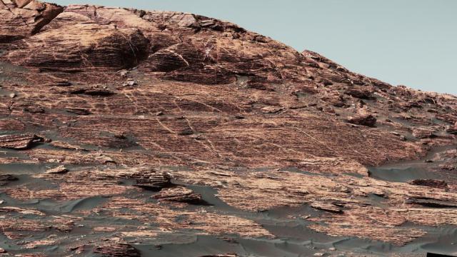
Vera Ridge as viewed by Curiosity on June 22, 2017. The rover is now making an ascent to get even closer. (NASA/JPL-Caltech/MSSS)
The ridge is located on the northwestern flank of Mount Sharp, in a region that’s better at resisting erosion than the shallower areas below Curiosity’s current position. NASA is hoping to gain a better understanding of why this is the case, why it’s rich in the iron-oxide mineral hematite (which may be related to the lack of observed erosion), and what the rocks of Vera Ridge can reveal about the environmental conditions of ancient Mars.
But to observe these tantalising features, Curiosity has some climbing to do. Mission planners are carefully selecting a route that, in addition to ensuring a safe ascent, will lead to the ridge layers that were previously studied from a lower vantage point.
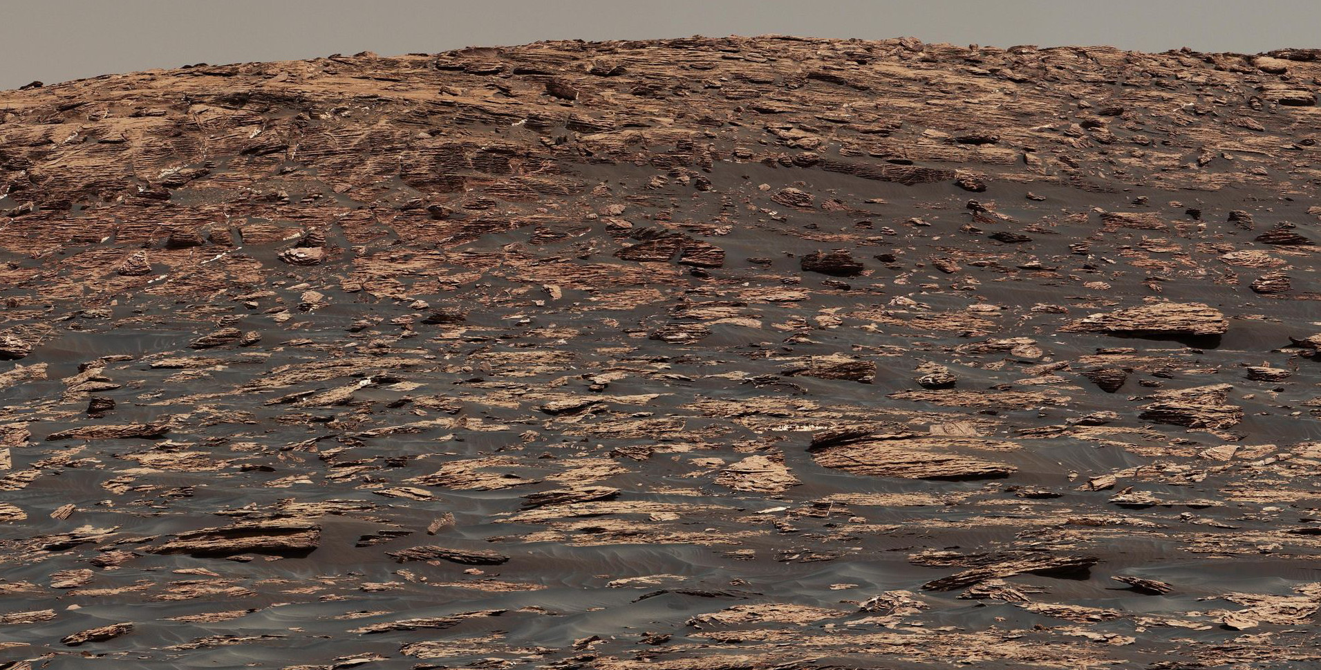
A view of the ridge two weeks before Curiosity began its ascent earlier this month. (NASA/JPL-Caltech/MSSS)
“As we skirted around the base of the ridge this summer, we had the opportunity to observe the large vertical exposure of rock layers that make up the bottom part of the ridge,” said Abigail Fraeman, the NASA scientist who organised the rover’s ridge campaign, in a statement. “But even though steep cliffs are great for exposing the stratifications, they’re not so good for driving up.”
To get there, Curiosity will have to climb 213 feet (65 meters), or the height of a 20 story building. The rover is now mounting a steep grade, requiring it to make a series of carefully controlled climbs across a total distance of a third of a mile (570 meters). Keep in mind that Curiosity is about the size of a car, and its trajectory is being controlled by mission planners located 250 million miles away.
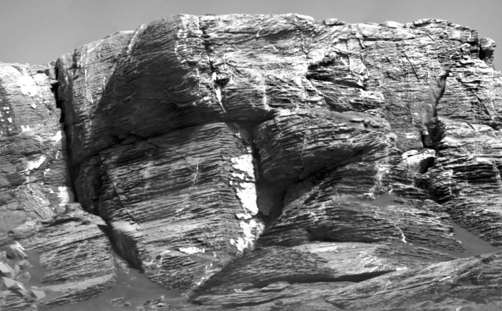
This view of Rubin Ridge from the Chemistry and Camera (ChemCam) instrument on NASA’s Curiosity Mars rover shows multiple sedimentary layers and fracture-filling deposits of minerals. (Image: NASA/JPL-Caltech/CNES/CNRS/LANL/IRAP/IAS/LPG)
But the rover is no stranger to ascents, and it’s been making steady upward progress since leaving its landing point at the base of Mount Sharp five years ago. Before the start of its latest climb earlier this month, the rover has already gained a total of about 980 feet (300 meters) in elevation, traversing a total of 10.76 miles (17.32 km) from its landing site to the base of the ridge.
New photos taken by the rover show finer layering, with extensive bright veins of varying widths intertwined within the layers. NASA is excited about the prospect of finally being able to investigate these features close-up.
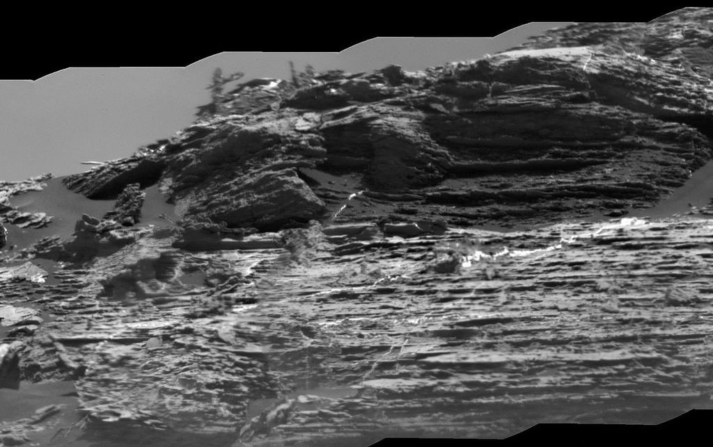
A view of Rubin Ridge showing sedimentary layers, mineral veins, and effects of wind erosion. (Image: NASA/JPL-Caltech/CNES/CNRS/LANL/IRAP/IAS/LPG)
“Using data from orbiters and our own approach imaging, the team has chosen places to pause for more extensive studies on the way up, such as where the rock layers show changes in appearance or composition,” said Curiosity Project Scientist Ashwin Vasavada. “But the campaign plan will evolve as we examine the rocks in detail. As always, it’s a mix of planning and discovery.”
[NASA]