Google just launched a Maps Gallery, a centralised atlas of maps created by governments, non-profits and other organisations. Although it’s still a nascent project, there’s already a lot of interesting finds in there.
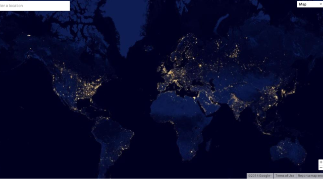
The maps in the gallery so far represent organisations like the World Bank, USGS, NASA and the US Census Bureau — Google says it will be adding more soon. (Click here for information if you want to get your organisation in on the fun.) Probably the coolest part is that the maps are layered on top of the standard Google Maps UI so that in many cases zooming in gives you access to more details. Above is Earth and night, and below are a few of our other favourites from the first batch.
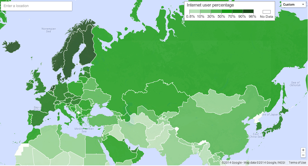
Internet Users (% of the population)
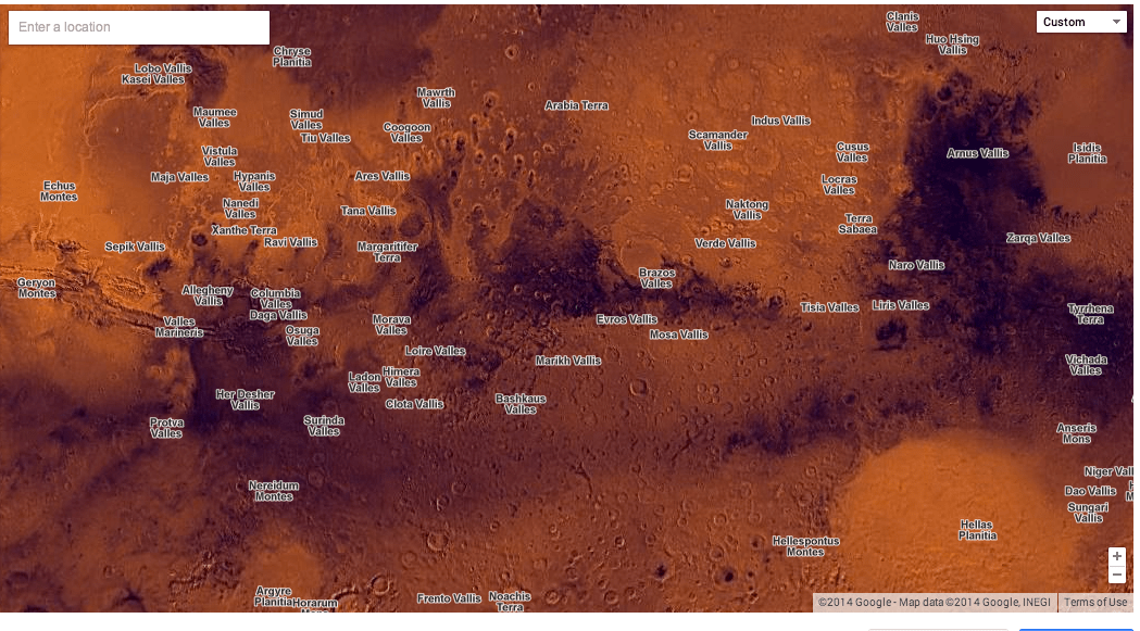
Mars
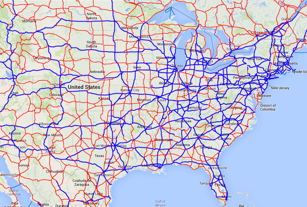
Roads of North America
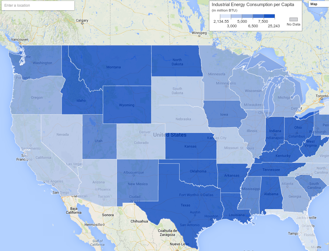
Energy Consumption: Industrial Energy per Capita, 1960-2008
[Google Maps Gallery via Google]