A well-drawn map isn’t just a functional chart, it’s a thing of beauty. National Geographic has been making gorgeous print maps for over 120 years and thanks to a new partnership, over 500 of them will be available online, powered by Google Map Engine.
On Google’s blog, National Geographic’s Frank Biasi says the historic society’s maps will feature overlays interactive editorial content. The public maps will be free to access, while high-resolution print and digital editions will be available for purchase. With hundreds of reference, historic and travel maps in National Geographic’s archives, there should be plenty for map geeks to ogle.
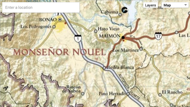
The full gamut will be available through Google’s Map Engine directory, but for a quick peek at a great medieval England map and the full chart of the Dominican Republic shown above, head over to Google’s blog. [Google via The Verge]