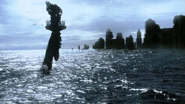
Super-typhoon Haiya, the single most powerful storm ever recorded, is an unsettling harbinger of troubles to come. Weather systems across the globe have gained terrifying intensity and destructive force over the past few years thanks to our rapidly warming planet. New defences are needed to protect our metropolitan centres, most of which are located within a stone’s throw of the ocean. The solution: fight nature with nature.
The Way Things Are Now
Mankind has always tried to exert dominance over the forces of nature, and since the start of the industrial revolution, we’ve been doing a pretty darn good job of it. Modern construction technologies and engineering methods allow us to modify land and waterways to suit our needs. From building up new neighbourhoods in the depths of San Francisco Bay to dictating the course of the mighty Mississippi to holding back the ocean itself in St Petersburg and the Netherlands, we employ hard infrastructure — sea walls, roads, bridges, and other man-made constructs — to bend nature to our will and mitigate the impact of weather hazards.
But in many instances, these massive public works projects, can actually make matters worse, economically, environmentally and socially. San Francisco’s landfill-based Marina district, for example, suffered significantly more damage than the rest of the city during the 1989 quake thanks to the garbagey-soil’s propensity for liquefaction, and lining the Mississippi River with concrete mats has transformed it into the world’s largest slip-n-slide, preventing the natural sediment buildup necessary for the river’s health. And not only that, but these measures aren’t failure-proof either, as the numerous, disastrous, levee failures during 2005’s Hurricane Katrina illustrated all too clearly.
What’s more, these projects are built to confront the hazard rather than negate it, creating an immovable object to oppose an unstoppable force. But why spend billions to clean up after major storms like Sandy and Katrina when we could utilise nature’s own natural defences to minimise damage in the first place? As Dune’s Paul Atreides once said, we must “bend like a reed in the wind”, and to do so we’ll need to stop thinking in terms of steel and concrete monoliths and start thinking in terms of nature conservancy and “living infrastructure”.
It’s the Environment, Stupid
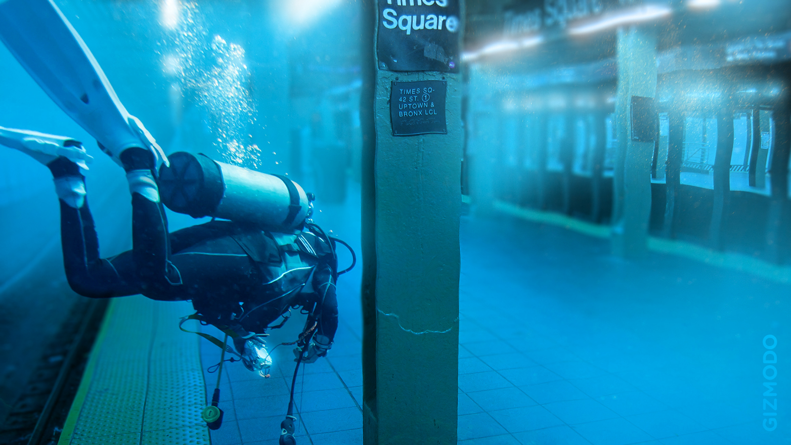
According to the Architect’s Resource Office (ARO), continued polar icecap melting will raise sea levels by as much as 1.8m by the end of the century. More than 180 US coastal cities could lose an average of 9 per cent of their land if that happens, including New York City, which would lose more than 20 per cent of Lower Manhattan. And with a Katrina-class hurricane pushing storm surges 7m above that, more than 60 per cent of Lower Manhattan, everything below 10th St, could be SOL on a bad day.
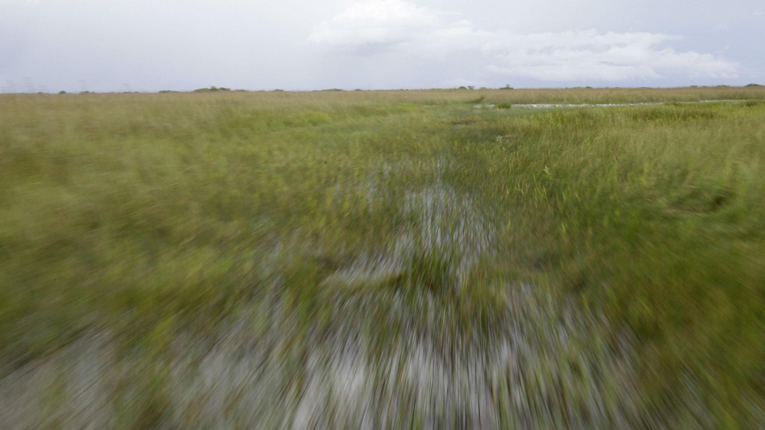
Rising sea levels, combined with the destruction of natural coastal habitats such as the Everglades, combine for a devastating one-two punch to our cities. Heck, even just removing these environments, which act as natural storm buffers, can result in devastation. For example, when 2004’s Hurricane Jeanne hit the island shared by Haiti and the Dominican Republic, the Haitian side — which was largely clear-cut of its forests — suffered far worse damage and thousands more deaths than its neighbour. Without forests and protective ground-cover to keep top soil in place, the Caribbean nation faced landslides and flooding during the storm, while the conservation-minded Dominican Republic did not thanks to its trees holding everything together.
The same is true for places like New York City’s Jamaica Bay and New Orleans. “It was this huge survey from 1903,” landscape architect Kate Orff said during the 2010 NYC MoMA exhibit, Rising Currents, which examined potential solutions to the threat of climate change-induced coastal flooding, “where they wanted to transform Jamaica Bay into the world’s largest shipping port, which if you know how shallow that bay is, makes no sense at all, other than, ‘Hey, it’s America and it’s 1900, and we can do anything!’”
“Jamaica Bay’s original ecosystem” she told the New Yorker, “is precisely what you’d now design to protect inland settlement: a 20,000-acre salt marsh plus barrier islands.”
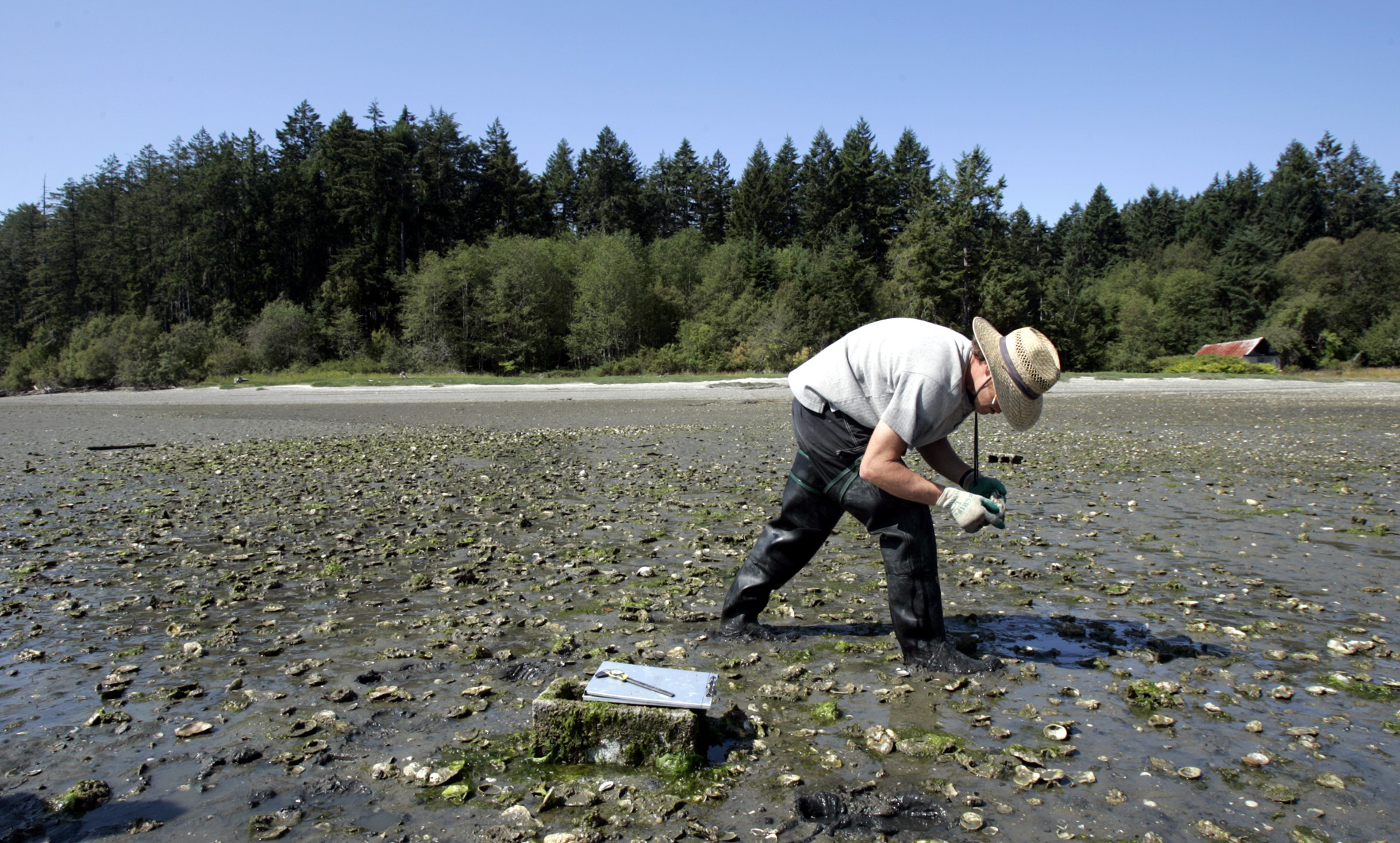
Similarly, extensive marshlands that used to span the Gulf Coast have been dug up or buried to make way for man-made flood protections such as the network of levees around New Orleans. Unfortunately, levees cannot provide the same level of defence against hurricanes as hundreds of thousands of acres of vegetation do. In fact, as Dr Jeffrey Masters, chief meteorologist of Weather Underground points out, for every 4.3km of marsh between the land and the ocean reduces storm surges by a full foot. Plus, natural fortifications like marshland provide invaluable other societal benefits as well: they provide refuge for wildlife, support tourism and commercial fisheries, and sequester massive amounts of atmospheric carbon. And the more carbon we take out of the atmosphere, the slower the planet warms, and the less frequently we’ll suffer through super-storms. It’s just that simple.
How We Can Fix It
Rebuilding New York’s coastline back to its pre-industrial revolution state would be no small feat but could provide the greatest level of protection for the rest of the city in another Sandy. “We imagine that [NYC] will and should get wet,” added Eric Bunge, whose firm, nArchitects also participated in the Rising Currents exhibit, “and that designing for a dry city is maybe madness. As a city, we choose not to run for the hills. If you index population growth to sea-level rise in New York, you have something like two hundred thousand more people for every inch of rising water between now and about 2030. The question is, where do you put all these people? It can’t be just the familiar post-industrial approach to the waterfront, with parks and leisure programs.”
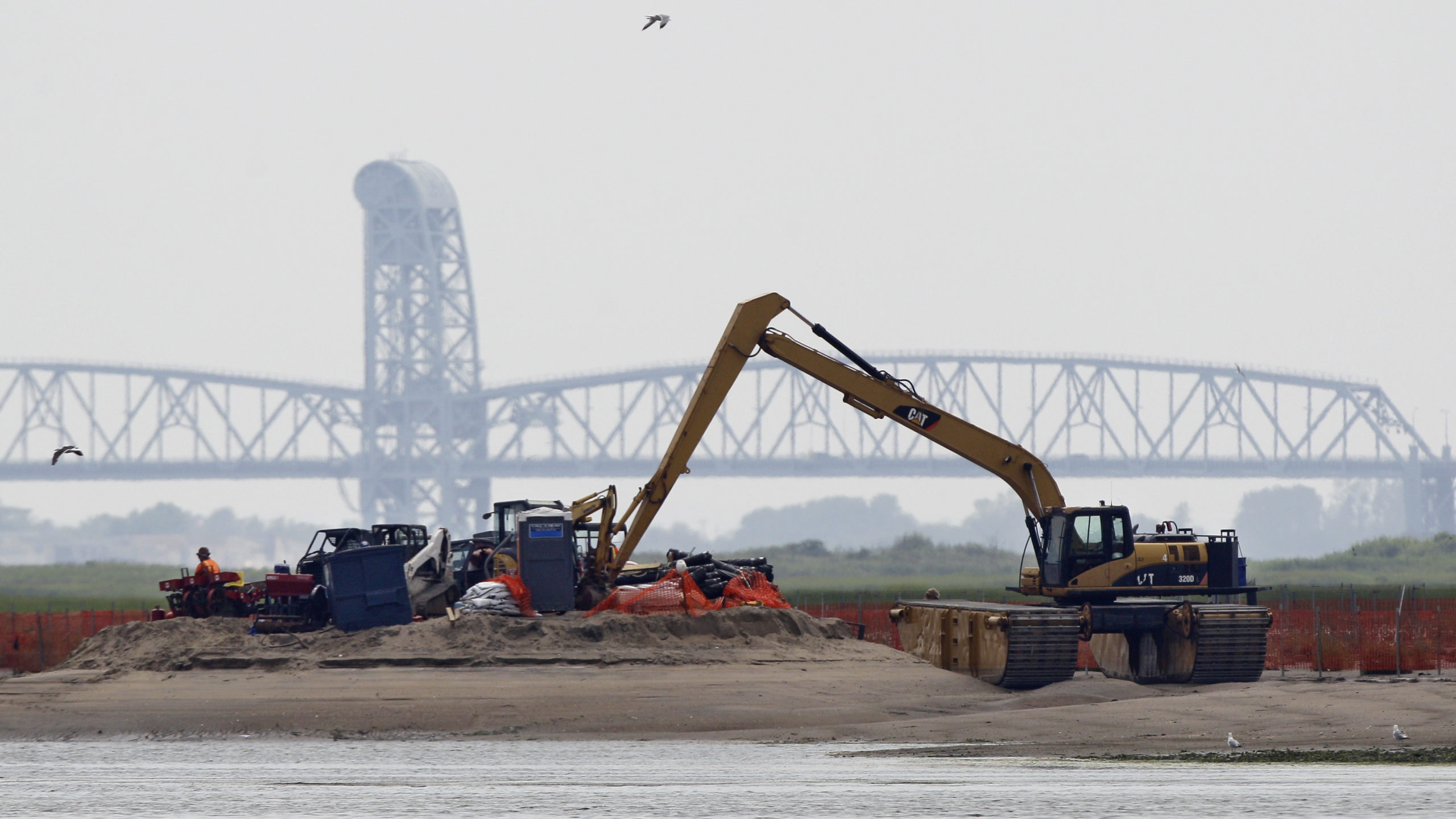
Instead, city planners could leverage the abundant islands and marshes throughout Jamaica Bay as natural storm buffers. “In lieu of a literal wall around lower Manhattan, which would cost millions of dollars but would only perform in a flood, we proposed an ecological infrastructure that would allow water in and out of lower Manhattan,” architect Adam Yarinsky told the New Yorker. “We’re thinking about a continuum of land and water.” And, in fact, the City of New York has already begun doing so. In 2010, Mayor Michael Bloomberg announced the formation of the Jamaican Bay Unit, a 9000-acre urban wildlife refuge — and the largest bird sanctuary in the northeastern United States — recognised by the National Park Service.
“It’s not about preventing flooding, anyway,” he continued. “It’s about mitigating the impact of flooding on the city, and living with the fact that there are times when the city would flood. But you can manage public spaces, improve the building stock, and relocate infrastructure so it won’t be damaged.”
And it’s not just a matter of going out and planting acres of reeds and marsh grass, simply providing a suitable substrate could be enough to create living infrastructures. Orff suggests that Oystertecture — wherein mats of woven rope are laid down in the coastal shallows and act as artificial reefs for communities of oysters — could help protect Chesapeak Bay in Massachusetts. As the oysters grow and mature, the form a wave-breaking barrier that protects the land behind it from storm surges.
Of course, neither hard nor living infrastructures can offer complete protection all of the time. Just as monumental projects like the Netherland’s Oosterscheldekering, carry unintended consequences — “It was built over such a long time that by the time they finished it [in 1986] they finally realised it would have been an ecological disaster if they had completely sealed off the sea,” Bunge told the New Yorker — so too does living infrastructure. As Dr. Masters explains:
If a marshland is subject to strong winds for long enough, the wetlands will completely flood, and there will be no reduction of storm surge at all — and an increase in storm surge is even possible, according to the mathematical equations governing the surge (Resio and Westerink, 2008). This has occurred in Louisiana during a number of storms — Hurricanes Rita, Katrina, Gustav, Ike, and Hurricane Betsy of 1965, along the eastern side of the protruding delta of the Mississippi River.
Resio and Westerlink (2008) found that during Hurricane Rita of 2005, strong winds blew along the east side of the Mississippi for almost a full day, completely flooding the 25 miles of wetlands fronting the Mississippi River levee at English Turn. In fact, the model results show that the surge probably increased in height, by 1 foot per 8.7 miles of inland penetration in the Hurricane Rita simulation, since the day-long period of strong winds allowed the surge to pile up against the levee.
Thus, while the wetlands were able to slow down the speed with which the surge reached the levee, the wetlands had no impact on the surge height in that location. A similar effect was seen during Hurricane Carla in 1961, a ferocious Category 4 hurricane that brought the highest storm surge ever observed to the Texas coast — a massive 22.7 feet at Port Lavaca. Carla moved so slowly — just 8 mph — that the surge had plenty of time to inundate marshes, and along one inland bluff fronted by wetlands, the surge was higher than at the coast.
In the end, supplementing civil engineering projects with ecological defences is only part of the overall solution to dealing with our rapidly changing environment. Early warning systems, effective evacuation strategies, education, and better building codes must be integrated into the larger scheme of of sustainable city development and planning if we plan on living anywhere near our growing oceans. [Global Post – New Yorker – Fast Co – Inhabitat – Wiki – UA News]
Pictures: The Day After Tomorrow, The AP