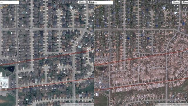
This is beyond sad. If you’ve been keeping up with the tornado that levelled Moore, Oklahoma, you probably saw the destruction it left behind. It looked like a movie set war zone or the aftermath of the apocalypse. But it was real. Google released satellite imagery showing what the destruction looked like from above. It’s not pretty.
Google’s Crisis centre reveals the tornado’s path, showing the damage outline and specific damage points. Some areas are so severe they’re almost unbelievable. In addition, Google revealed satellite imagery from April 29, 2013 (before the tornado) and May 22, 2013 (after the tornado) to show us the before and after.
[clear] [clear]
If you want to donate to the Moore, Oklahoma cause, you can send your donations to the Red Cross [Google via CNET]
