Apple Maps hasn’t exactly got the best rep in Australia. For years, the native Maps app was practically unusable, forcing many an iPhone user onto Google Maps, which I don’t know about you, but it would always make my iPhone overheat and was just an annoying time when I’d receive an address via iMessage. But Apple has been giving Maps some updates to change all this.
In late 2021, Apple gave Maps a massive overhaul. The Apple Maps update laid the groundwork for it to push out features to Aussie users easily, giving us all a reason to reconsider opening that third-party app. It’s part of Apple’s goal to be the world’s best map.
Well, today, Apple Maps has been given a few extra features down under. But, if you don’t live in Sydney or Melbourne, you might be a little annoyed.
So what’s new?
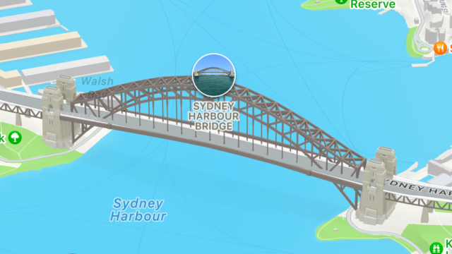
Users looking at sites in Sydney and Melbourne will have access to Apple Maps’ 3D cities experience. The maps are still cartoon-like, so the 3D element is more about making the sites look more realistic than real. This includes adding shadows, more details for things like bridges and buildings, you can see foliage cover that’s not just a splatter of green but a render of what the actual cover looks like in real life and it also means you’ll see roads better, which include turn signs, bus and taxi lanes, and crosswalks, as some examples.
As you’re driving by, you can see, for example, a bridge pass you by.
To capture this, Apple’s teams took photos and videos of the spaces in the real world. The result? The detail on the map matches the real world more closely.
The Apple Maps update also includes a handful of custom-designed landmarks (around 12) such as the Melbourne Cricket Ground and Sydney Harbour Bridge, which boast a lot of detail. You can also see lights coming from within one of these landmarks when nighttime switches over.
Also coming as part of the Maps update is windshield view for drivers using the Apple app. When approaching overlapping complex interchanges, Maps will now show a road-level view, making it easier to see upcoming traffic conditions or the best lane for an approaching exit. Outside of the car, however, you’ll also receive immersive walking directions shown in augmented reality – a feature previously reserved for those in Sydney and Melbourne but now made available to Perth, Canberra, Brisbane and Adelaide.
As part of its Maps update, Apple also launched Cycling Navigation across Australia. You can read more about that here.