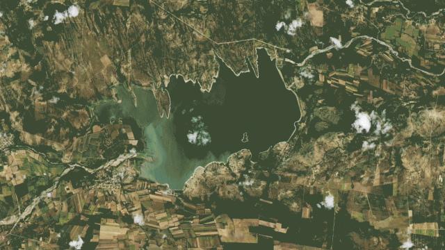
Even as someone who writes about climate all the time, it’s still a shock to see satellite imagery of climate crises, to really get a grasp on how large human influence can be on our warming planet. Here’s how the Nothern Hemisphere’s summer of droughts, heatwaves, floods, and wildfires looked from space.
First up, above: Jaw-dropping images of the Cerro Prieto reservoir in northern Mexico show how the reservoir dropped to just 0.5% of its capacity in July, compared to its much fuller state in July 2015. Mexico endured punishing drought conditions this summer, with 21 million people, representing two-thirds of the country, facing some kind of water shortage.
Lake Powell Dries Up
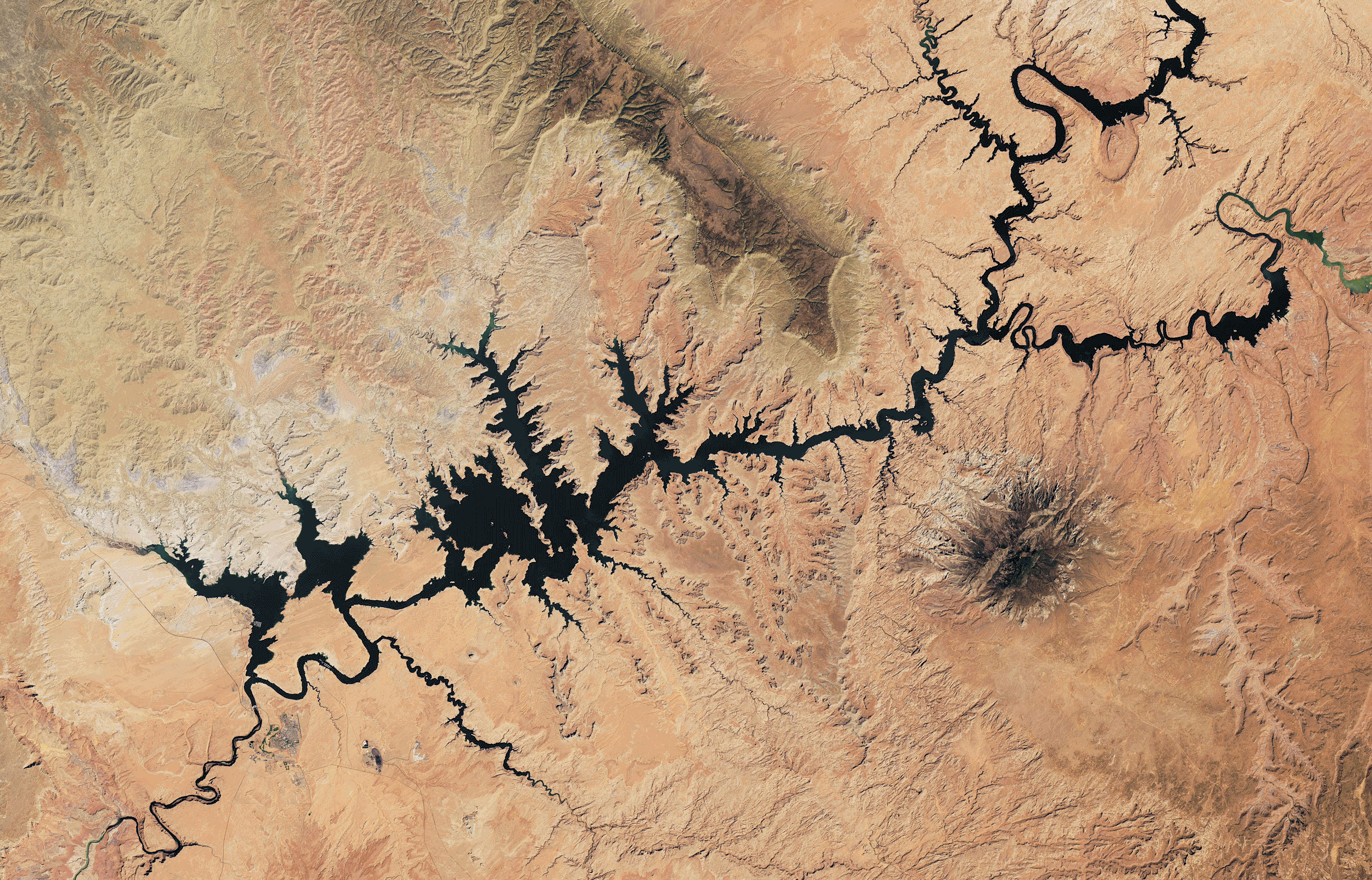
Lake Powell, the second-largest reservoir in the U.S., has displayed one of the most visible markers of climate change this summer. A victim of both the West’s worst drought in 1,200 years as well as chronic overuse, the reservoir reached its lowest point on record in May. These Landsat images show the difference between the reservoir in August of 2017 versus August 2022.
Lake Mead Shrivels, Too
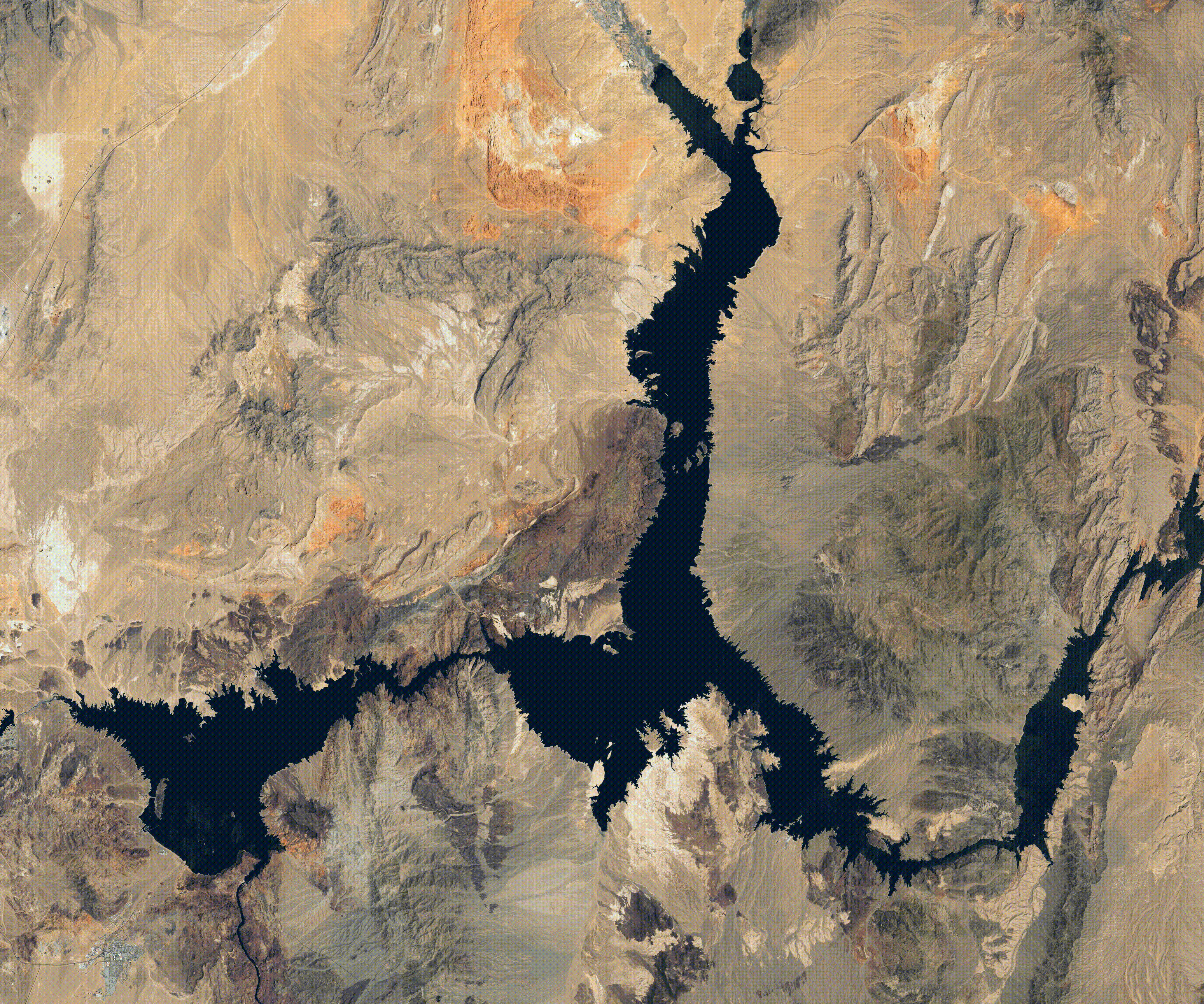
Not to be undone by its counterpart upriver, Lake Mead, another crucial Western reservoir, also plummeted dangerously low this summer, hitting the lowest levels since the lake was filled in 1937. In recent months, Lake Mead’s low water levels have led to dozens of strange, previously hidden artifacts and curiosities being exposed, from bodies to sunken boats. These Landsat images show the difference between the reservoir in July 2000 and July 2022.
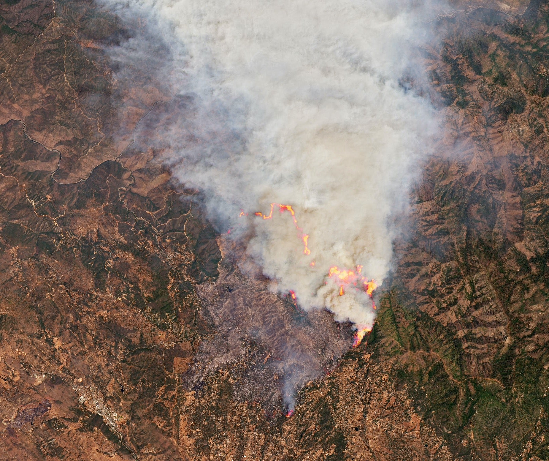
Historic Fire in New Mexico
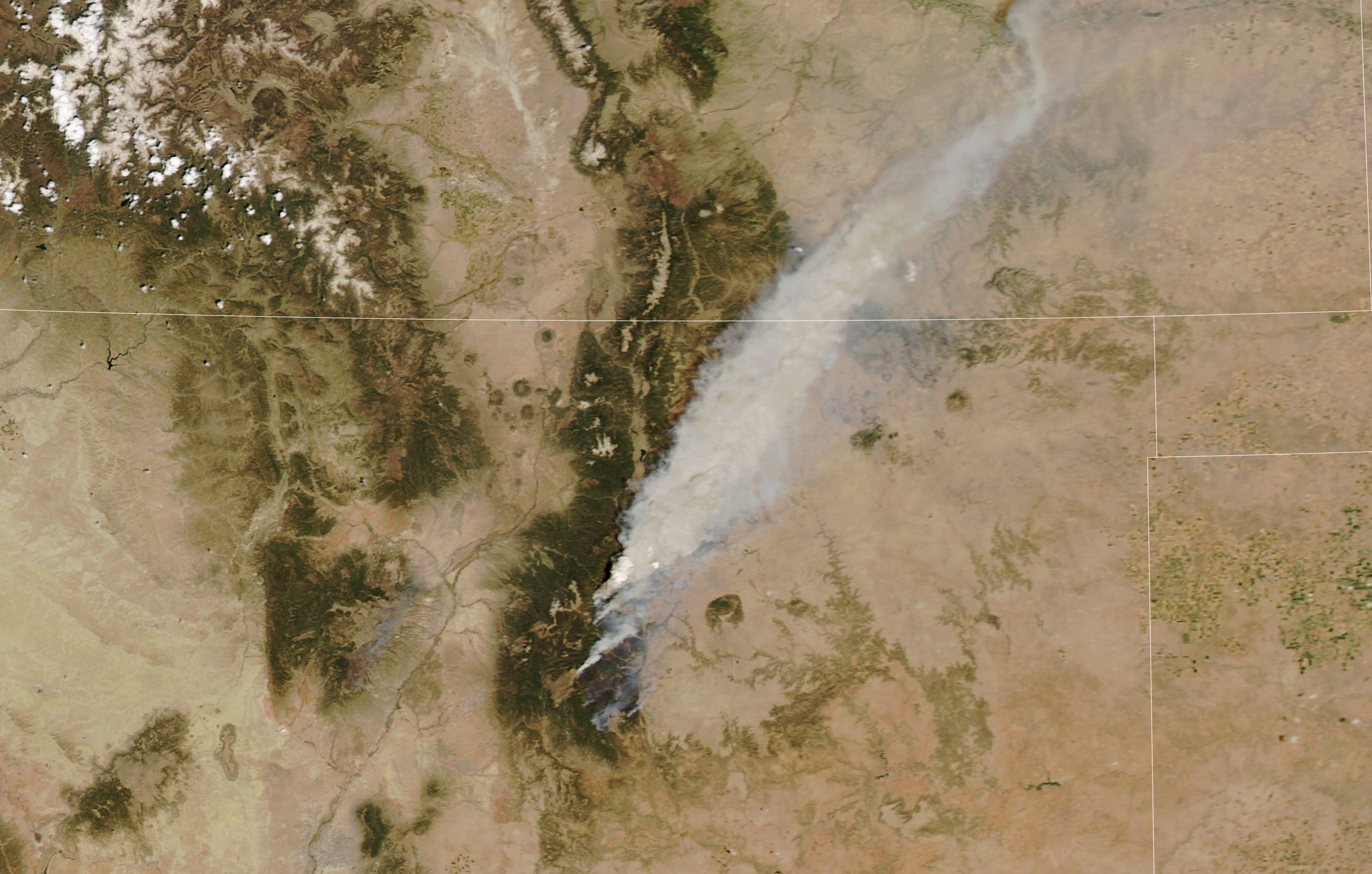
2022’s fire season got off to an early start in New Mexico. The Calf Canyon-Hermits Peak fire, which burned for two months after it was accidentally set by a controlled Forest Service burn, became the largest wildfire in that state’s history. This MODIS image from May shows a pyrocumulonimbus cloud from the fire as seen from above, drifting north over the state border into Colorado.
The Great Salt Lake Shrinks
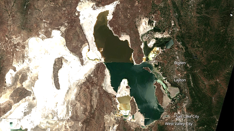
The Great Salt Lake’s water level has been declining for years — but as the West goes through intense drought, it also reached new lows this summer. These photos show the differences in the lake’s extent from July 2019 to July 2022. Conditions are so bad on the lake, which provides $US1.3 ($2) billion of income each year to the state of Utah, that lawmakers in May floated the idea of piping in salt water from the Pacific to fill the lake.
Fires Consume Yosemite
In the month of July, multiple wildfires spread through Yosemite National Park in California, fuelled by intense drought conditions, hot temperatures, and low humidity. The fires threatened hundreds of the park’s giant sequoia trees, including some of the famous “named” trees, like the 3,000-year-old Grizzly Giant. This Landsat image from July 24 shows active fires and a burn scar from the Oak Fire, which burned more than 19,000 acres.
Alaska’s Active Fires
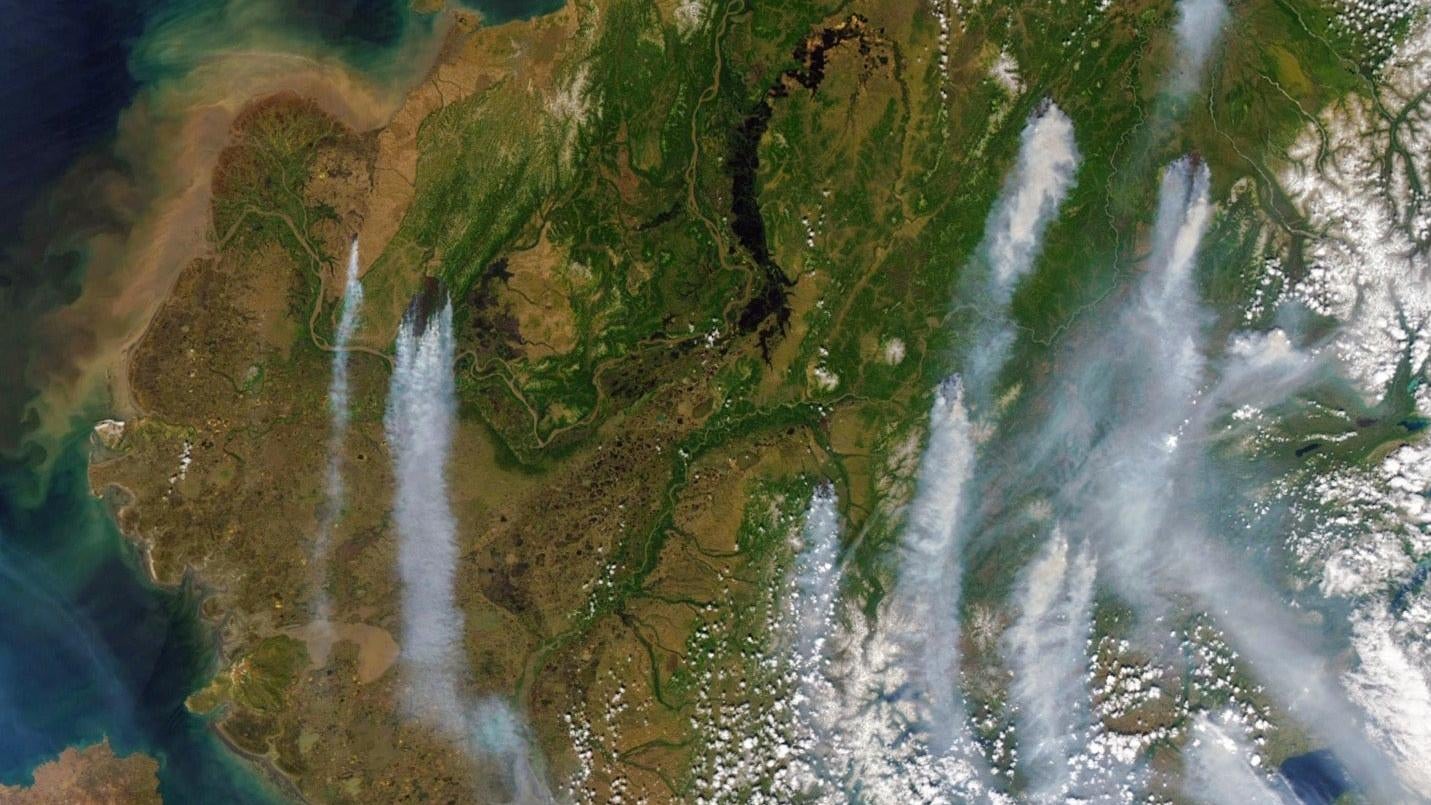
Alaska set a depressing record on June 15, when officials said that over 1 million acres had already burned. That’s the earliest point in Alaska’s wildfire season that that marker has ever been reached. This Landsat image of south-central Alaska, taken June 10, shows plumes of smoke from some of the dozens of active fires that were burning at the time. By the end of July, fires had burned more than 3 million acres across the state — the annual average is just 1.1 million acres — driven by unusually dry and hot temperatures.
Devastation in Pakistan
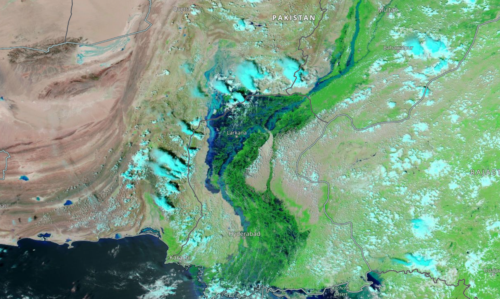
Since June, at least 1,100 people have died in Pakistan in one of the most destructive monsoon seasons the country has seen in years. Large portions of the country are underwater, affecting more than 30 million people and leaving a trail of destruction in the wake of unusually heavy rains. This MODIS image of Sindh Province, taken at the end of August, shows how flooding and river overflow have created a 62-mile (100-kilometre) stretch of “lake” around the Indus River.
Massive Burn Scar in France
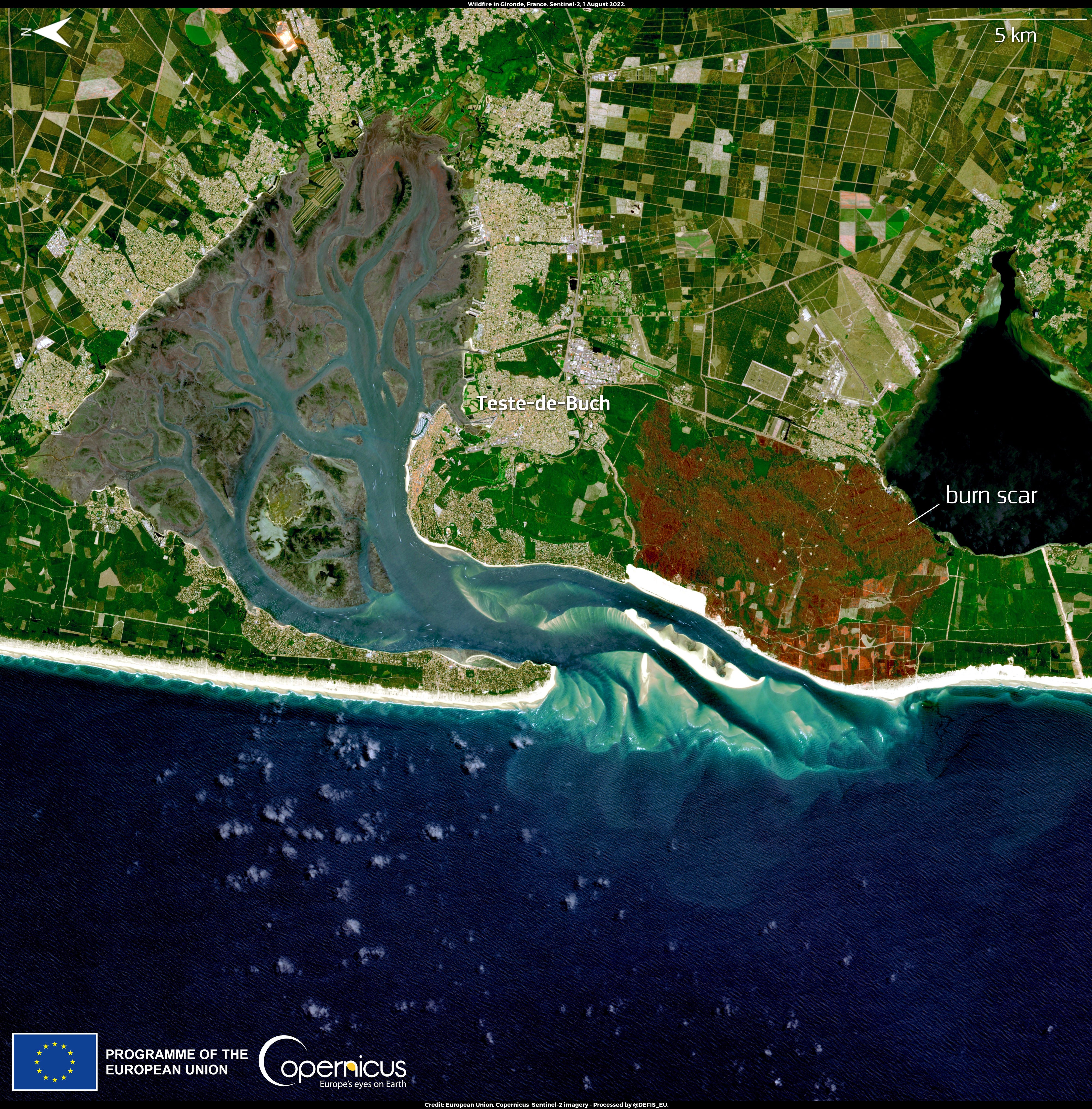
Europe’s summer of heatwaves came with an unusually early and intense wildfire season, as countries across the Mediterranean region experienced a slew of devastating fires in July. The coast of France was particularly hard-hit, as the country experienced its driest month on record since the 1960s. Here, an August 1 satellite image shows the browned burn scar near the town of La Teste-de-Buch on the coast.
Raging Wildfires in Spain
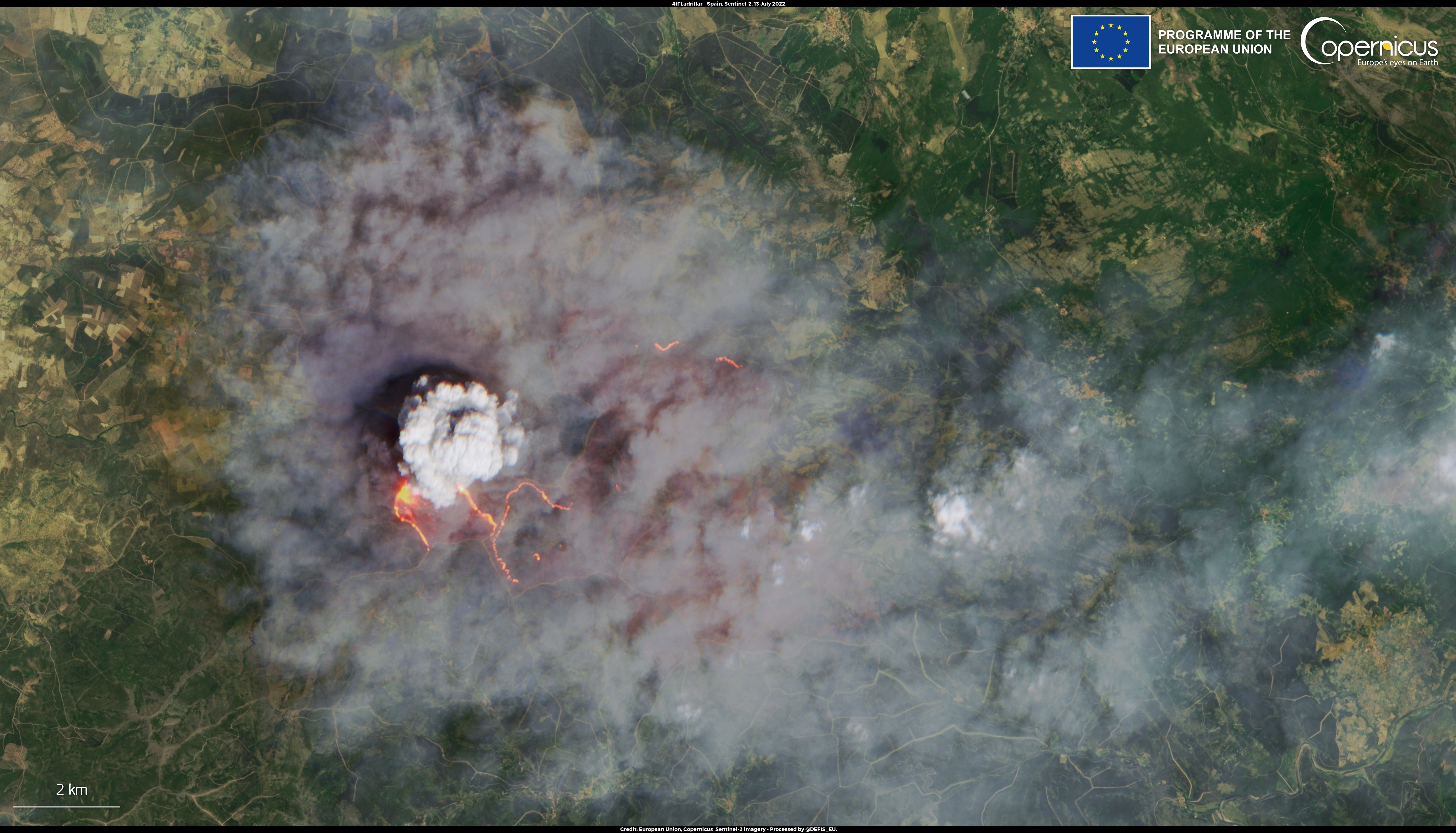
Neighbour Spain also saw out-of-control wildfires in July. Here, a satellite image from July 13 shows a huge, dense cloud from a fire burning in the Castilla y Léon area in western Spain.