There are multiple fires currently burning across the U.S. Southwest. The largest is a megafire in northern New Mexico’s San Miguel County called the Calf Canyon/Hermits Peak fire, which has burned more than 165,000 acres of forest and grassland and is only 20% contained. The fire began as two separate blazes but combined into one fire complex on April 19.
On Wednesday, President Biden approved a disaster declaration for five counties in New Mexico impacted by ongoing wildfires. The declaration frees up federal funding to help support firefighting efforts in the state, as well as aid for temporary housing and other relief programs for people affected.
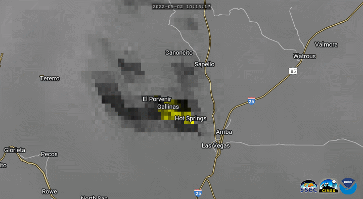
The megafire already ranks as the third largest ever recorded in New Mexico, and it has burned more land than all fires combined in the state during 2021. So far, it has destroyed at least 172 homes and forced thousands of people to evacuate. It also threatens area’s rich cultural history, which extends much farther back than the United States itself, as reporting from the New York Times describes. The Calf Canyon/Hermits Peak blaze is barreling ever closer to Las Vegas, New Mexico, a city with a population of about 13,000.
Two other fires are burning nearby. First there’s the Cerro Pelado blaze that has swept through nearly 27,000 acres so far. Cerro Pelado’s fireline is less than 10 km from the Los Alamos National Laboratory. That fire rapidly grew by more than 20% overnight. Then, there’s the Cooks Peak fire which has covered almost 60,000 acres so far.
The Calf Canyon fire began as a prescribed burn and was first declared a wildfire on April 6 after unexpected erratic winds caused it to spread. April is early for fires of this size in New Mexico, where fire season typically peaks in June. Human-caused climate change has been making fire seasons longer, causing them to both begin earlier and end later in the year. Climate change exacerbates heat and drought, two major drivers of wildfires.
Another major driver is wind. Warm, dry, and very windy weather is expected to hit the region beginning on Saturday, with wind gusts starting up to 45 mph, and intensifying late into next week — potentially worsening the blaze. For now, a couple of days break in wind has allowed firefighters to set up another round of fire lines and other defences on the outskirts of Las Vegas to help manage the blaze’s spread.
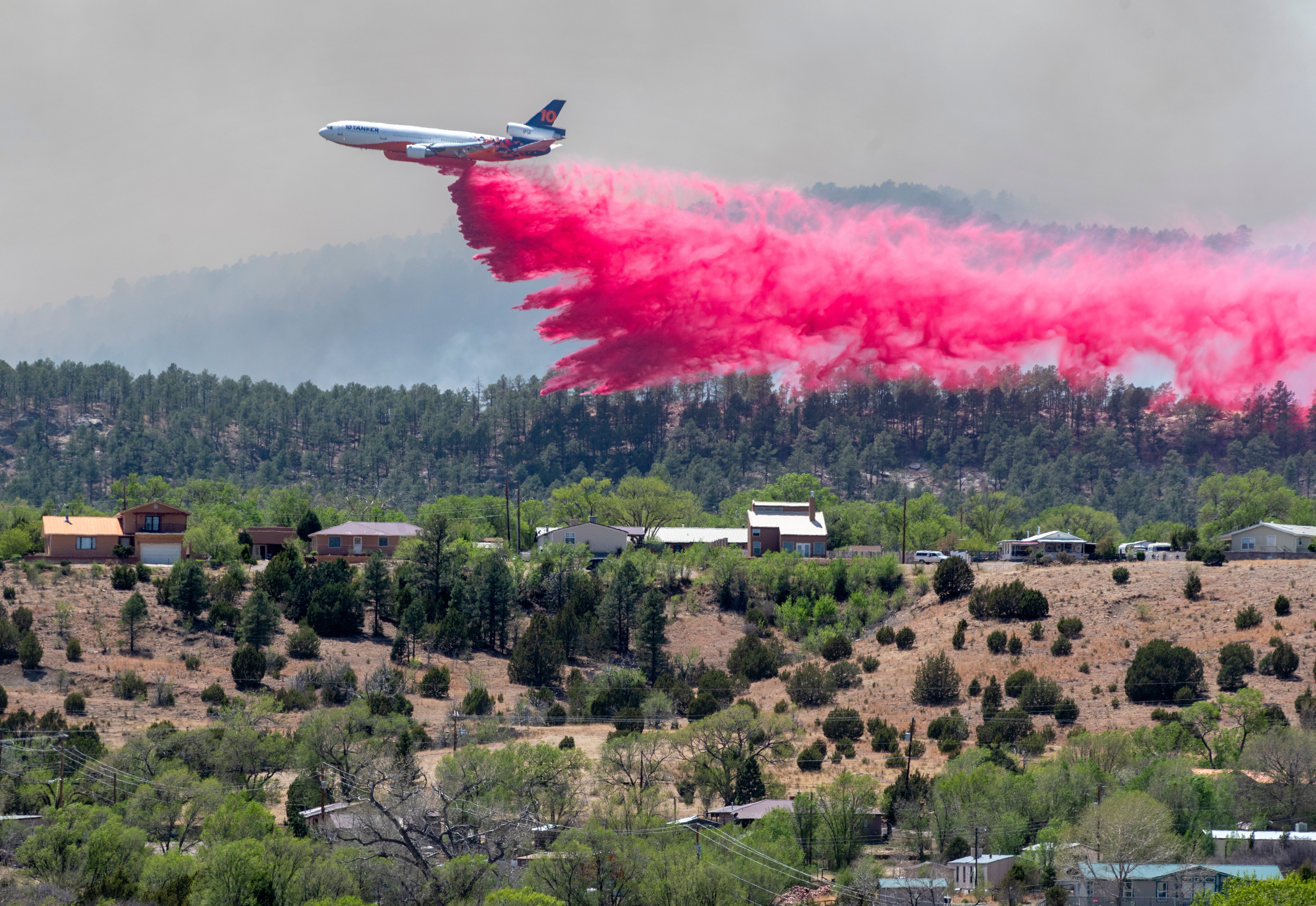
Almost 1,300 personnel have been assigned to fight the Calf Canyon/Hermits Peak fire, while around 2,000 wild land firefighters are working elsewhere in the state and country, according to the Associated Press. “The primary focus of firefighting efforts will be containment line construction around the perimeter of the fire, as well as structure protection throughout the fire area,” said the U.S. Forest Service in its Thursday update.
Firefighting Aircraft
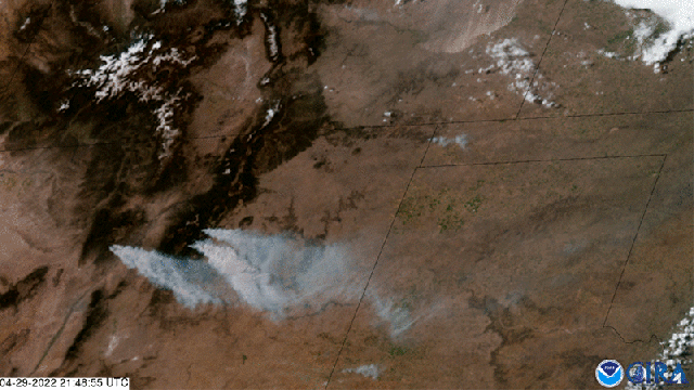
Smoke Seen From Space
Firefighting Aircraft
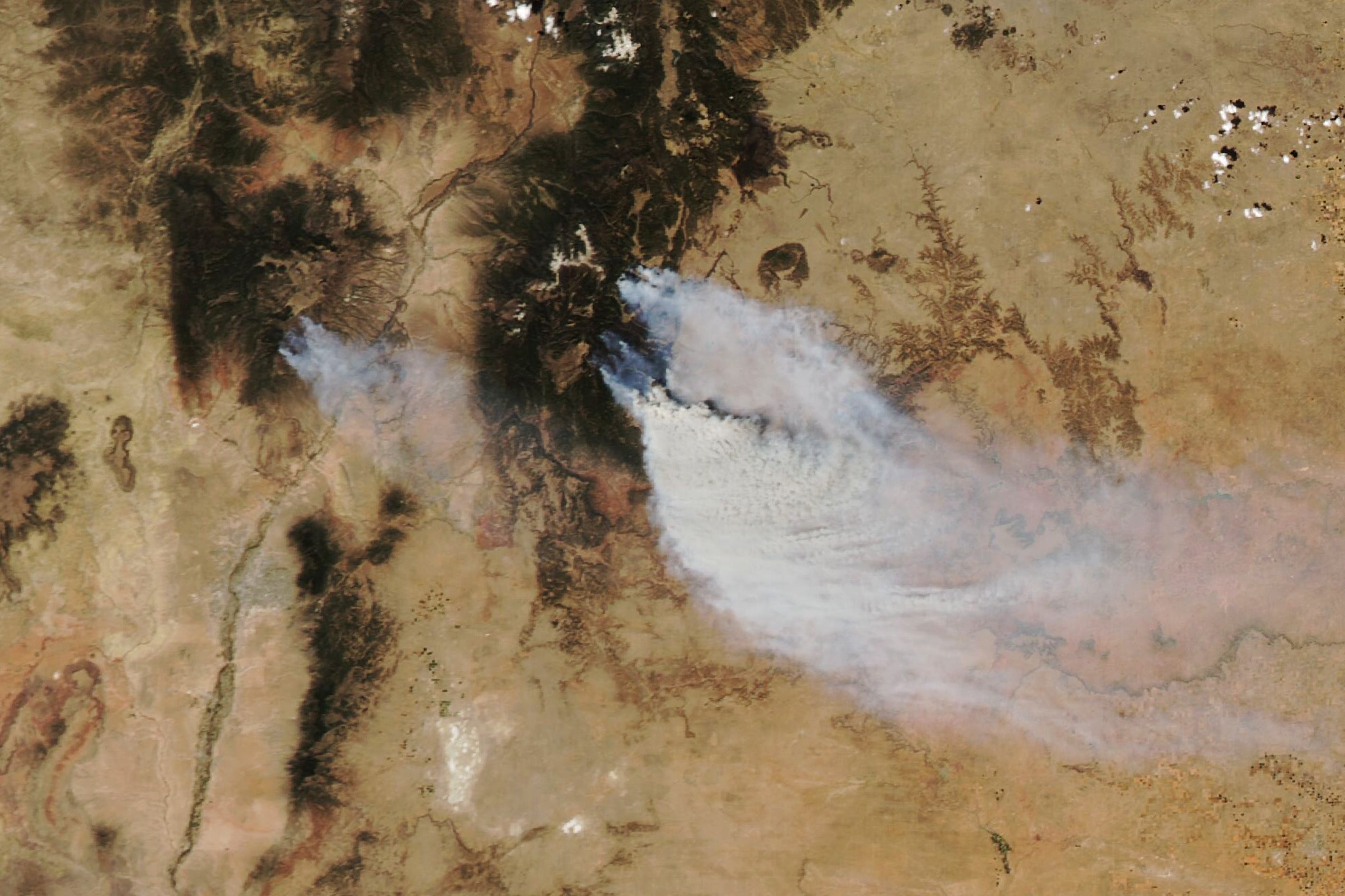
Smoke Plume
Smoke Plume
Infrared Satellite Image