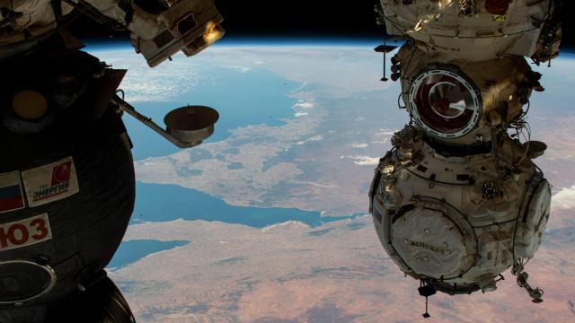
NASA Earth Observatory has been working overtime since its inception in 1999 to bring us stellar coverage of our planet. The Observatory publishes images taken by different satellites or by astronauts aboard the International Space Station depicting Earth’s geography, environment, and geology. You can see ice sheets melting, wildfires burning, clouds floating, waves churning, as well as humans impacting the planet. Earth Observatory features one special image every day from its archives, and here’s our roundup of some of the coolest photos they featured in April.
Cowabunga, Dude – April 1, 2022
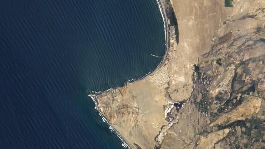
A collaboration by NASA and the United States Geological Survey resulted in Landsat 8, a satellite that captured this interesting phenomenon near the town of Puerto Malabrigo, Peru. The waves that break on Puerto Malabrigo’s beaches, which can be seen in this image taken on March 23, 2021, may be the world’s longest breaking waves. Citing Andrew Thomas, an oceanographer and former surfer, NASA explains that the waves begin to propagate from storm systems in the Pacific and Southern Oceans. These waves travel parallel to the coastline of Peru, until features along the pictured peninsula trigger them to break. Here, waves can break for minutes instead of seconds as they coast along the remaining distance to the beach.
Dune (Algeria’s Version) – April 3, 2022
Algeria’s Tassili n’Ajjer National Park looks like a frame from Denis Villeneuve’s adaption of Dune in this image taken December 11, 2020 using one of the external cameras aboard the International Space Station. In the left of this image is Issaouane Erg (erg is derived from the Arabic word for “dune field”), a sandy expanse that features some alien-looking forests of sandstone amongst its dunes. On the right is darker sandstone featuring winding chasms that were once coursing rivers. The park has also been designated as a UNESCO World Heritage Site due to its over 15,000 cave paintings.
Australia in Technicolor – April 4, 2022
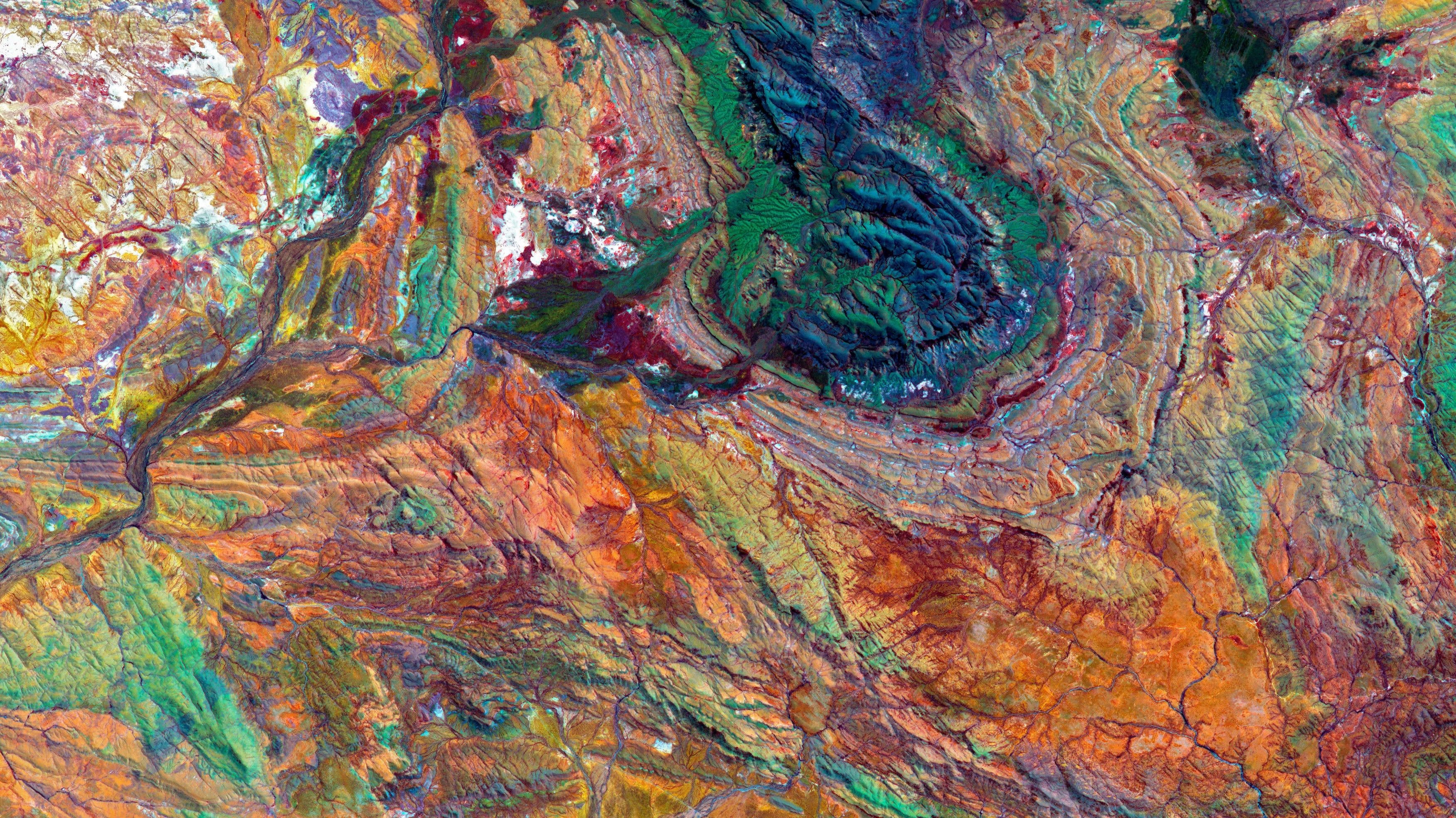
Full disclosure, this is not what our country really looks like from space. This false-colour photo was taken all the way back on October 12, 2004 using NASA’s Advanced Spaceborne Thermal Emission and Reflection Radiometer onboard the Terra satellite. According to NASA, this image was taken using shortwave-infrared, near infrared, visible red, and visible green light in order to effectively distinguish rock types obscured by vegetation. These rocks, more specifically, are located within Hamersley Basin in Western Australia.
You’re Watching The English Channel – April 5, 2022
The English Channel was moving and grooving in March 17, 2022 when the Hawkeye onboard NASA and the University of North Carolina Wilmington’s SeaHawk Cubesat collaboration snapped this image. For reference, France is on the right, England is on the left, and some of those tiny white specks between them are ships. These streaks of green are likely sediments from rivers, sediments churned up from the ocean floor, and phytoplankton blooms, says NASA.
A Hole in the Sky – April 9, 2022
On April 3, 2022, the Terra satellite’s Moderate Resolution Imaging Spectroradiometer snapped a picture of this patch of sky, which seems to be the work of a cosmic entity that punched a hole through the Earth’s clouds. Gary Patryka, an atmospheric scientist at NASA’s Goddard Space Flight Centre, has a more scientific explanation. He said: “It looks like there was a frontal weather system zipping by from west-to-east between 50-60 degrees south latitude. At the same time, a deck of more stationary, low clouds closer to the tip of Africa was being eroded by a high-pressure region with sinking air. The sinking air produced a semi-circle ring of clouds between 45-50 degrees south. When both of these phenomena lined up in longitude, it gave the appearance of a giant hole in the clouds.”
Pretty in Pink – April 10, 2022
International Space Station astronauts caught the peculiar coloration of this body of water in Torrevieja, Spain in a photo taken on June 7, 2021. The pink hue of the Torrevieja Salt Lagoon, which looks absolutely trippy on the ground, is apparently caused by bacteria. Dunaliella salina is a bacteria that thrives in salty environments, and is also rich in beta-carotene, which is a colourful compound found in several vegetables.
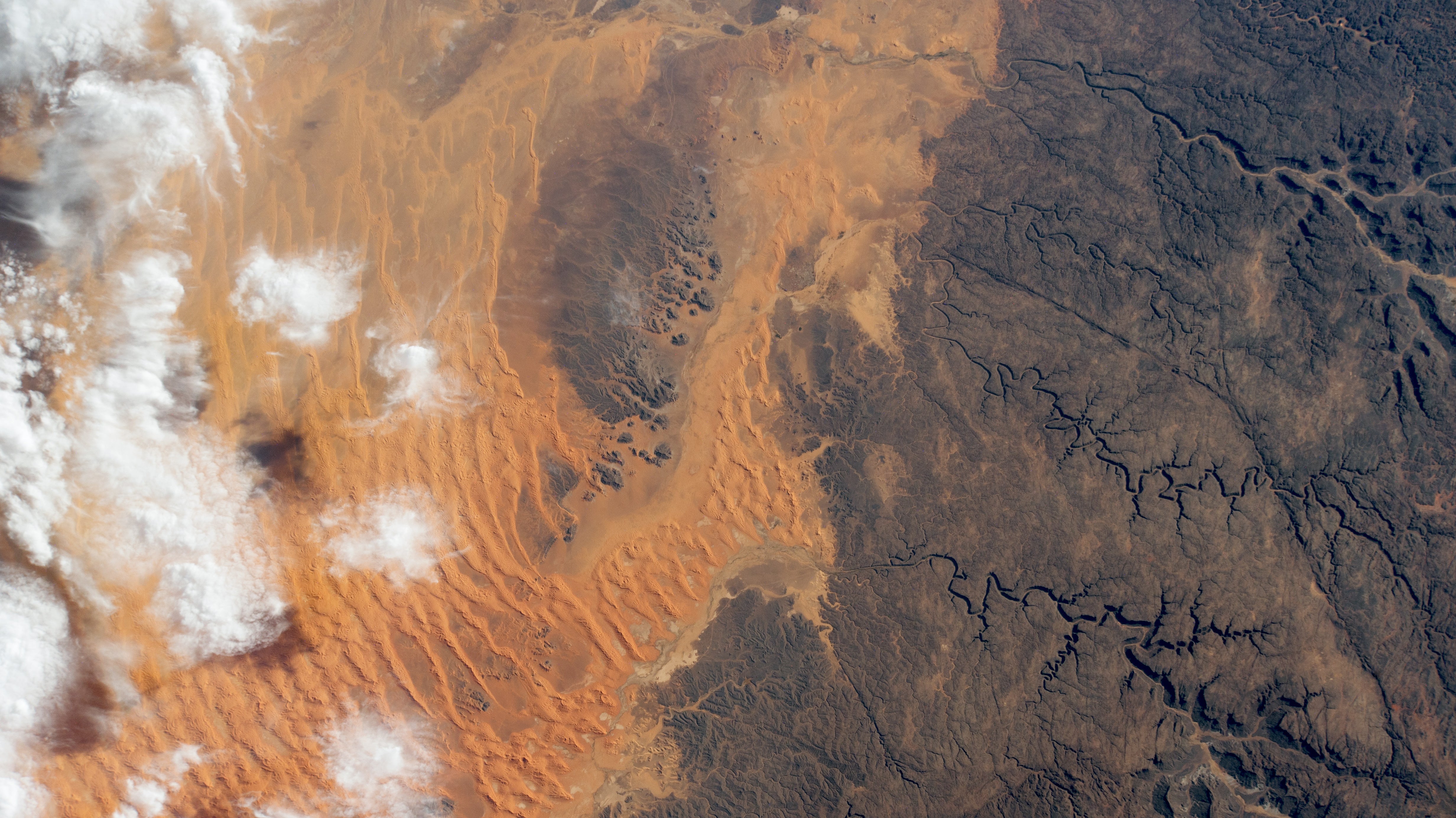
A Dust Storm in Iraq – April 12, 2022
Iraq fell prey to a nasty, multi-day dust storm in early April. This photo, captured on April 9, 2022 by the Visible Infrared Imaging Radiometer Suite on the Suomi NPP satellite and the Moderate Resolution Imaging Spectroradiometer on the Terra satellite. The Suomi NPP (“NPP” stand for National Polar-orbiting Partnership) was launched in 2011 as a joint effort between the NOAA and NASA to collect more data on Earth’s weather for NOAA’s predictive models.
The Dungeness Spit – April 13, 2022
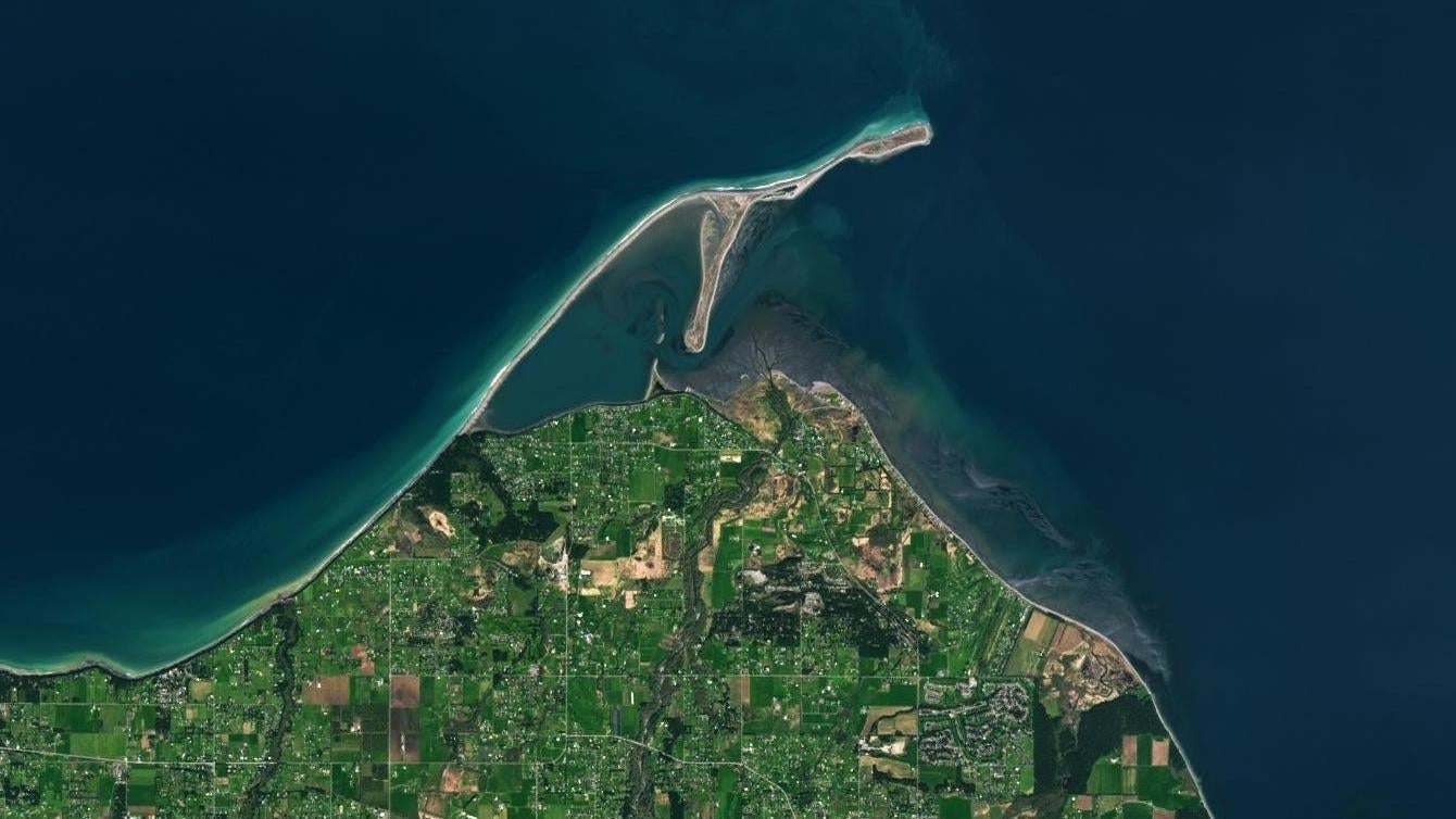
This nearly 6 km long sand spit is located off the northern coast of Washington, U.S. in the Strait of Juan de Fuca, near the town of Dungeness, which shares its name with the popular crab. The Dungeness Spit is one of the largest sand spits in the world and is growing 15 feet every year due to longshore drift carrying sediment along the landform. The photo here was taken on April 6, 2022 with NASA’s Landsat 9 satellite using the Operational Land Imager 2.
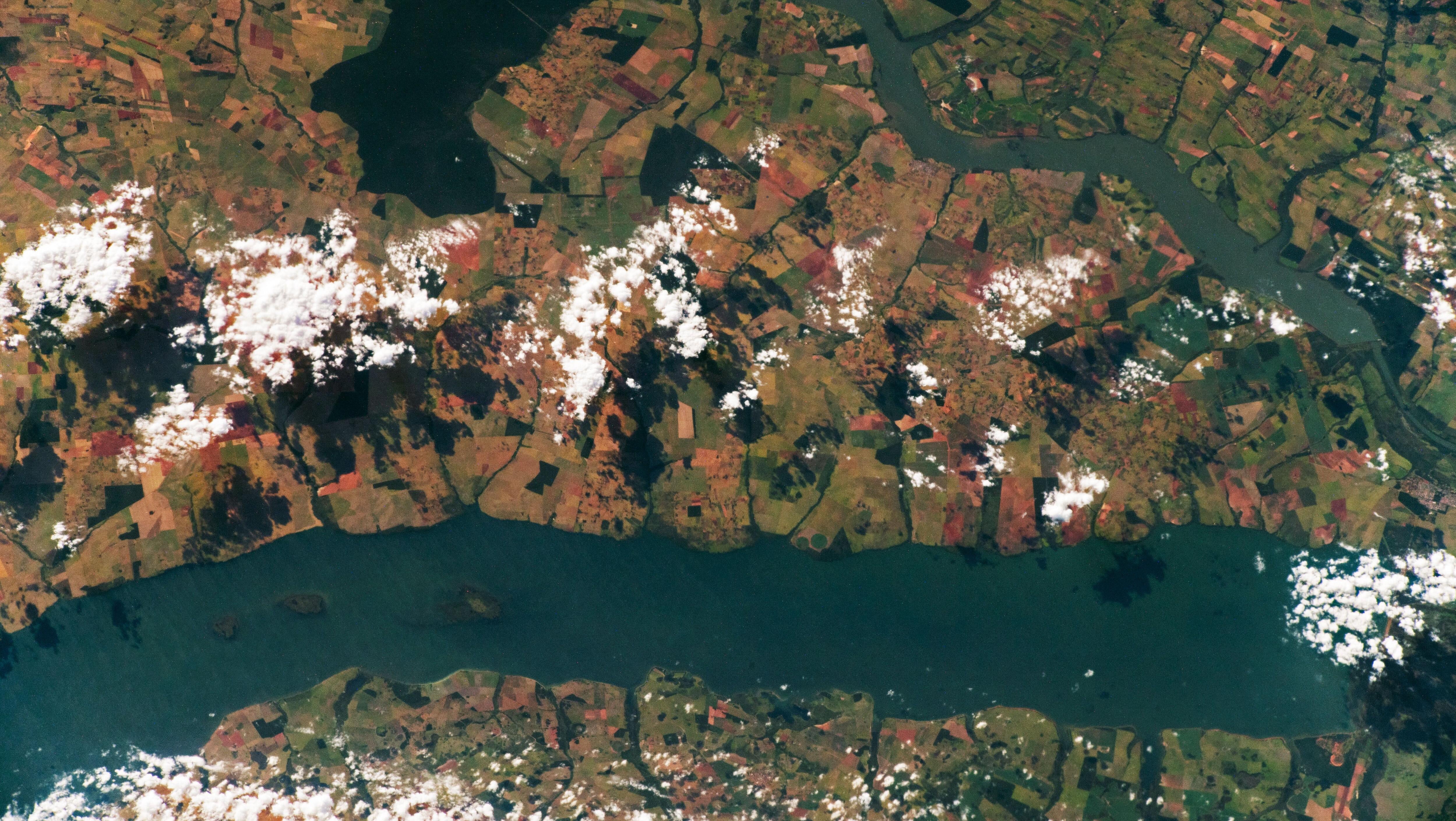
The Braided Rivers of India – April 17, 2022
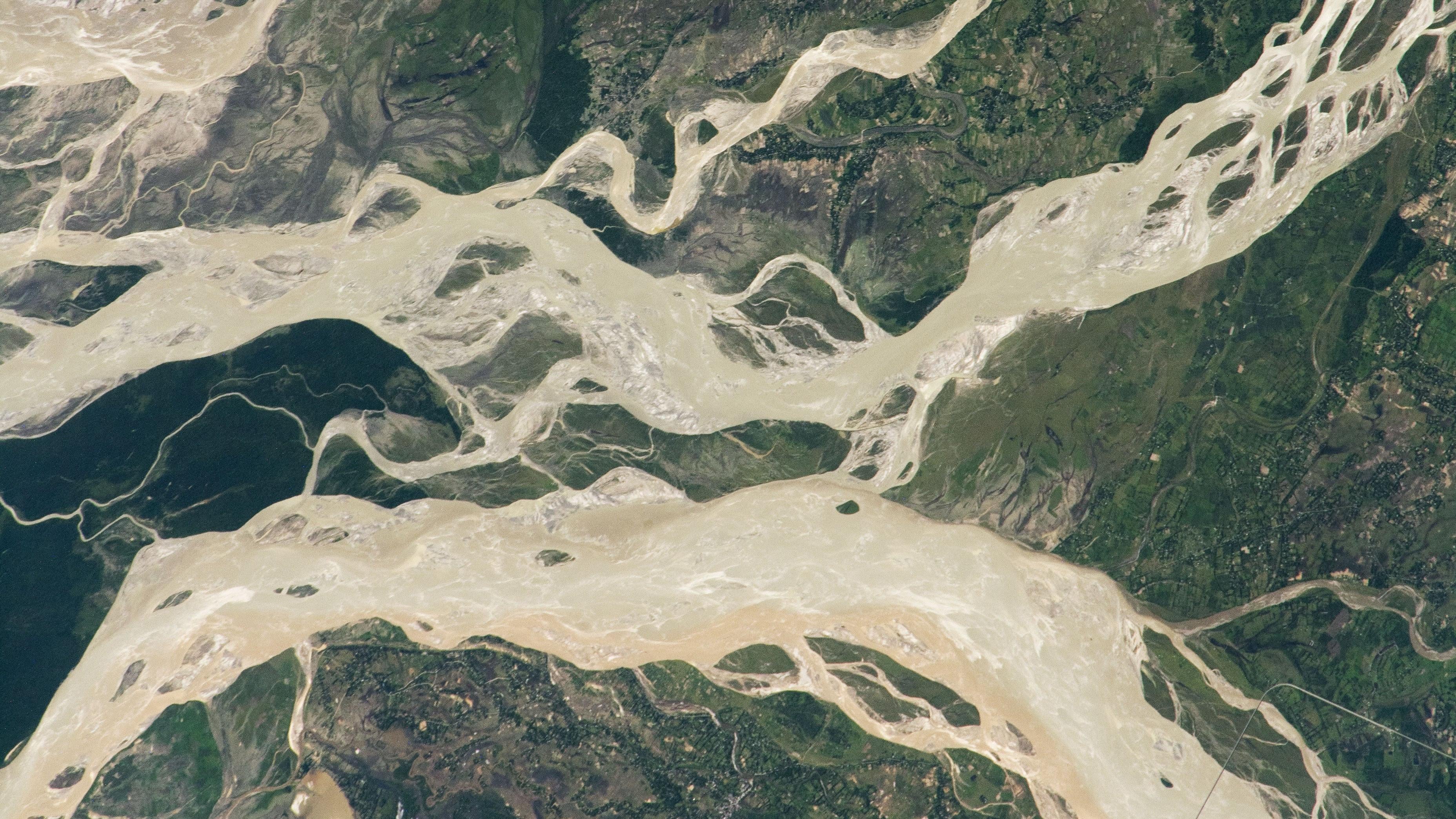
The Dibang and Lohiti Rivers, pictured here in an image taken from the International Space Station on May 28, 2020, are tributaries of the larger Bahmaputra River which flows across approximately 4,023 km from it’s source in the Himalayan glaciers all the way to the Ganges Delta. This image is a great example of a braided river, which consists of a river made up of several smaller river channels flowing in between islands that are highly susceptible to erosion.
Spring Has Sprung in Tennessee – April 21, 2022
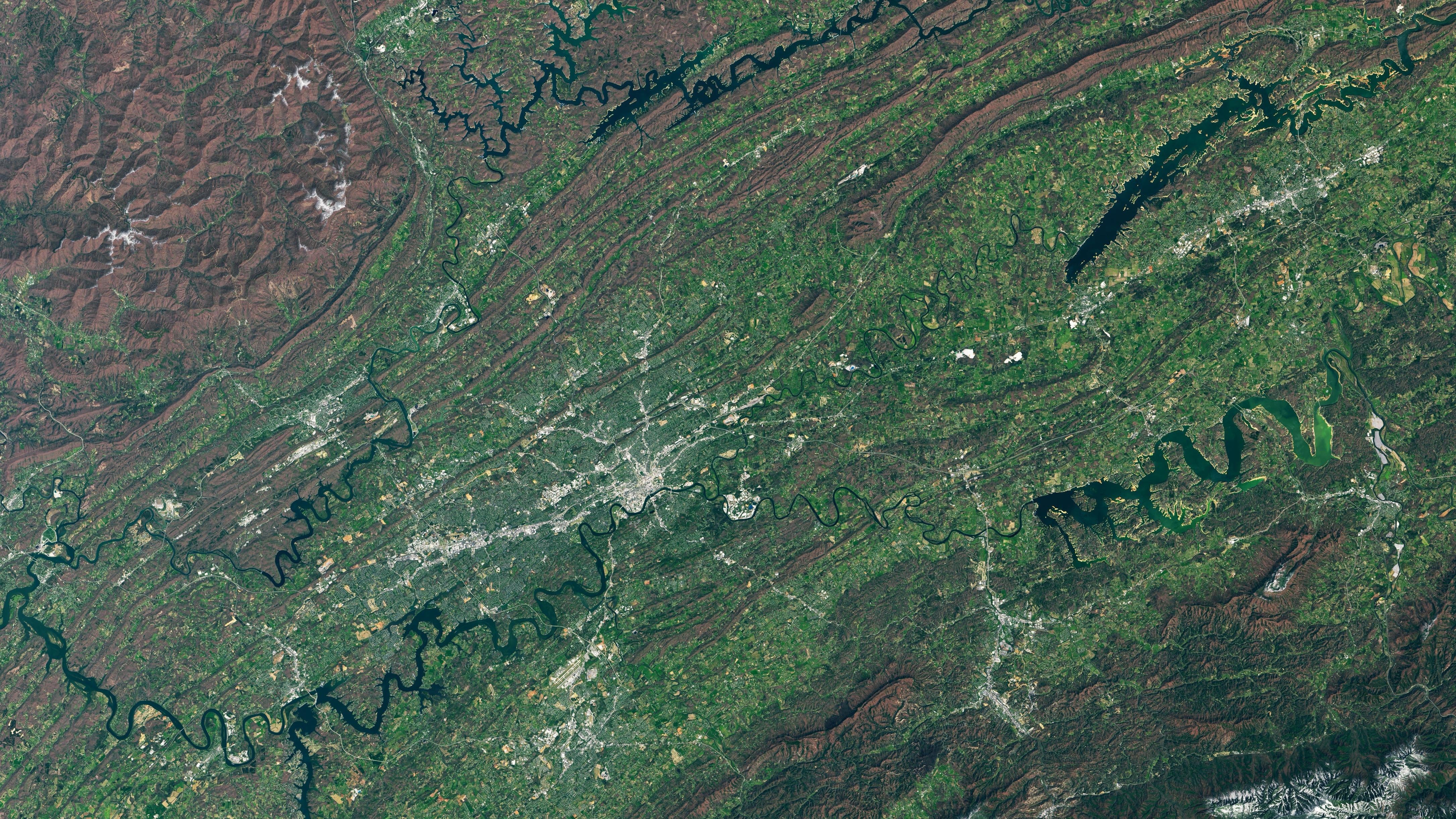
The Appalachian Mountains look absolutely green and lush on April 10, 2022, when the Landsat 8’s Operational Land Imager captured this photo. For reference, the city of Knoxville is that grey spider-looking clump near the middle of the image. NASA, citing data from the National Phenology Network, says that the beginning of spring (which is measured by the Network using the First Bloom and First Leaf Indices) in the eastern parts of Tennessee came a little earlier than previous years.
A Wildfire in Mongolia – April 22, 2022
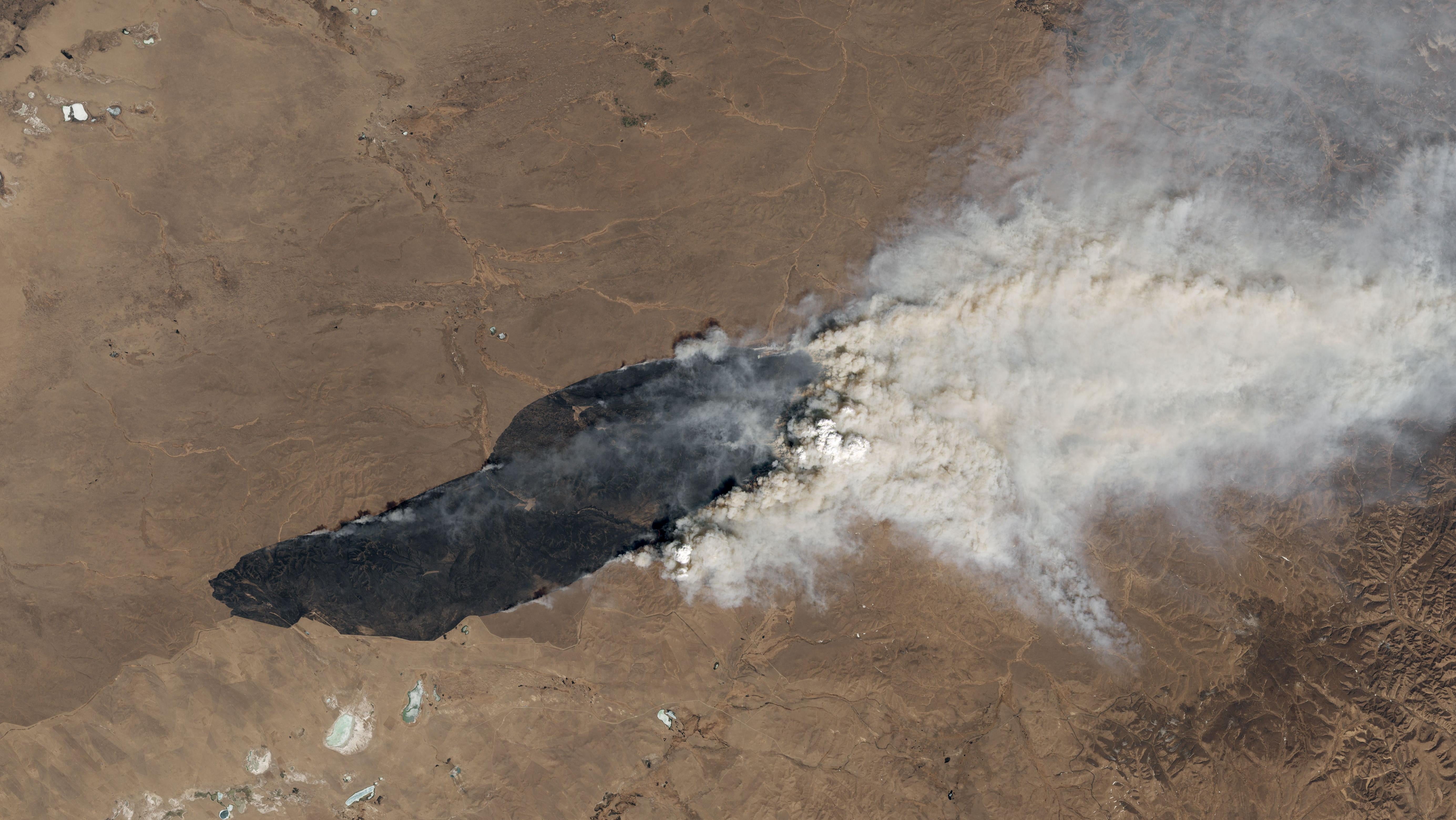
Landsat 8’s Operational Land Imager also caught this wildfire at 2:50 UTC on April 19, 2022. The fire, which burned in Eastern Mongolia, was first detected by NASA on April 18 and generated a pyrocumulus cloud, which caught the attention of meteorologists.
Tawi-Tawi, Phillippines – April 23, 2022
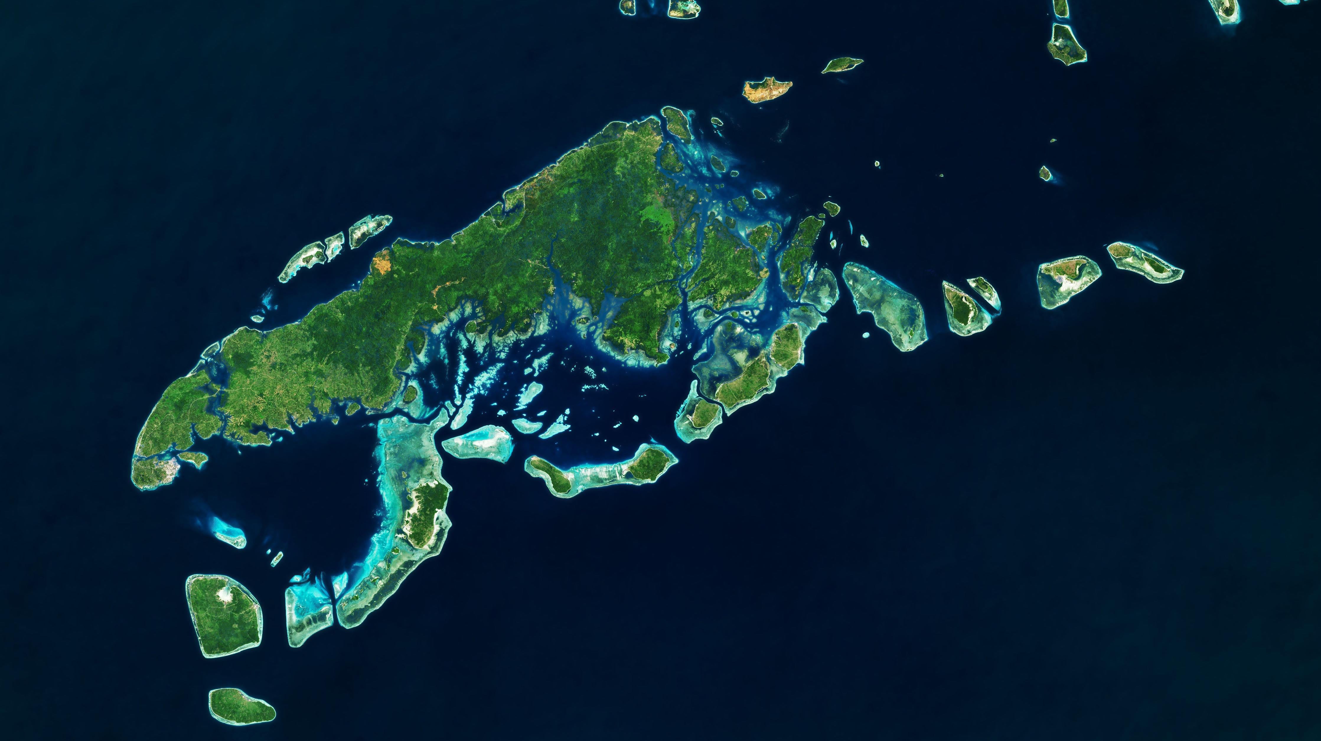
To some, this island province in the Philippines looks like a leaping frog or an open-mouth dinosaur in this image of Tawi-Tawi by the Landsat 8 Operational Land Imager. This image is actually a composite of several different images captured from 2013 to 2022 as cloud cover typically obscures this island, which is one of the southernmost parts of the Philippines.
Pontal do Paranapanema – April 24, 2022
This photo of the Pontal do Paranapanema State Reserve (also known as the Great Pontal Reserve) in São Paulo, Brazil was taken by an International Space Station astronaut on December 7, 2021. In 1970, the thought-to-be extinct black tamarin was rediscovered in Pontal do Paranapanema. Over the following years, efforts were made by scientists to preserve the habitat and population of the black lion tamarin with the help of local farming communities.
Feeling Salty – April 25, 2022
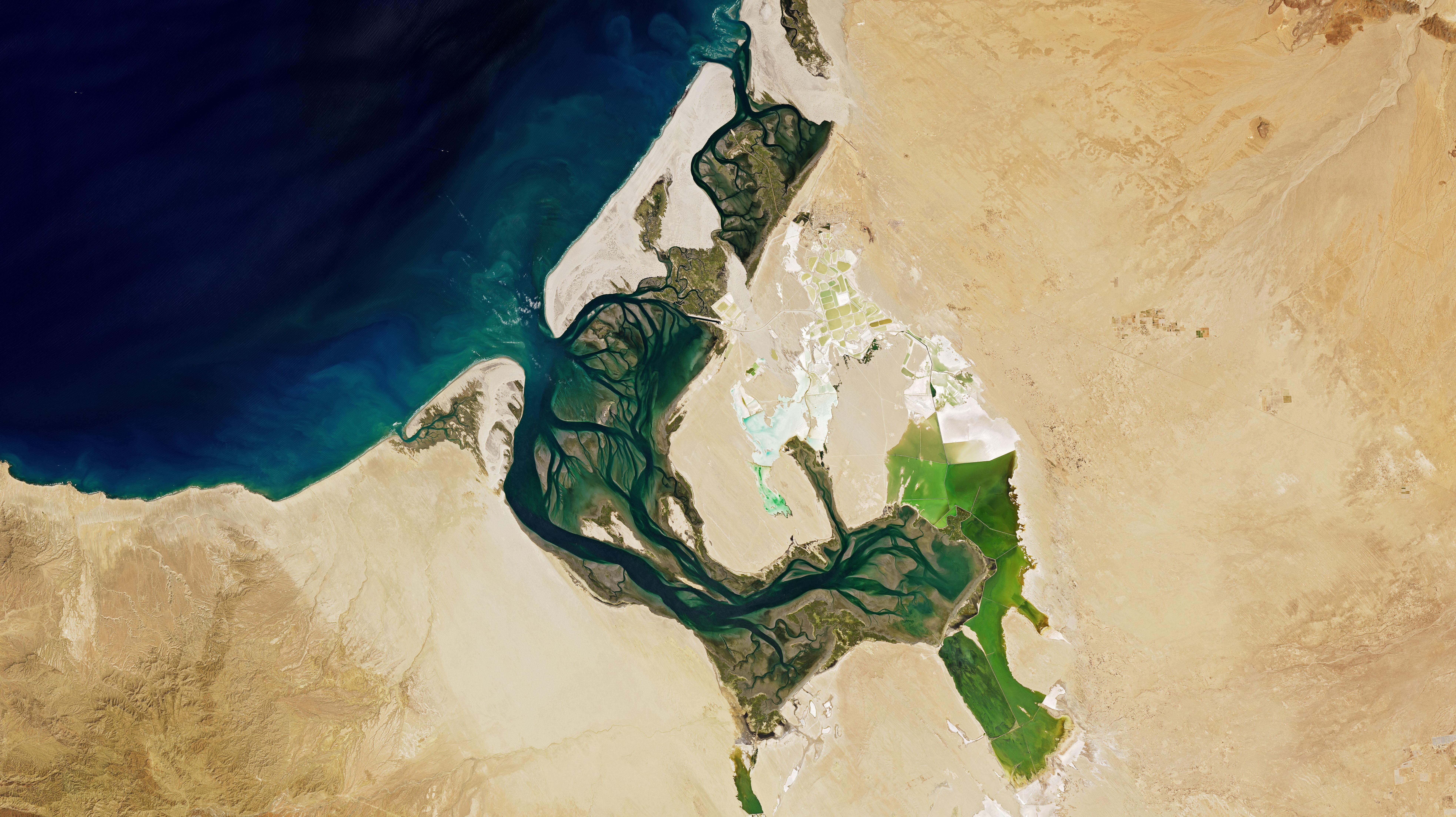
One of Earth’s largest saltworks is located on the Baja California Peninsula. The plant, near the town of Guerrero Negro, is located on the east side of the peninsula, and produces 9 million metric tons of salt each year by evaporation of ocean water as opposed to mining. The saltworks was founded in this location in 1954, and on March 23, 2022, Landsat 8’s Operational Land Imager caught this photo of it.