The NSW government is going to stand up a Quantum Technology Centre in Sydney, where it will tinker with the not-so-futuristic tech to determine the possibilities of running the state’s transport network on quantum computers.
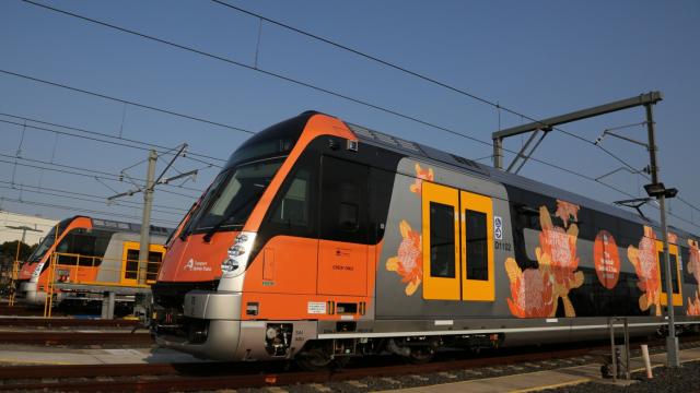
The plan is for quantum computers to process and analyse massive amounts of transport info in real-time, allowing customers to more accurately track the location and capacity of a train or bus.
We’re exploring the possibilities of quantum technology. This new technology has the potential to give customers across NSW personalised real-time info to help optimise their journeys, reduce delays and improve reliability and safety.https://t.co/1F5NE3Fcxf pic.twitter.com/7gYNoUCN5T
— Transport for NSW (@TransportforNSW) November 8, 2021
The government says quantum technology would boost the computing power needed to reduce delays, improve reliability and optimise journeys across NSW transport.
“While this might sound like the stuff of science fiction, Transport for NSW is making quantum computing a reality. It has the potential to solve problems on the network in real time by instantly recalculating timetables and routes,” NSW Minister for Transport and Roads Rob Stokes said.
“It could essentially become a ‘self-healing’ network that interacts with cutting-edge technologies, including autonomous vehicles, artificial intelligence and smart sensors. It may also allow Transport for NSW to give customers personalised real-time information to make their journeys faster, safer and more reliable.”
[related_content first=”1695506″]
As part of this plan, Transport for NSW is establishing a Centre of Quantum Technology. The centre will be based in Sydney’s Tech Central, which will be co-led by a dedicated quantum technology director and a fellow of Quantum Technology.
But the state’s ministers are looking further than just transport, with Minister for Regional Transport and Roads Paul Toole seeing application in delivering information during times of crisis.
“This ground-breaking technology can also calculate potentially life-saving information during a bushfire or flood by mapping out the safest route on the road network or to the closest evacuation centre,” Toole said.
“The faster you get information in an emergency, the better your chances of protecting life and property are, so this will be a game changer when it’s rolled out to the regions.”