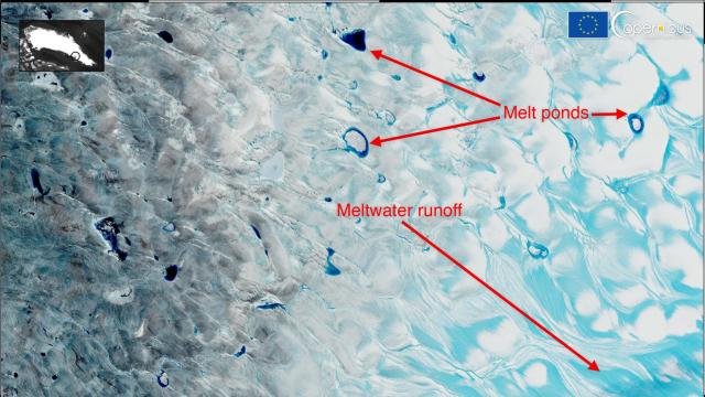
The image above is beautiful, but looks can be deceptive. It shows there’s way too much ice is melting in Greenland, and we should all be concerned.
The tranquil, surreal scene was captured by a European Space Agency satellite over the weekend. It shows meltwater swirling over the ice cap in the southwestern part of the country. But while everything looks calm, the image is a sign of a future that’s anything but.
The melting on the ice cap was triggered by an Arctic heat wave — the region’s second major one of the summer. It brought temperatures in some areas to 18 degrees Celsius warmer than the seasonal average, and also caused raindrops to fall at the National Science Foundation’s Summit Station, a weather observatory roughly 3 kilometres above sea level, for the first time in recorded history.
The ice melt extent peaked at 872,000 square kilometres on Sunday, according to the National Snow and Ice Data Centre. That’s an area of about half of the ginormous sheet. That’s major, especially so late in the season. But this meltdown was actually slightly smaller than the big melt event that happened in late July, which spread across 880,595 square kilometres. Due to this year’s heat, the Greenland ice sheet reached its highest maximum daily melting rate recorded since 1950, losing seven times more ice than normal, according to an analysis by University of Liège climate scientists.
There’s only one other year when multiple melt events covered more than 800,306 square kilometres. That year is 2012 in case you ever have to answer a Jeopardy! clue about it. During that summer, winds lofted massive amounts of soot from wildfires in other parts of the Arctic to Greenland, which drove a meltdown across nearly the entire ice sheet surface.
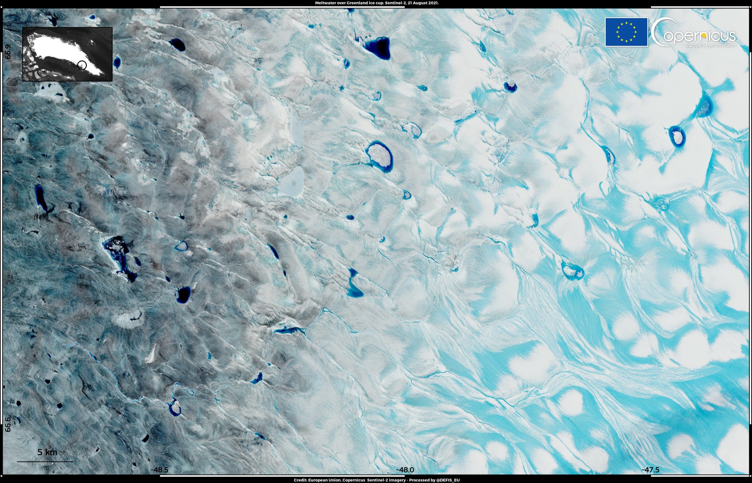
Though the meltwater left behind these events is painting beautiful pictures across the ice, the warming is a climate warning. The Arctic is heating up faster than any other location on Earth. Dark-coloured meltwater absorbs more heat than ice or snow, so when water pools on the ice, it can create a feedback loop, spurring more ice to melt and widening the deep blue ponds.
The blue melt ponds visible in the image are essentially dreamy pools of hot fudge that spell the ice sheet’s ruin. Rainwater can also quicken the melting, and the pockmarks the rain leaves behind can further destabilise the sheet. Soot has also shown up on the ice sheet with more alarming regularity, adding another means to melt. Even sunny skies are working against Greenland’s ice, and all these factors are leading to long-term damage.
That’s driving sea level rise up. According to the recent United Nations climate report, seas are rising faster than at any point in the last 3,000 years, and ice melt from Greenland and Antarctica’s ice sheets is the main reason why. So yes, meltwater ponds over ice caps are gorgeous, but the scenes they could create around the world are gruesome.