We’re heading into the peak of Atlantic hurricane season with a storm on the horizon. And unfortunately, it could be a very serious one.
Tropical Storm Henri brought plenty of rain to the Northeast and parts of the Caribbean last week, but what’s forecast to become Hurricane Ida could be on another level. The storm is currently a tropical depression in the Caribbean, but everything is lining up for it to be a beast as it moves northwest over the coming days, ploughing over Cuba and the Cayman Islands as a tropical storm before hitting the warm waters of the Gulf of Mexico. There, it will bloom into a hurricane that is poised to wreak havoc somewhere on the Gulf Coast on Monday, almost a year to the day after Hurricane Laura hit western Louisiana and 16 years after Katrina struck New Orleans.
If you live in the region, absolutely start paying attention to the forecast. The track will likely change in the coming days as soon-to-be Ida moves closer, but the risk of a life-threatening storm is very real.
Where Things Stand Now
Our storm to watch is a tropical depression, the unnamed precursor to a tropical storm. (Though it does get a number, at least, and this one is Tropical Depression Nine.) Winds are currently blowing at 56 km/h, just a shade below tropical storm levels.
The National Hurricane Centre is expecting the depression to pass the threshold for a tropical storm — that is, when winds rise above 63 km/h — by this evening as the storm continues its course to the north. The agency has issued tropical storm warnings for the Caymans and Cuba in anticipation of what will be Tropical Storm Ida reaching those countries in the next 36 hours. The Caymans will likely feel tropical-storm-force winds by this evening.
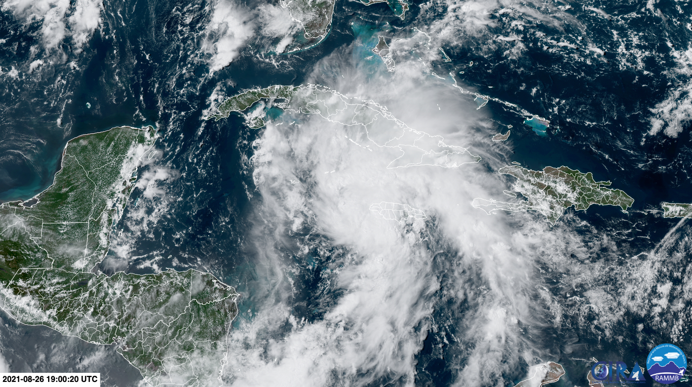
This is already a pretty big system; while Jamaica isn’t forecast to be hit by the storm, it is expected to be drenched by Ida as bands of rain wrap around the strengthening system. The NHC is calling for up to 38 centimetres of rain on the island, located 370 kilometres east of the Caymans. Cuba and the Cayman Islands themselves will see widespread rainfall totals of 15 to 25 centimetres of rain, with some areas getting 50 centimetres. That could mean floods and landslides across each of those nations.
What Happens Once Ida Reaches the Gulf of Mexico
Ah, the million-dollar question. Once Ida clears Cuba’s western tip, the storm will be in the Gulf of Mexico. Waters there are plenty warm to help Ida become a hurricane.
Outside an area churned up by Hurricane Grace off the Yucatán Peninsula last week, most of the Gulf is abnormally warm. And the waters where Ida is forecast to go are particularly toasty, running up to 2 degrees Celsius above normal for this time of year. Critically, those waters are 30 degrees Celsius or hotter, a threshold that tends to help storms rapidly intensify. Your regular reminder that hotter than normal waters is also a hallmark of climate change.
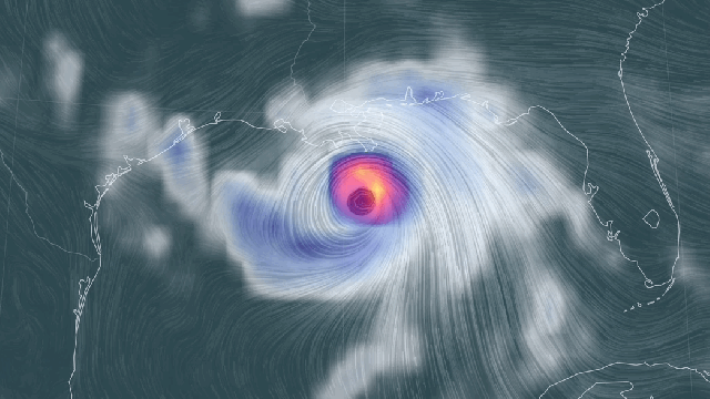
By Sunday morning, the NHC forecast indicates that Ida could be a shade below a Category 3 hurricane, what’s considered a major ‘cane. Right now, the forecast track puts it somewhere off the coast between Louisiana and Texas. That is particularly worrisome given that the region was walloped by Hurricanes Laura and Delta last year, as well as the deep freeze that hit the South this winter.
It’s too early to be talking about exact landfall or impacts in the U.S., and the track will likely shift. That said, everything indicates this is not a storm to be trifled with. Major storm surge, rain, and wind are all in the cards. If you live along the Gulf Coast, this is basically the “ready” phase of “ready, set, go” in terms of preparation. That means it’s worth watching the track closely over the next few days, and as the track becomes clearer, perhaps shifting into “set” mode.
The Peak of Hurricane Season Is Nearly Here
The map of the tropics is starting to look a little busier. In addition to the storm in the Caribbean, the NHC is also tracking two other areas of interest in the Atlantic. The agency has been expecting an above-average season in terms of activity, and the statistical peak is in mid-September so things are ramping up right on time. Unfortunately.
The agency also upped what an “average” season is this year after a decade of new data showed we’re seeing more storms form in the Atlantic. That’s due to climate change as well as better observations. So cluttered maps like the one currently on the NHC site — and last year’s record-setting season from hell — are precursors of the future.