About 32 kilometres off the Californian coast, the 4,7630-kilogram remote submersible Doc Ricketts swept its strobe lights and sonar pulses across the seafloor like a transient silent disco. The vehicle wasn’t just putting on a show for the deep-sea denizens of the Pacific. It was mapping the terrain and ecology of a unique geological formation some 793 metres beneath the ocean’s surface.
Doc Ricketts was the tool by which a human team from the Monterey Bay Aquarium Research Institute scoured the seafloor, assessing its bathymetry and rich ecology.
“Our goal is to map benthic habitats at centimeter scale in complex terrain, in the deep ocean, efficiently,” said Dave Caress, a principal engineer for MBARI and the leader of the seafloor mapping team, in an email. “We can currently cover an area around [100 metres by 150 metres] in a single 10-hour ROV dive. In order to achieve efficiency scalable to truly large surveys, we ultimately hope to field this sensor package from an autonomous underwater vehicle.”
The subject of inquiry was Sur Ridge, an anomalous escarpment of rock at the bottom of the Pacific Ocean. Thought to have formed during the Cretaceous Period, the submarine ridge is a combination of sedimentary and metamorphic rock. It’s about the size of Manhattan and has been the subject of MBARI investigations for over 20 years.
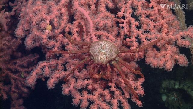
Towering some 488 metres above the muddy plains surrounding the structure, Sur Ridge is taller than the Empire State Building in parts, though has its own geography of peaks and valleys within it. Recently, the research focus has been on the ridge as a hotspot for biodiversity; it’s been found to host over 250 different species, and the team was inspecting a particularly verdant section bedecked in corals and deep sea sponges.
For the recent work, the team outfitted Doc Ricketts with lidar laser scanners, a sonar system, cameras, and lights mounted on the vehicle’s undercarriage. Lidar is a technology is commonly used in aerial archaeology and mapping terrestrial ecosystems like the rainforest. The system works by shooting laser pulses at a target region, and making a topographical map of that region based on the time it takes each pulse to bounce back off it. The deep-sea offered a technical challenge for the researchers efforts, though, not just for lidar, but other forms of monitoring as well.
“Put simply,” Caress said, “what we are trying to do is technically very difficult, not least because we want to operate electronic equipment at great pressure in a corrosive, electrically conductive medium.”
The team conducted nested surveys, meaning with each pass they looked at the Sur Ridge’s biodiversity hotspot in higher resolutions. Taking the information collected together, the team created a huge dataset describing the hotspot, from the rougher sections of the bedrock’s topography to the structure and size of the more immobile lifeforms at the bottom, like the coral. Other life was less compliant.
“We found that the ROV was mobbed by sablefish, which increased in numbers as the survey went on,” Caress said. “The problem was that the fish moved along under the ROV, getting in the way of the cameras and the lidar, and kicking up so much muddy water that they ruined the survey data. We ultimately decided that the sablefish were being attracted by the strobe lights used for our photography.”
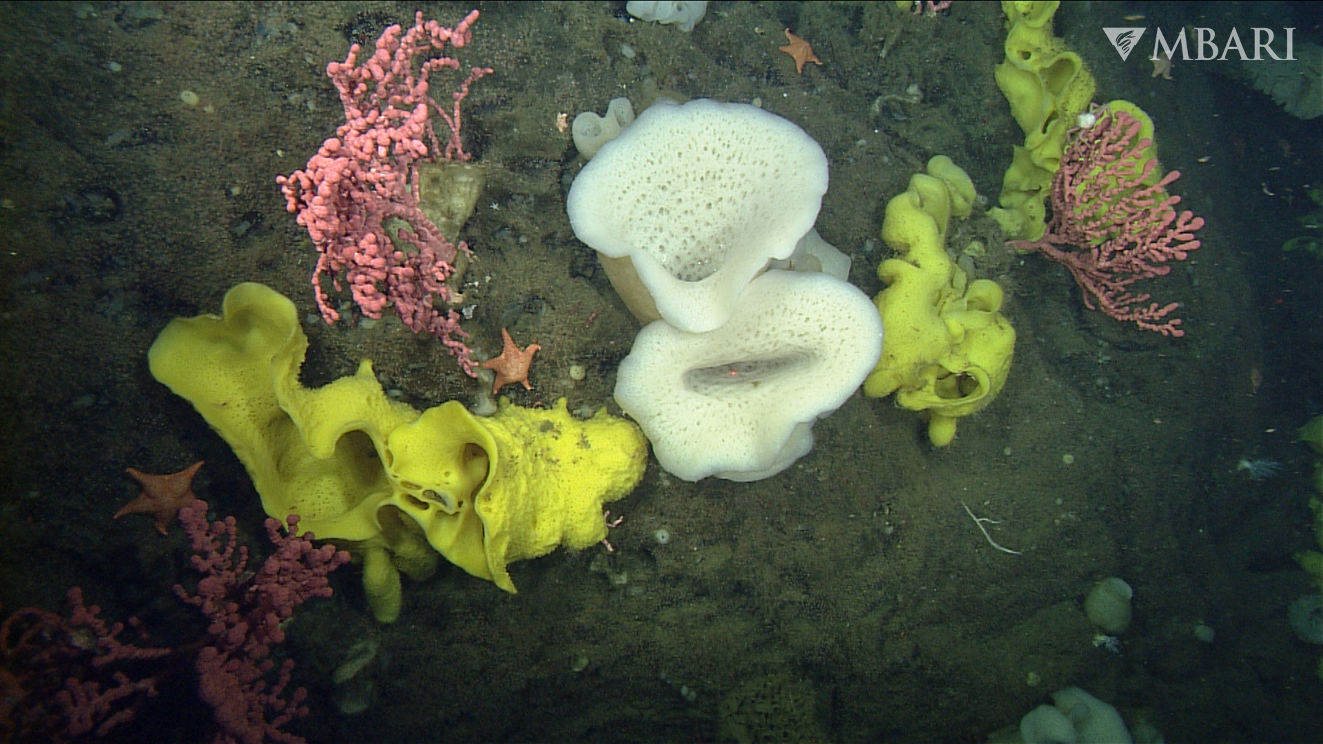
Last year, the Ricketts submersible was deployed with a laser system that allowed MBARI researchers to better understand the mucoid structures provided by the ethereal, gelatinous larvaceans living off the coast. The recent 3D-reconstructions of Sur Ridge were possible thanks to the triumvirate of instruments put to task — sonar, which doesn’t detect such soft tissues as living things, and lidar and photography, which detect everything. Capturing the seafloor at resolutions of less than half an inch, the team was able to reconstructed the surveyed area in sharp relief, down to the tiniest phalanges of a pink coral’s fan.
“Once we know where the animals are, we can look at a photomosaic made by stitching together the individual photographs and assess whether the animal is alive or dead,” Caress said, “and sometimes determine the species.”
The research is crucial for a variety of purposes, including conserving at-risk ecosystems and finding the best places to generate wave power to clean up the electric grid. Understanding what’s beneath the waves is all the more vital given that roughly 2.4 billion people live within 97 kilometres of the coast, according to the United Nations. Areas like the waters off California, home to the California Current, are also home to vast fisheries that sustain people’s livelihoods but also require sustainable management.
The mapping data the team collected will be a relatively small, albeit useful contribution to the Seabed 2030 project, an extensive internationally collaborative effort to map the entirety of the ocean floor by the end of the decade. Most of that scanning is being done using sensors on ships traversing the Earth’s ocean, so the Sur Ridge project went (literally) overboard in getting such high-fidelity video and point cloud data directly from the ocean’s bottom.