You probably use your smartphone to get from point A to point B, but have you fully explored all the features and options available along the way? Google Maps, Apple Maps, and Waze all have navigation modes that are smarter and more versatile than you might have realised. From changing direction mid-route to avoiding parking problems, here’s how you can make the most of them.
Google Maps
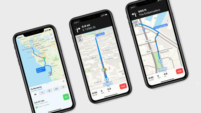
When you’ve asked Google Maps to figure out some directions for you, don’t neglect the Steps and more (Android) or Steps (iOS) button at the bottom. Tap it to see how busy the route will be over the next few hours, how easy it’s going to be to park, and each turn that you’ll have to make along the way (on Android these turns are accompanied by Street View photos of each junction, though this isn’t available on iOS yet).
From the main directions screen, tap the three dots on the top right, and then Route options if you want to avoid highways, toll roads, or both. After you’ve made your selection, the route gets calculated again. The same menu lets you add multiple stops to a journey, which is useful not just for making a trip with multiple stops, but also for taking a particular route to your destination (if you want to take a more scenic journey, maybe).
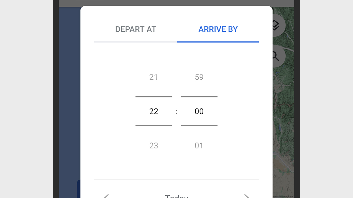
In Google Maps on Android, you can tap the three dots and then pick Set depart or arrive time to see how the journey looks at some point in the future. The main reason you might want to do this is to check how the traffic conditions might have changed from what they are now (the congestion or lack of it will be estimated based on historical data).
Google Maps for iOS has a different feature that you can access from the bottom of the Steps screen we mentioned before — select the Remind you to leave on time and the app will do exactly that, based on a departure or arrival time that you specify. It’s an odd discrepancy between the versions of the app for Android and iOS, but there are plenty of similar platform variations spread across Google’s mobile apps.
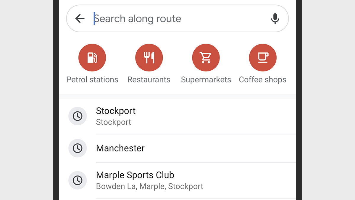
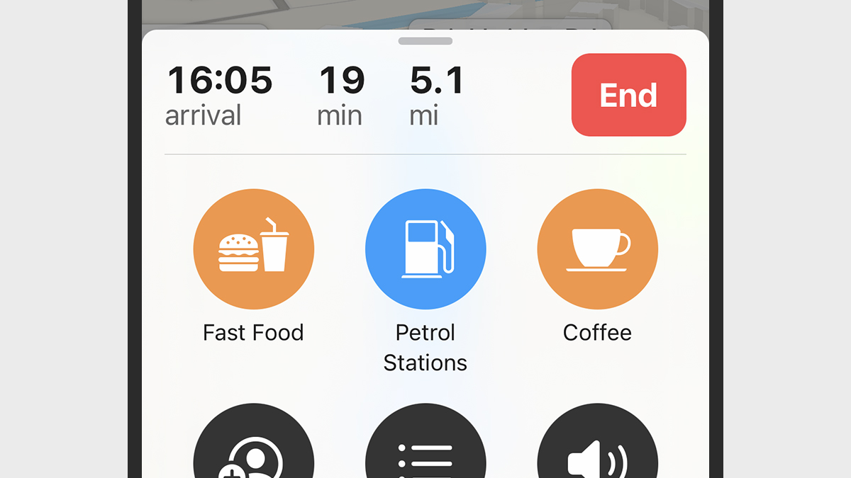
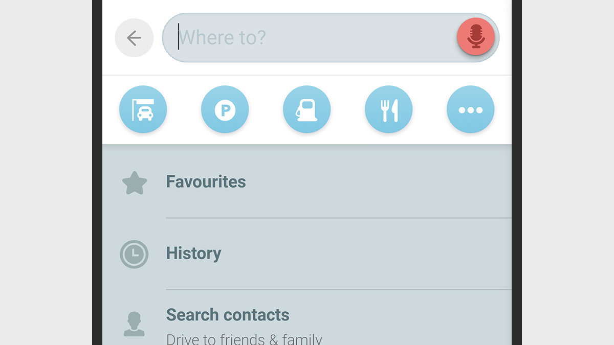
If you need to stop for gas or just a snack, you might have to take a detour in the middle of your journey. To do this, tap the search icon on the navigation screen (the magnifying glass) and then enter your search — you can look for gas stations and grocery stores, or whatever you need. Google Maps will show you a range of options close to your current route and then give you the instructions to make the detour once you’ve chosen one.
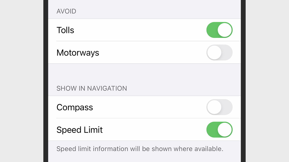
It’s also worth diving into the settings for Google Maps, accessible via the main app menu. Tap Navigation settings (Android) or Navigation (iOS) and you’re able to force day or night mode no matter what the time of day, keep the map fixed with north ahead, show or hide speed limits on roads, and adjust the volume of the spoken guidance that accompanies you on your travels.
If you’re walking around rather than driving, you can use the augmented reality Live View feature to make sure you always have your bearings and to overlay AR pointers on top of the real world: After you’ve requested directions, tap the Live View button to get started. While you’re walking, you can tilt the phone up in front of you at any time to get a fix on where you should be heading next.
Apple Maps
You can configure various navigation settings for Apple Maps on the iPhone by opening up the main iOS Settings app and choosing Maps from the list. Setting your preferred type of travel, for example, will control which type of navigation Apple Maps defaults to whenever you load up some new directions.
Pick Driving to tell Apple Maps to avoid toll roads and highways when it creates a route, or Cycling if you want to avoid hills or busy roads. If you’re travelling by car, you can also set whether or not the compass and speed limit labels are shown on screen while you’re getting from A to B.
Under Navigation & Guidance are options for the navigation voice volume, which you don’t necessarily want set at the same volume as your music or podcasts. If you’re listening to spoken audio while driving, you can make it automatically pause itself whenever Apple Maps’ built-in turn-by-turn prompts want to say something.
In the Apple Maps app itself, after you’ve looked up some directions, you can scroll down past the suggested routes to look for alternatives that don’t include toll roads or highways. If you want to change the defaults for these rules, head to the Driving section in the Maps section of iOS Settings again.
To search for places while you’re already en route to your destination, swipe up on the pane at the bottom of the screen listing your travel time — you’ll see relevant options like gas stations and coffee stops, which can be added to your journey without changing the ultimate destination. There’s also a Details option you can use to see all of the individual turns you need to take on the journey.
Included in this same panel is a useful Share ETA option, which does exactly what you might expect: You can let someone know how long you’re going to be through a link sent via text or email. The people you’re sharing with are then able to see your route, your destination, and your current location inside Apple Maps for the rest of your journey.
Finally, don’t neglect the Do Not Disturb options that are built into iOS, which just might just prevent you from getting into an accident. Head to Do Not Disturb from the main iOS Settings app, and you’ll see there’s an option to automatically enable the mode when your phone detects that it’s in motion. You can also set up an auto-reply message for your contacts (or just some of your contacts) to let them know that you’re driving.
Waze
Waze is just about the best alternative to the big two mapping apps — though it’s owned by Google — and where it really shines is in its community-driven features. Use the orange bubble icon (bottom right) if you need to send a report about traffic congestion, an accident, a police stop, or any other kind of hazard.
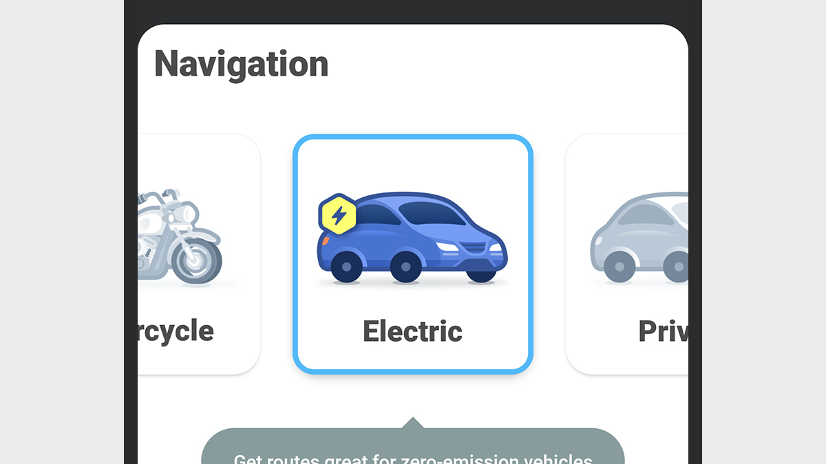
Tap the Car info button (Android) or tap the blob that represents your vehicle (iOS) to set what type of vehicle you’re going to be travelling in. You can specify that you’re driving a motorcycle or an electric car from here, for example, and Waze will make the necessary adjustments, adapting the route to suit. You can specify your preferred fuel type from the same screen.
On Android, tap More routing options to take control of how Waze maps out your journey from start to end. You can tell the app to avoid highways and toll roads, and also ban dirt roads and “difficult junctions” if you want a driving experience that’s as stress-free as possible. These options will be applied the next time you take a trip. On iOS, you need to start a navigation search, then tap the cog icon (top left), then choose Navigation to get to the same set of options.
When you’re on your way somewhere, pull up the panel at the bottom of the screen with a tap, then scroll down to Add a stop to put in an extra detour — there are quick links for gas stations and car parks, or you can search the map for something specific. The stop will be added to your journey without changing the ultimate destination.
One of the most useful features in Waze is the way you can work out the best time for a trip, based on estimated traffic levels, and then save it for later. Use the Find the best time to leave panel that appears when you’re searching for directions to figure out when the traffic will be the lightest — you can then tap Save and Waze will remind you when it’s time to set off on your journey.
Waze has a share ETA feature built right in — if you tap the info panel at the bottom of the screen in navigation mode, and then choose Share drive, you can send a link to someone else through the app of your choice. If the recipient doesn’t have the app installed, then they’ll see the route and your time of arrival on the web.
Finally, the Waze interface can get a bit on the busy side when you’re navigating from one place to another. It’s great that it has so much information available, from traffic jams to weather hazards, but you might not need it all of the time. From the main search page, tap the cog icon in the top right corner then Map display and Reports to choose what is and isn’t shown on screen.