Even by the Arctic’s increasing erratic standards, it’s been a weird spring and summer in Siberia. The region of the world that’s considered a bastion of frigid temperatures and frozen landscapes is buckling under the intense pressure of the climate crisis.
Through the first five months of the year, Siberia has been a bright red smudge on global temperature maps. Temperatures there have averaged 8 degrees Celsius above normal since January. It hit 30 degrees Celsius oil spill threatening an Arctic lake that was likely caused by thawing permafrost soil. If the list of maladies stopped there, it’d be bad enough.
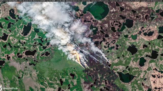
But because this is 2020, they do not. The most staggering change of all in Siberia is the increasingly fire-dotted landscape. The heat that has engulfed Eurasia has led to major fires across Siberia (to say nothing of the Ukraine and fires within the Chernobyl exclusion zone this spring). Flames have even spread into the Arctic where fires have burned largely uncontained.
The remoteness means that satellites are the best way to capture the unfolding chaos. The same remoteness means the fires are unlikely to threaten towns like those typically seen in the western U.S. But they do pose a major concern to the climate, particularly the so-called “zombie” fires that have sprung back up. Those fires tend also burn in underground peat reserves that are rich in carbon and can amplify climate change by releasing it into the atmosphere.
The Arctic Circle delineates the area where the sun doesn’t set at the summer solstice or rise on the winter solstice, beginning roughly around 66 degrees North. It’s a marker for one of the most extreme parts of the Earth, which is what makes fires there so rare. It includes a fair chunk of land far from the seas that ring the Arctic Ocean, but Gizmodo found at least one fire burning relatively close to the East Siberian Sea.
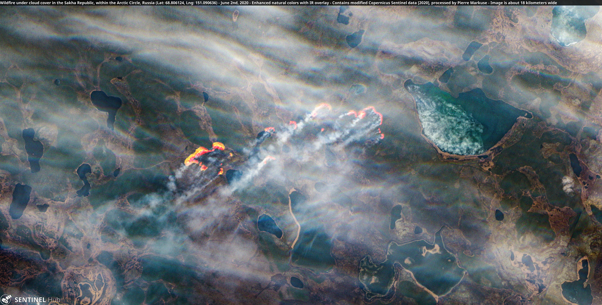
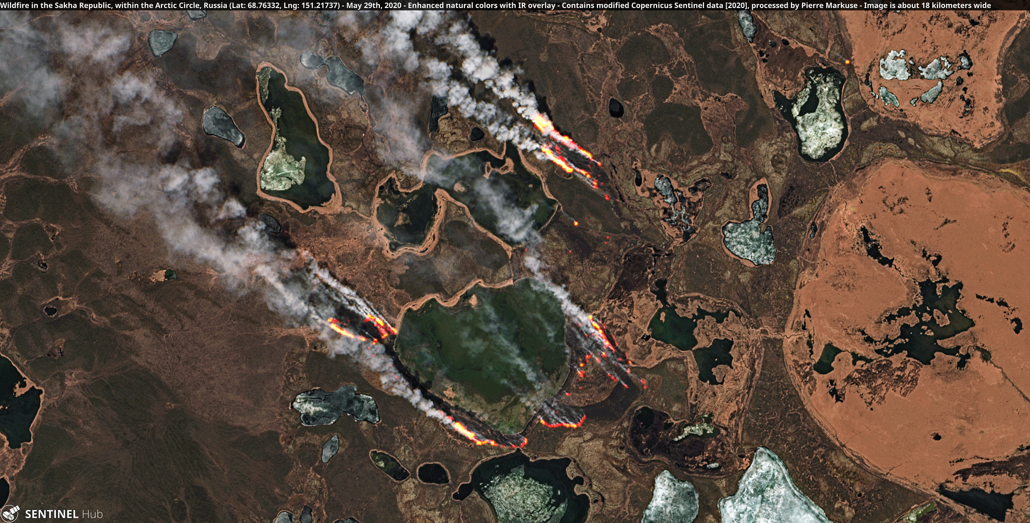
High clouds don’t obscure the blazes from satellite. It’s important to note that what looks like “flames” in the satellite imagery represent hot spots within the fire.
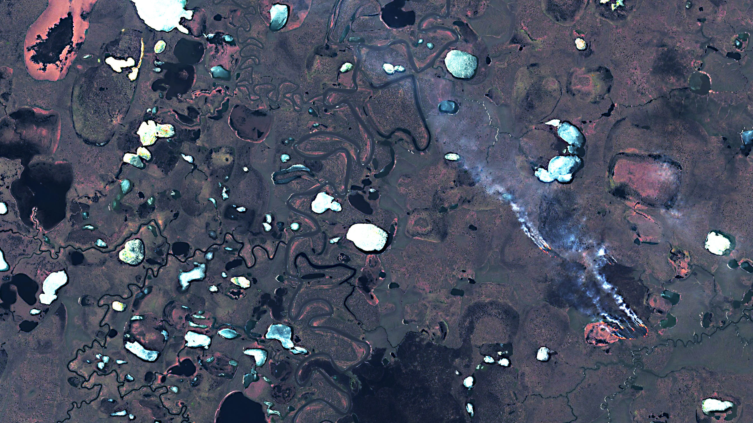
Above the Arctic Circle, Siberia’s landscape is largely treeless. The fires burn through tundra and bog-like landscapes. That includes areas undergird by permafrost, a type of frozen soil that locks up carbon. Rising temperatures are causing it thaw out, creating havoc in the region.
The fuel tank collapse that led to the diesel spill currently threatening an Arctic lake is a microcosm of the problems to come. Up to a third of Arctic infrastructure is sited on permafrost that could become unstable by midcentury, impacting up to 4 million people that directly rely on it.
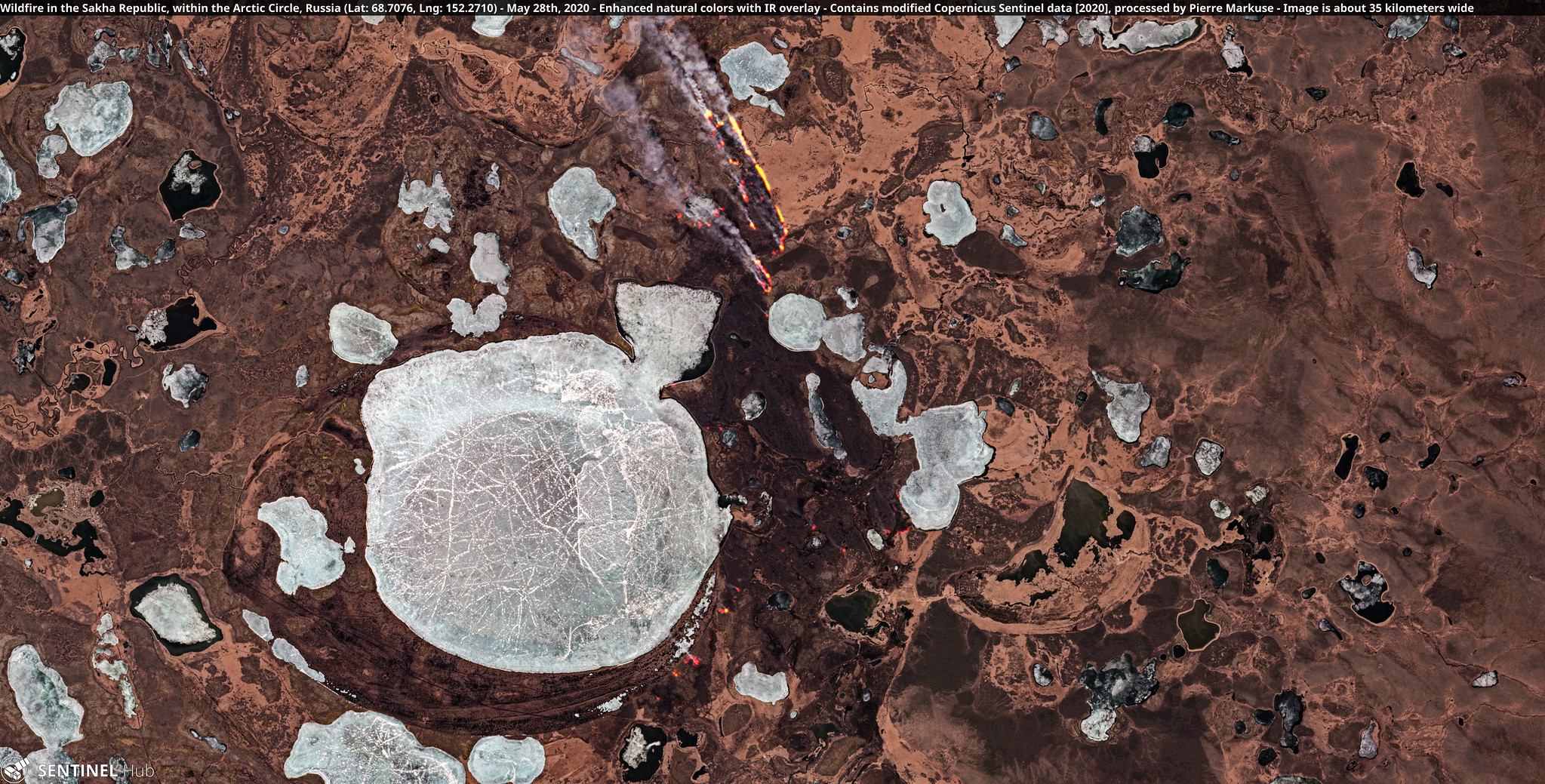
Yes, those are flame licking around a frozen lake because we live in hell.
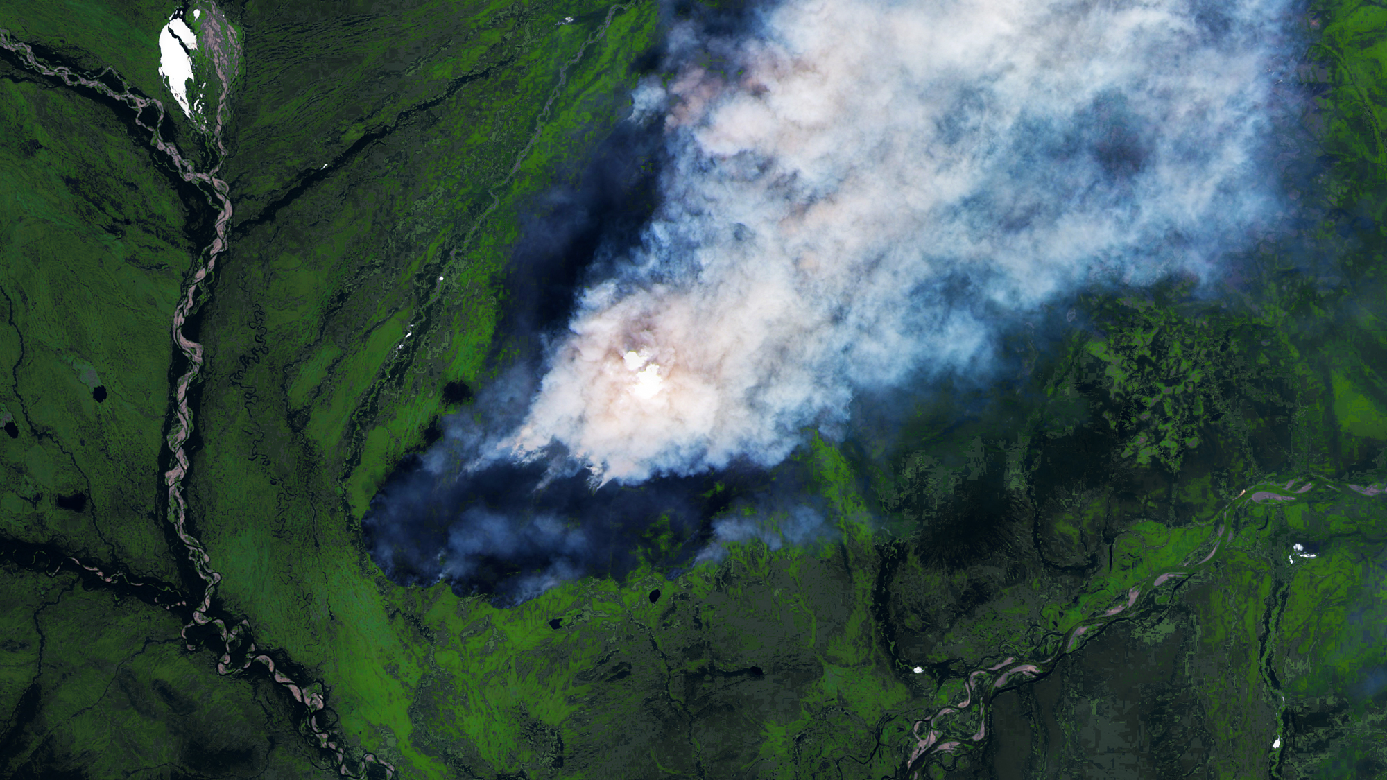
Even when they’re not burning by frozen lakes, the wildfires of Siberia still look daunting from space. On a clear day, the towering plume of smoke is the only thing visible for miles above the flat, tundra landscape. And yes, those are patches of snow.
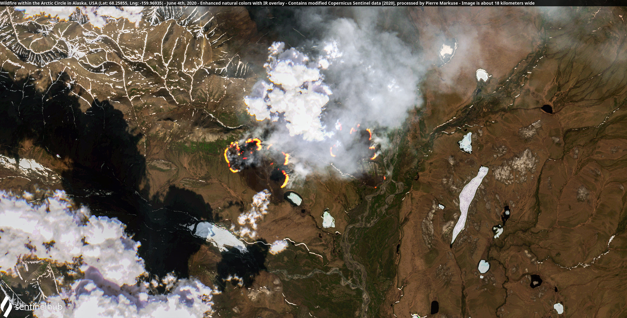
Lest you think it’s only a Siberia thing, Alaska is also seeing fires despite a cold winter and spring (the region is also rich in permafrost). Fire risk is also rising in the Northwest Territories and the Yukon next door in Canada, according to the Global Wildfire Information System. In other words, the northern part of the globe isn’t done with fire season just yet.