For the first time ever, archaeologists have used ground-penetrating radar to map an entire city while it’s still beneath the ground.
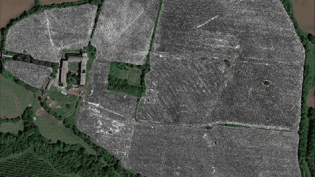
A preliminary map of Falerii Novi, an ancient Roman city located 50 kilometers (50 km) north of Rome, has been compiled with data taken from ground-penetrating radar. It’s “preliminary” because it wasn’t humanly possible for the researchers to fully analyse the 28 billion data points collected during the course of the project, explained Martin Millett, a co-author of the study and an archaeologist at the University of Cambridge, to Gizmodo.
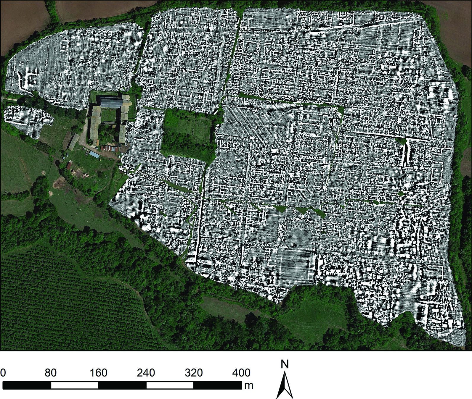
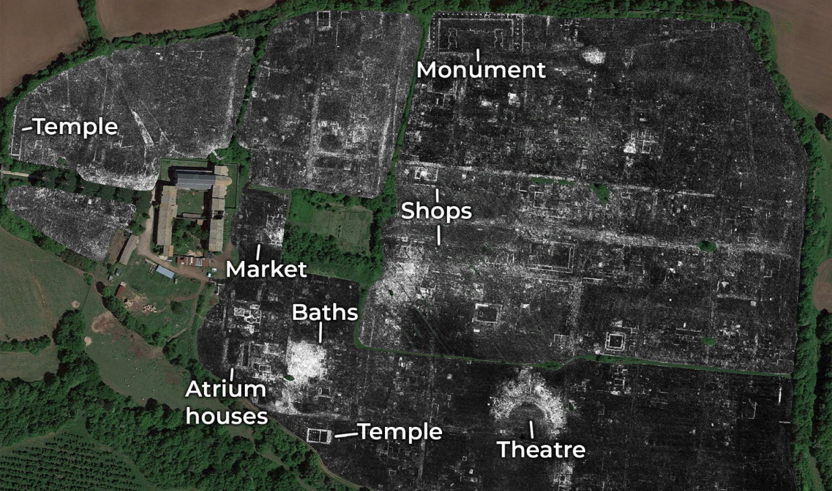
The researchers were able to document the locations of buildings, monuments, passageways, and even water pipes — all without having to pick up a single hand trowel. In addition to documenting these previously unknown architectural features, the scientists were able to chronicle changes to the city over time and discern unique elements not seen elsewhere in ancient Rome. The new research was published today in the scientific journal Antiquity.
Falerii Novi is well documented in historical accounts, representing just one of roughly 2,000 cities across the Roman Empire. It first appeared in 241 BCE and was occupied until the Medieval period, when it was finally abandoned around 700 CE.
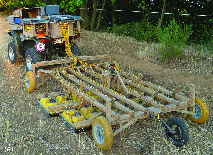
For the new survey, Millett and his colleagues used an all-terrain vehicle to tow a rig equipped with ground-penetrating radar. The scientists made scans every 12.5 centimeters (4.9 inches) across the entire 30.35 ha site. Falerii Novi was chosen as a good place to test the technology, as the town is not obscured by forests or buried beneath newer structures. What’s more, the site is protected under Italian law.
“But even if this city wasn’t protected by law, it would’ve been impossible to excavate on this scale,” Millett told Gizmodo, adding that it has taken nearly 200 years to excavate Pompeii, another ancient Roman city.
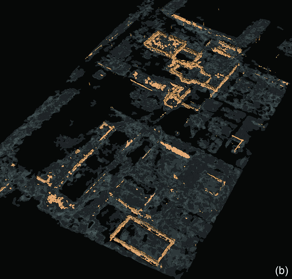
Equipped with their radar scans, the archaeologists documented a bath complex, a market, a pair of temples along the periphery, an outdoor theatre, atrium homes, and a shopping area. They also discovered a large public monument consisting of two structures facing each other in a configuration not seen elsewhere in ancient Rome.
“Part of the importance is that our survey is showing us an ordinary Roman town in Italy, not a special town — but it is extremely impressive to see this level of architectural detail across the whole site,” said Millett.
Falerii Novi had an unorthodox layout and was less standardised compared to other ancient Roman cities. Previous work with magnetometers, another non-invasive scanning method, identified sacred spaces within the city. The new work identified large buildings within this marginal space, particularly next to Falerii Novi’s gates.
“Although we are yet to understand how this sacred landscape functioned, the survey provides new insights into the variety of planning concepts underlying what are sometimes incorrectly considered to be ‘standardised’ Roman town plans,” wrote the researchers in the study. “By providing a contrast with more familiar towns such as Pompeii, this work also raises important questions about the planning of Roman towns more generally.”
[referenced url=”https://gizmodo.com.au/2020/06/lost-monument-of-early-maya-civilisation-discovered-in-mexico/” thumb=”https://gizmodo.com.au/wp-content/uploads/2020/06/04/p1qwsfdura1fwukdix6y-300×169.jpg” title=”Lost Monument of Early Maya Civilisation Discovered in Mexico” excerpt=”The surprising discovery of a 2,800-year-old monumental structure in Tabasco, Mexico, is shaking our conceptions of Maya civilisation and its emergence as a cultural force.”]
To cope with the massive amount of data, the researchers are developing an automated process to help with the analysis, which will involve computer-aided object detection. This could result in further insights and discoveries.
What’s more, the new paper represents an important proof-of-concept, showing how ancient history can be studied in detail while leaving everything in its place.