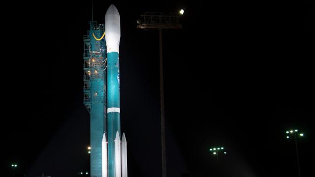
NASA’s last Delta II rocket blasted into the atmosphere from Vandenberg Air Force Base in California on Saturday carrying the Ice, Cloud and land Elevation Satellite-2 (ICESat-2), Space.com reported, in the rocket’s 155th and final mission.
First entering service in 1989, the Delta II was NASA’s workhorse rocket, with Saturday’s launch capping off 100 successful launches in a row. (The last failure was in 1997, when a Delta II carrying a GPS satellite exploded seconds after leaving the pad.) As noted by the Verge, prior payloads have included the Spitzer and Kepler space telescopes, the Spirit and Opportunity Mars rovers, and the original ICESat.
Its operators, Lockheed Martin and Boeing’s joint United Launch Alliance, are switching over to their existing Atlas V and Delta IV Heavy fleets as well as the still-in-development Vulcan Centaur rocket. Competitors include SpaceX, which successfully tested its absurdly powerful and partially reusable Falcon Heavy earlier this year, as well as Blue Origin.
According to Space.com, the Delta II used in this mission was equipped with four boosters, and it carried a small secondary payload of four small CubeSats for a variety of science experiments:
For its 155th and final mission, the Delta II flew in its 7420-10 configuration, outfitted with four Graphite Epoxy Motor (GEM) side-mounted boosters, which were jettisoned 1 minute and 22 seconds into the flight, and a [3m]-diameter payload fairing, which was similarly disposed of about 4 minutes later as the rocket climbed into space. The Delta II’s second stage engine completed the first of its four planned burns 11 minutes after liftoff, placing it into an initial elliptical transfer orbit.
The Delta II’s second stage AJ10-118K engine reignited for 6 seconds about 47 minutes into the mission before deploying ICESat-2 into orbit. Twenty-three minutes later, the stage fired again to set up the release of four small satellites.
ICESat-2 carries a single instrument, the Advanced Topographic Laser Altimeter System (ATLAS), which is designed to measure the thickness of the Earth’s ice sheets using a laser light split into six beams that pulse 10,000 times per second.
According to the Verge, it will pass over the same position on the planet every 91 days, which will allow program scientists to observe how the polar ice sheets are changing over time. The data will also also be useful for measuring forest growth across the planet.
ICESat-2’s commissioning process, which takes 60 days, won’t start for at least two weeks.
“We’re going to have measurements all over and we’re going to have them at much higher resolution, so we can do a much better job tying the change [in ice levels and forest growth] to climate overall,” ICESat-2 program scientist Tom Wagner told Space.com.
“The ice sheets are really big,” Tom Neumann, another program scientist at NASA’s Goddard Space Flight Center, told the Verge. “Antarctica, for example, is about the size of the continental United States plus Mexico, and covering that much area by aircraft is just not feasible. If you want a picture of how the whole ice sheet is changing, you really have to look at it from the vantage point of space.”