Before now-Tropical Storm Irma made landfall in the Florida Keys, killing at least nine and doing untold damage, then-Hurricane Irma barrelled through the Caribbean, killing dozens and flattening entire islands.
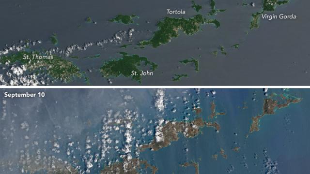
St John and the southern portion of Tortola. Image: NASA Earth Observatory
According to the NASA Earth Observatory, the damage to the Virgin Islands is obvious even from its Landsat 8 satellite, which was able to capture high-definition photographs showing the islands’ lush green turning to a muddy brown after Irma hit them at Category 5 status with 298km/h winds.
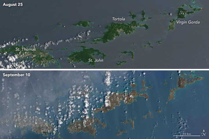
Image: NASA Earth Observatory
There’s no definitive explanation for why the island chain turned into a completely different colour, though it is likely a combination of factors.
Irma tore up ground, sprayed debris, and generally left the ground covered in detritus. As NASA Earth Observatory’s Kathryn Hansen wrote, other possibilities include that high winds stripped away plants, revealing bare soil, or that “salt spray whipped up by the hurricane can coat and desiccate leaves while they are still on the trees”.
Images of Virgin Gorda, she added, show remaining greenery in the south and west of the island were likely protected by hills.
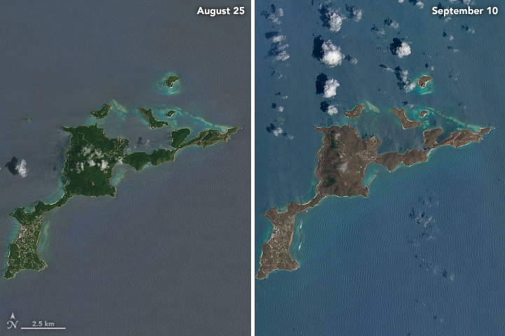
Virgin Gorda. Image: NASA Earth Observatory
The entire Caribbean region saw at least 38 deaths as a result of Hurricane Irma, which wiped some smaller islands such as Barbuda practically off the map. The observatory posted similar satellite images showing widespread devastation there; the neighbouring island of Antigua, where the damage was reportedly less widespread, remained bright and green.
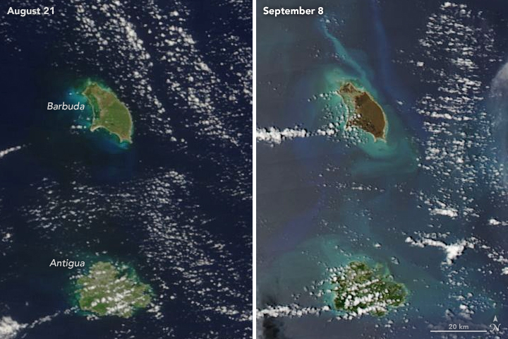
Image: NASA Earth Observatory
NASA’s Earth Observatory captured the images using the Operational Land Imager, an instrument carried on the Landsat 8 system launched in 2013.
The Virgin Islands saw such serious damage that the Washington Post reported locals say no one knows how to proceed in Irma’s wake, with looting and armed burglaries reported. Video showed widespread destruction. Entire towns had few surviving structures.
Restaurant manager Lauren Boquette, who was on St John, told the Post they emerged to see “beyond rough times, it was end-of-the-world times. Everything normal to us has been destroyed.”