It teased us with the possibility of a no-show, but a weak La Niña has officially arrived, according to NOAA. Parts of the northern United States can expect a cooler and wetter-than-average winter, while southern California, unfortunately, can expect more drought.
Image: Hernan Pinera/Flickr
After pulling us off a La Niña watch in September and then reinstating it last month, NOAA has now confirmed that La Niña conditions are here. In the simplest of terms, this means monthly sea surface temperatures in the Niño 3.4 region of the equatorial Pacific (see below) are more than half a degree cooler than average, and they’re expected to stay that way for several months. It also means we’re seeing indications of a strengthened Walker circulation pattern, with cool air sinking more vigorously in the central and eastern Pacific as warm air rises more intensively over the western Pacific.
NOAA’s Climate Prediction Center slightly favours (55 per cent chance) a weak La Niña persisting through the US winter.
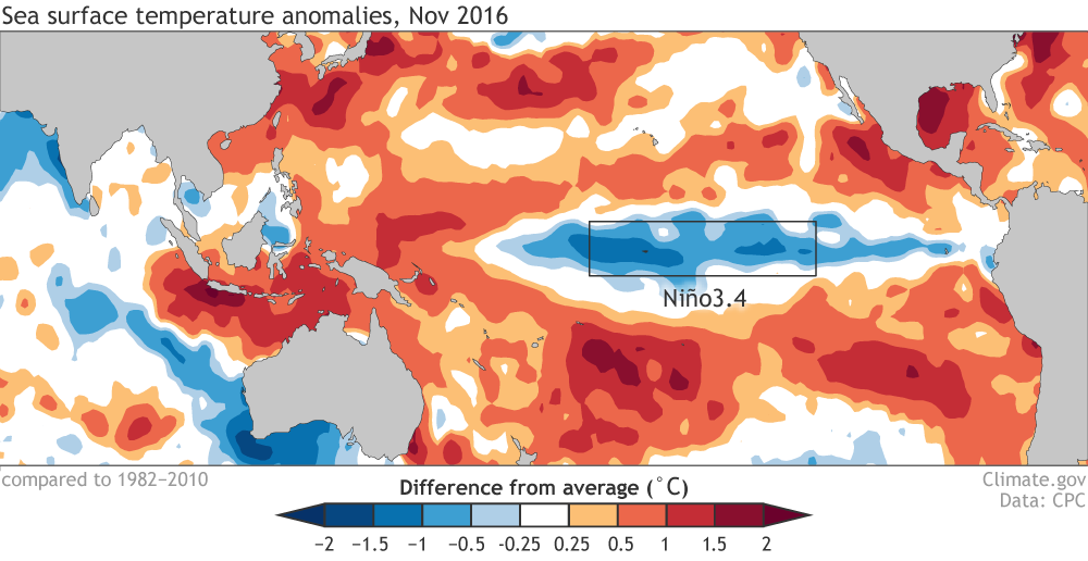
Average sea surface temperature data during October 2016, compared with the long-term average. Image: Climate.gov
Like its recently-departed counterpart El Niño, the La Niña pattern causes changes in global atmospheric circulation that affect weather around the world. While El Niño tends to promote an elongated jet stream that brings extra stormy weather to the southern United States, La Niña favours below-average precipitation and warmer temperatures across the same region. At the same time, La Niña winters often feature cooler weather across parts of the northern United States and Canada, and additional rain and snowfall in the Pacific Northwest and around the Great Lakes.
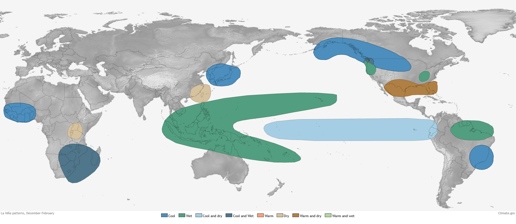
Expected La Nina wintertime impacts. Blue indicates cooler-than-average conditions, while green indicates wetter-than-average conditions. Image: NOAA
NOAA’s recent winter weather outlook reflected La Niña’s influence, as you can see in the temperature and precipitation maps below:
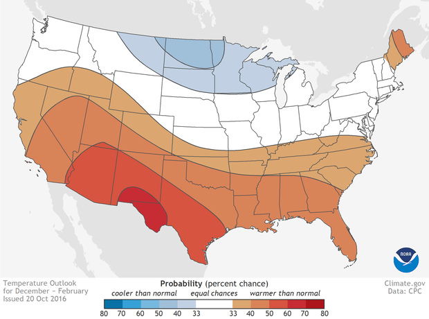
Image: Climate.gov
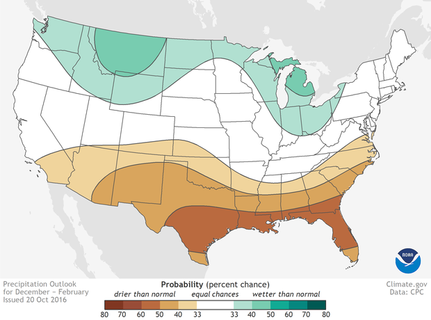
Image: Climate.gov
Perhaps the biggest takeaway for the United States is that California’s drought woes aren’t going away. While northern California’s reservoirs may experience some much-needed recharge this winter, La Niña is expected to leave the central and southern parts of the state high and dry, in conditions of “extreme or exceptional drought”. It seems extra cruel seeing as last winter’s monster El Niño failed to deliver blockbuster storms.
“The weak La Niña is likely to contribute to persisting or developing drought across much of the southern US this winter,” Mike Halpert of NOAA’s Climate Prediction Center said in a statement.
It’s important to note that NOAA discusses La Niña’s influence in terms of probabilities: The likelihood of warmer, cooler, wetter or drier-than-average conditions, rather than the absolute strength of the effect. We should also keep in mind that it isn’t certain La Niña will persist throughout the winter; at this point it’s nearly a toss-up.
But for now, at least, we can welcome the cool embrace of La Niña, and all that she promises to bring (or withhold).
[Climate.gov, NOAA]