To help understand just how destructive earthquakes can be, researchers could spend years examining the aftermath. But displaced residents need to begin cleanup, and return to their homes, as soon as possible. So researchers at Brigham Young University came up with a way to preserve the destruction caused by an earthquake so it can be studied indefinitely.
Immediately after a magnitude 6.2 earthquake hit central Italy earlier this year, a team of civil engineers and professors from Brigham Young University and the Geotechnical Extreme Events Reconnaissance Association — or GEER, for short — visited the sites to document the destruction, including how ancient and modern structures were affected, before cleanup efforts got underway.
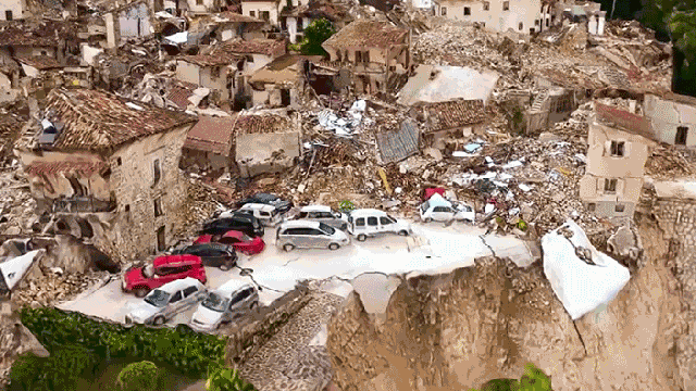
But instead of snapping a few photos, the team used a camera-equipped drone to capture over 50-gigabytes of high-res aerial footage. This data was then used to generate 3D interactive models of the affected areas which could be studied, thousands of kilometres away, while cleanup efforts continued in Italy.
The use of a drone allowed researchers to not only study areas that were far too dangerous and unstable to access on foot, it also allowed the destruction to be captured from multiple angles, facilitating the creation of the 3D models back in the United States. It also meant the researchers weren’t in the way of rescue and cleanup teams trying to assist the local residents as quickly as possible.
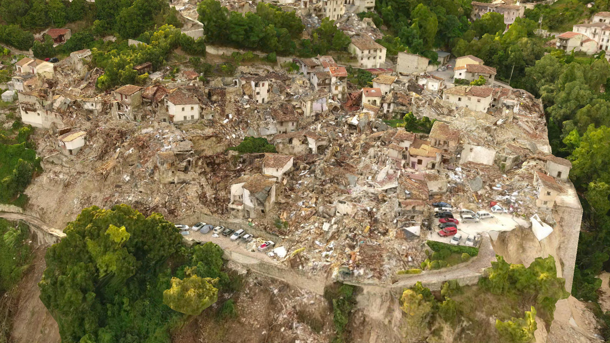
The BYU team has already completed a 3D model of one of the areas hardest hit by the earthquake, and posted the results online which can be studied right in a browser. Eventually the team hopes the data and models will give engineers a better idea of how to design structures that can better withstand the forces of an earthquake of this calibre. But to also better predict where landslides, and other devastating side effects of an earthquake, might occur, and maybe even prevent them from happening the next time the ground starts shaking.