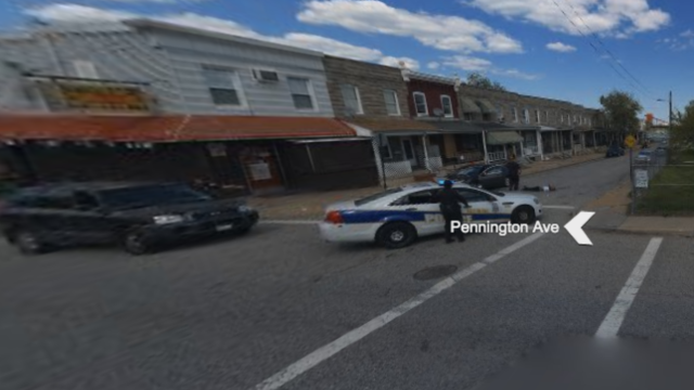
In Bing Maps, a street view at the corner of Pennington Avenue and Hazel Street in Baltimore’s Curtis Bay neighbourhood shows a single police car, two officers and what appears to be a man in the middle of the street bleeding from the skull.
Image: Bing Maps
According to the caption, these images were taken 29 April 2015, mere days after the death of Freddie Grey at the hands of the Baltimore Police Department.
Uh, @bing, your street view camera picked up a dead body in the street in Baltimore’s Curtis Bay neighborhood (warning: graphic) pic.twitter.com/U1cB0s2EXW
— Justin Fenton (@justin_fenton) October 24, 2016
The Baltimore Sun wrote, on that same day:
Homicide detectives were investigating two incidents that occurred during daylight hours Wednesday — men who were shot in the head in the 3800 block of Liberty Heights Ave. in Northwest Baltimore, and at Pennington Avenue and Hazel Street in Curtis Bay. The Curtis Bay victim died at the hospital, while the Liberty Heights victim was being treated at an area hospital.
Baltimore Police Department was not immediately available for comment, but it seems beyond likely that Bing has been hosting picture of a now-deceased gunshot victim for a year and a half.
It’s not known what sort of review process street view images undergo, as Microsoft was also unavailable for comment at the time of publication.