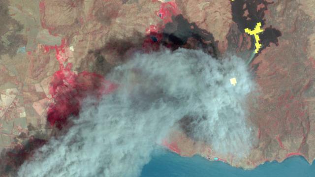
Image Cache: Since 1999, NASA’s Terra spacecraft has been capturing amazing images of thermal emissions and radiation across the surface of the planet for Japan’s Ministry of Economy, Trade and Industry. Now, those images have been made publicly available.
Browse through the cool photos, animations and diagrams in Gizmodo’s Image Cache here.
The images — all 2.95 million of them — reveal some amazing scenes. In particular, the satellite’s Advanced Spaceborne Thermal Emission and Reflection Radiometer (ASTER) instrument is used to capture data about land surface temperature and reflectance, so many of the images focus on, according to NASA:
monitoring glacial advances and retreats, monitoring potentially active volcanoes, identifying crop stress, determining cloud morphology and physical properties, evaluating wetlands, monitoring thermal pollution, monitoring coral reef degradation, mapping surface temperatures of soils and geology, and measuring surface heat balance.
Phew. There are actually two imaging devices aboard the satellite, so it acquires stereo images that also include elevation data. That makes it particularly useful for analysing natural disasters, such as the aftermath of flooding and volcanic eruptions, say.
You can access the data here.
[NASA]
Image of Nicaragua’s Momotombo volcano from the ASTER device. Hot lava flows are shown in yellow. Image by NASA/GSFC/METI/ERSDAC/JAROS, and US/Japan ASTER Science Team
