Image Cache: NASA has just received the first batch of the sharpest images of Pluto captured during the July flyby — and they’re incredible. Are you ready to go cross-country skiing and ice climbing three billion miles from home? Because Pluto’s terrain is a frozen wonderland.
Browse through the cool photos, animations and diagrams in Gizmodo’s Image Cache here.
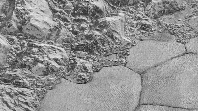
The images below are part of a sequence captured by New Horizons’ Long Range Reconnaissance Imager about 15 minutes from its closest approach to Pluto on July 14, from a distance of just 17,000km above the dwarf planet’s surface. Together, these images form a 80km-wide strip that begins northwest of Pluto’s “heart” region, traversing the icy al-Idrisi mountains, and finally taking us on a tour of Sputnik Planum’s patterned plains.
Instead of the usual “point and shoot mode”, LORRI snapped the pictures every three seconds while the Ralph/Multispectral Visual Imaging Camera scanned Pluto’s surface. At 77-85 metres per pixel, they’re six times higher resolution than the global Pluto map the New Horizons team put together earlier this year. As such, they offer planetary scientists an unprecedented glimpse into the geomorphology of a world far more complex than we could have imagined.
“These new images give us a breathtaking, super-high resolution window into Pluto’s geology,” said New Horizons Principal Investigator Alan Stern. “Nothing of this quality was available for Venus or Mars until decades after their first flybys; yet [for] Pluto we’re there already — down among the craters, mountains and ice fields — less than five months after flyby. The science we can do with these images is simply unbelievable.”
More of these super hi-res images are expected to trickle down from outer space over the next few days, so stay tuned. Me, I’ve already packed my space-grade snowshoes — just waiting for the next flight out.
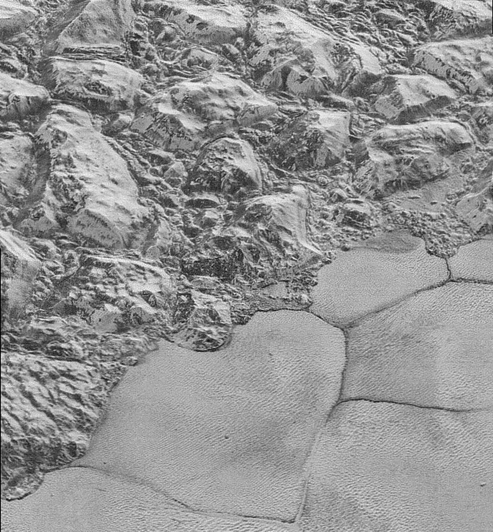
The “shoreline” of Sputnik Planum, the informal name for Pluto’s icy, block-shaped plains. The boundary between Sputnik and the al-Idrisi mountains is incredibly dramatic in this image, underscoring the complex geologic forces that brought these features together.
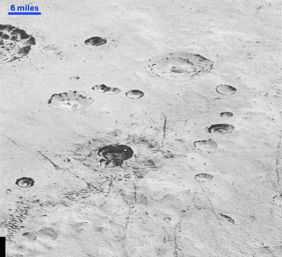
Pluto’s icy plains are pockmarked with craters from ancient impacts. In this image, we see distinct geologic layers — similar to those found in rock outcroppings or drill cores on Earth — within the interior walls of several craters. These features are a huge asset to scientists hoping to piece together Pluto’s geologic past.
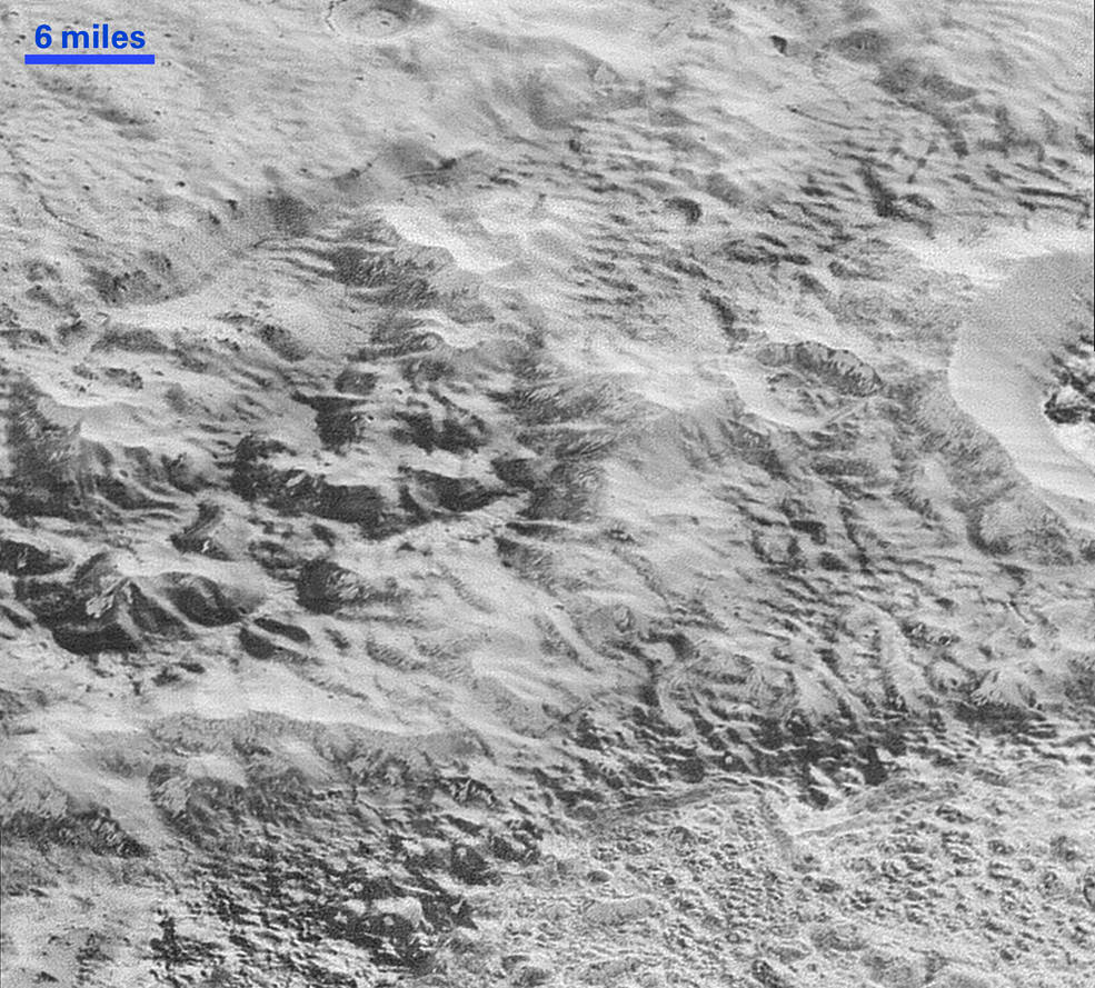
The “Badlands”: A complex mess of topography sculpted by erosion and faulting. The cliff tracking from the left to the upper right near the top of the image is part of a canyon system that runs hundreds of kilometres around Pluto’s northern hemisphere. The mountains in the center are built mainly from water ice, but the New Horizons science team suspects they have been shaped over time by other exotic ices, including nitrogen and methane.
[NASA]