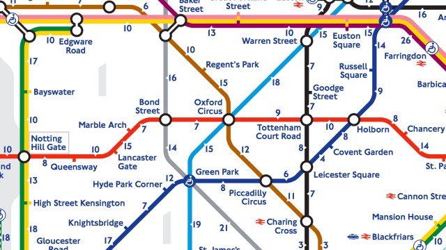
Transport for London has released another alternative version of the Tube map — and it’s actually really useful. The London transport manager has created a ‘Walk the Tube’ map, which shows how long it takes to totter between stations.
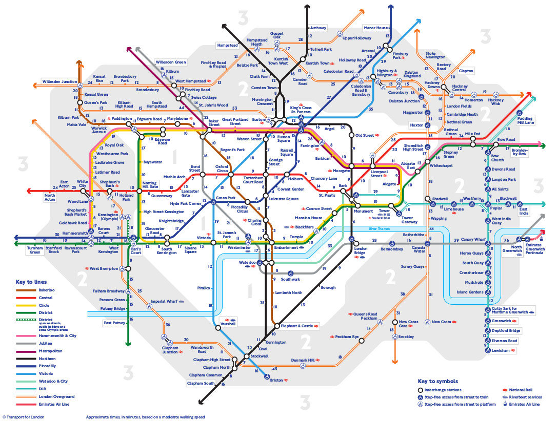
The full-sized version is here. It shows that people who catch the Tube from Covent Garden to Leicester Square and Mansion House to Cannon Street (or vice versa) are wasting both time and money, as the journey takes less than five minutes on foot. On the other hand, the walk between Euston and South Hampstead takes a whopping 53 minutes, despite the stations being directly linked.
“What we have seen is that people are desperate for this sort of thing, so we have created it,” said a TfL spokesperson. “We focused on central London, zones 1 and 2, and based the times of our journey planner. We’re investing heavily in improving walking and cycling routes across London, with all the health benefits they bring. This is going to be great for people to see how quick and easy it is to so many stations.”