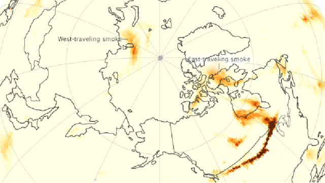
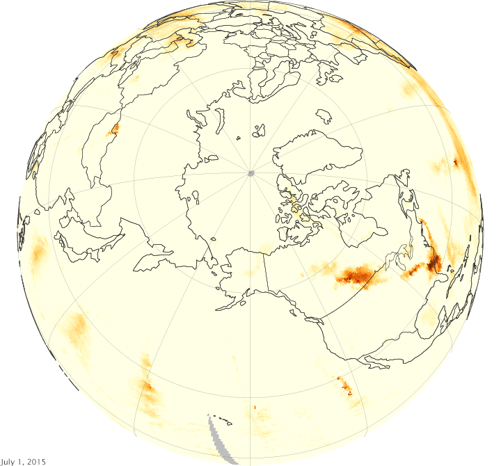
Smoke plumes from last month’s wildfires in Alaska and Canada wrapped all the way around the Arctic circle in less than two weeks.
In this animation of satellite imagery from NASA, you can watch smoke from Alaskan wildfires drift west while smoke from Canadian wildfires goes east, until the two massive smoke plumes converge over Greenland. The brown areas on the map track the movements of high concentrations of aerosols — the tiny solid particles in smoke. In other words, those are the smoke plumes.
It took less than a week for smoke from Alaskan wildfires to drift west over the Russian Arctic, and it was over Greenland by July 14, two weeks after the fires started. At the same time, winds carried smoke from Canadian wildfires east across North America, and then across the north Atlantic to Greenland.
But you might not have seen the smoke overhead, because the plumes were high up in the atmosphere, above the lower-level clouds. NASA says that could spell trouble for the Arctic, which is already the area of our planet hardest hit by global warming. “Researchers have found that when aerosols are located over clouds, or any other bright surface, they can impart a net warming effect on the climate. That, in turn, can affect the stability of the atmosphere and the lifetime of clouds,” wrote NASA in a press release.
NASA captured these images with its Ozone Mapping Profiler Suite aboard the Suomi NPP satellite, which has been in polar orbit since late 2011.
[NASA]