The Enviornmental Protection Agency has a new tool called EJSCREEN, which lets you overlay the agency’s environmental data on a geographic map, along with layers of information showing poverty. The result is as depressing as you’d probably expect.
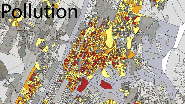
The maps are colour-coded to show poverty, and pollution (as measured by fine particle density). Grey is in area that’s below the 50th percentile, with the colours going up to yellow then red as the poverty (and pollution) increases. As you can see, in the image of downtown Manhattan above, there’s a fairly stark overlap between areas with high poverty, and high pollution.
That’s just one isolated example, but the EPA is aware that environmental injustice — the idea that everyone, regardless of socioeconomic status, should face the same risk from environmental factors — is rampant. The agency hopes that by giving people a mapping tool they can use to examine the overlap in their own communities, a little progress can be made.
[EPA via Smithsonian]