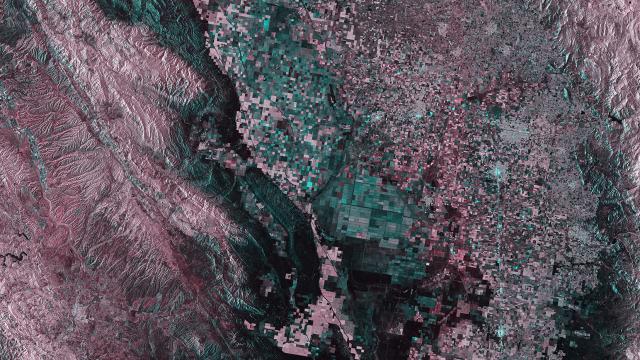
This view of central California from space is amazing for any number of reasons: you can make out the San Andreas Fault, for one, and it’s quite simply gorgeous to look at. But it’s also a parched landscape, whose vibrant greens have dulled to dirty browns.
This radar image was captured on April 1st by the European Space Agency’s Sentinel-1A environmental satellite. You can see the almost-straight running from top-left to bottom centre; that’s the San Andreas Fault. But elsewhere in the image is a patchwork of green and brown fields, where once all was verdant. As drought has continued to worsen, more and more fields have lost their natural water and, in some cases, artificial irrigation supplies — increasing the number of brown squares you can make out in this image. [ESA]