Exactly 10 years ago, Google uploaded an announcement to its press page: Google Launches Free 3D Mapping and Search Product!
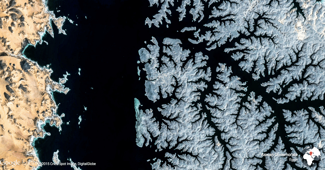
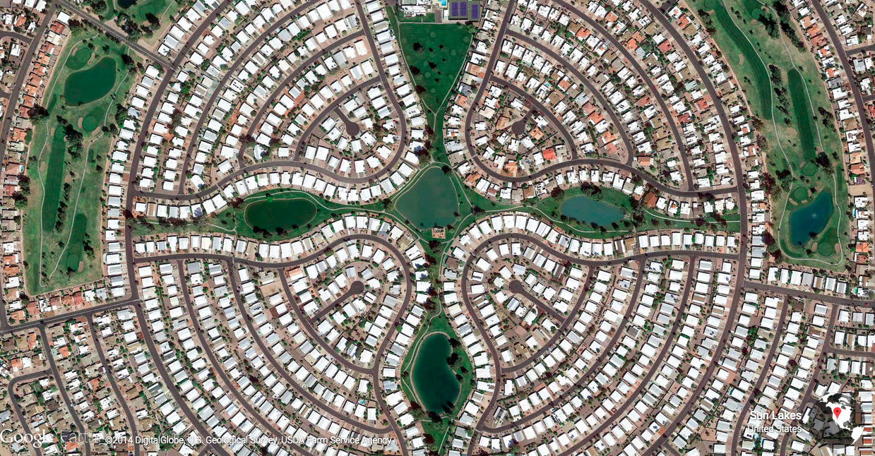
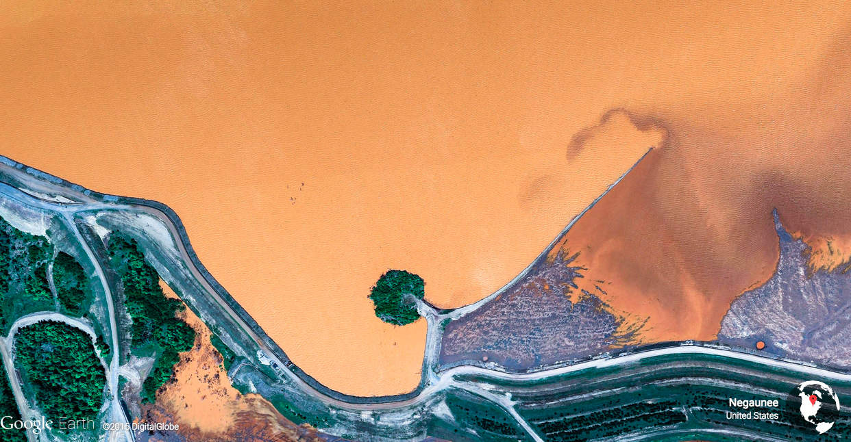
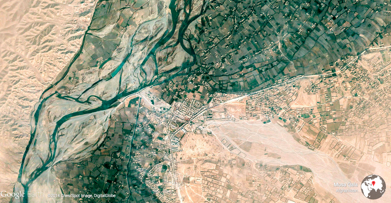
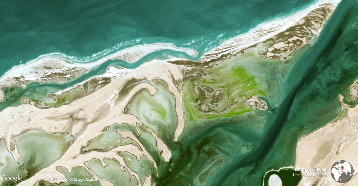
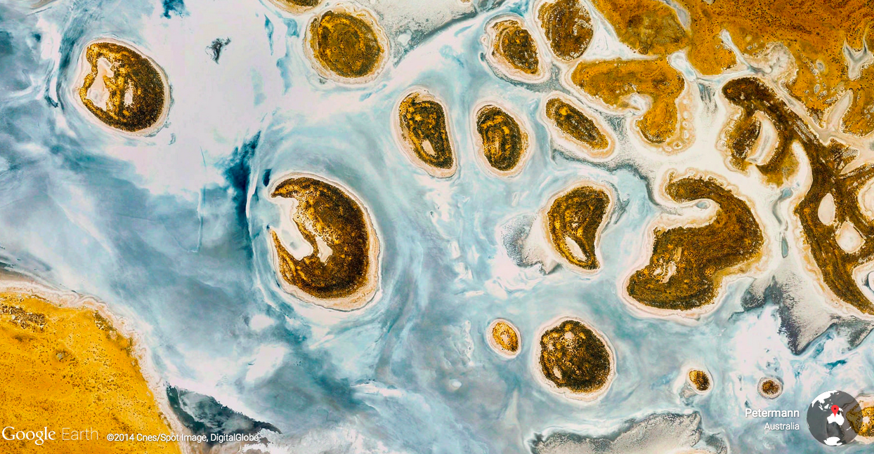
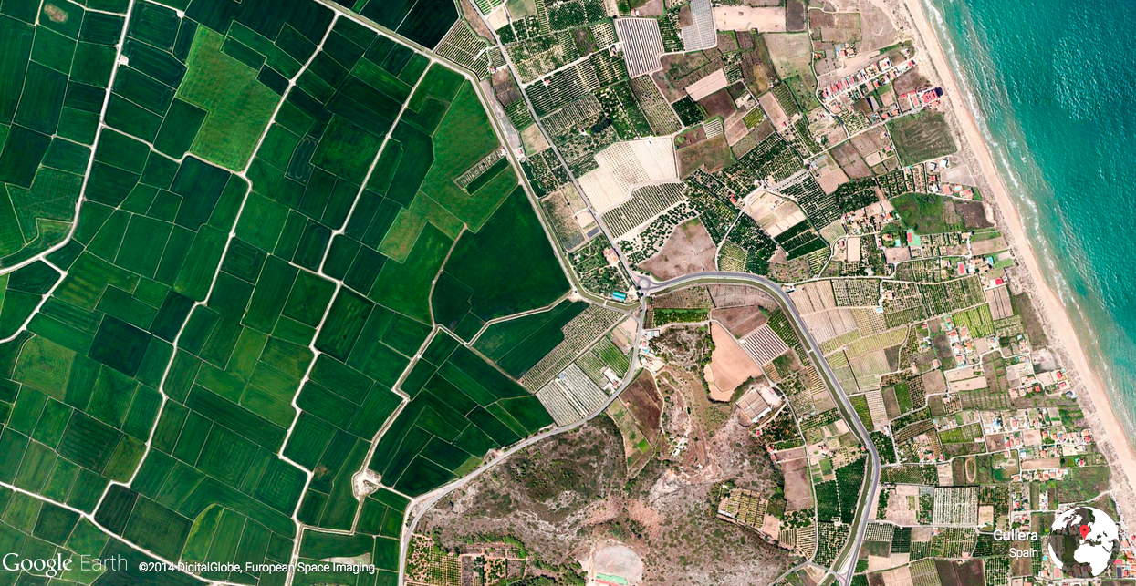
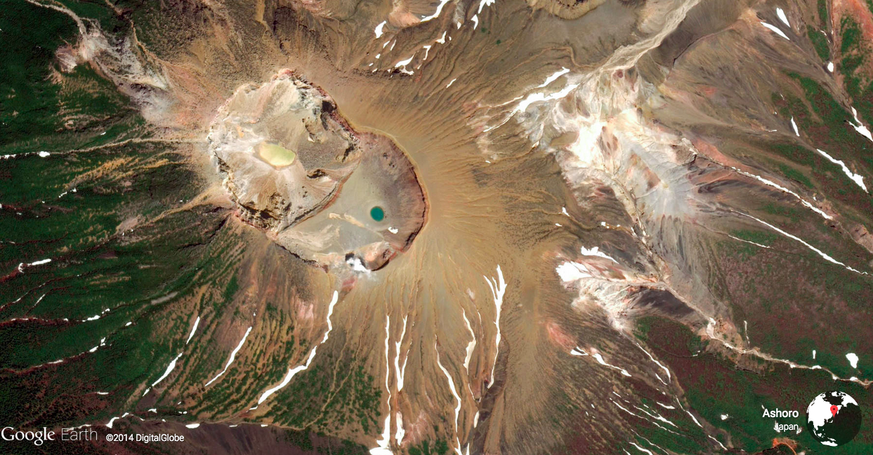
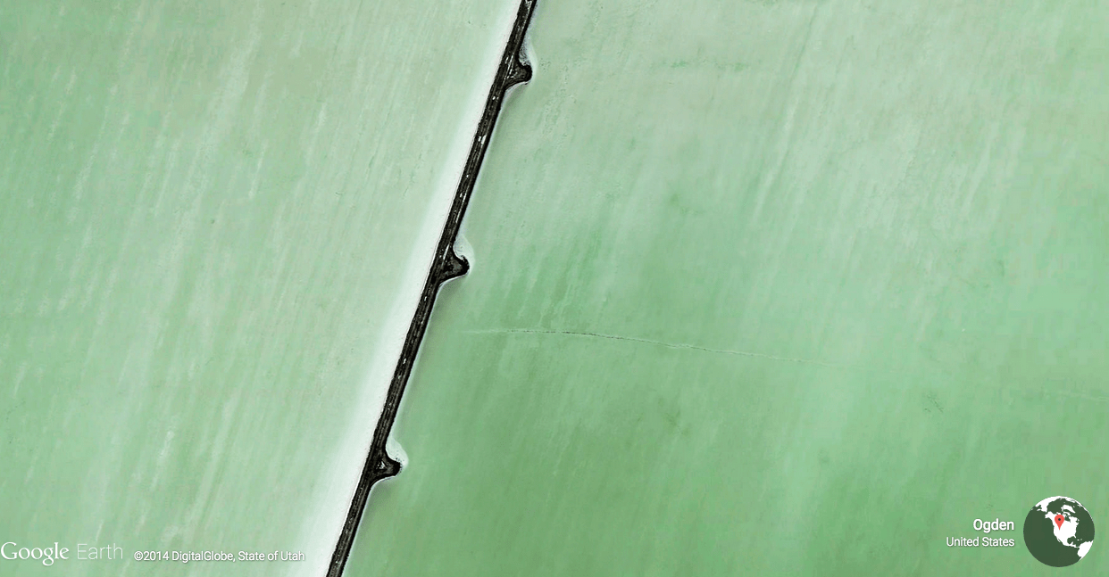
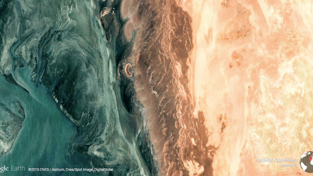
Google Earth turns 10 today, and to celebrate, the engineering team added 1500 new images to its great Earth View project, where it collects the most compelling images recorded by its source satellites.
The project, which apparently started out as a “20 per cent” project of some Earth engineers, not has its own web gallery to go along with the Chrome extension we wrote about last fall.
Of course, Google Earth isn’t just beautiful images — it’s remarkable for the sheer breadth of ways it’s impacted the way the world works, from inspiring anthropological and geological insights (see world’s best preserved crater, rampant deforestation; lost Egyptian pyramids; and entire lost worlds) to providing a brilliantly simple way to prank the entire internet (see appendix A).
It’s also the cornerstone of a young generation of cartographers and engineers, as Google Earth’s Engineering Manager Sean Askay explains on the company’s blog today, remembering how he landed a job at the company:
I started making my own maps with KML a few weeks after Earth’s release in 2005. For my master’s degree, I used Google Earth to build a virtual representation of a high-tech biological research reserve. Vint Cerf saw my work, which eventually led to a job on the Google Earth Outreach team, turning my passion for telling stories with maps into a career.
So put aside your creeping dread of being surveilled from above at all times for a minute and enjoy the stunningly beautiful images that those cameras soaring 600km above us happen to capture too.