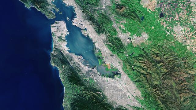
This shot was taken by Landsat this spring and beyond being unbelievably beautiful, it’s also a great example of what Landsat does best: Give scientists a macro look at land cover, urban patterns, and geological features.
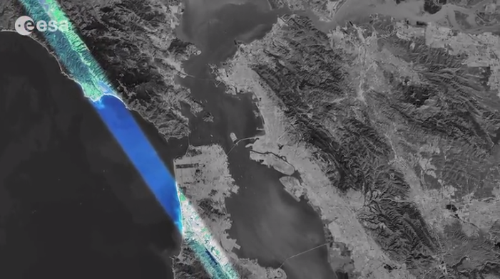
For instance, as the European Space Agency points out, you can clearly see the San Andreas fault as it runs diagonally across the Bay:
The ESA isn’t just pointing this out for us because it’s interesting — high-res imaging of the Earth’s surface is becoming a crucial tool for everything from studying environmental phenomena like volcanic eruptions and deforestation, to studying how urban growth is taking place (or fading away) in cities around the world. Satellite imaging is increasing in resolution exponentially — soon, still images like this one will seem out-of-date.
After all, this week we watched the first HD video taken from space.
[ESA]