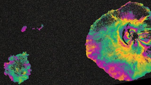
Back on November 23, the Pico do Fogo volcano on Cape Verde’s Fogo island erupted. This image shows how that incident looked when it was captured by the Sentinel-1A satellite’s radar sensors.
In fact, the European Space Agency satellite captured two images: one before the event on November 3, and then another afterwards on November 27. By processing the two images together to measure differences in radar phase on the two dates, scientists could create a radar interferogram which shows with great accuracy the change in height of the ground beneath.
The result is this rainbow-coloured image, showing the major shifts that occurred on Pico do Fogo’s slopes. Now, Earth scientists are using these images to help them map the volcano’s subsurface magmatic system. [ESA]
