If you Google Map Guéckédou, the Guinean city smack dab in the Ebola virus’s deadly domain right now, you’d see just an abstract blotch of beige and yellow. Zoom all the way in on satellite view, and you can barely make out the outlines of buildings. Don’t even think about trying Street View. Google Maps simply reflects the state of mapping in parts of Guinea. There are no good maps of Guéckédou — until the good folks of the internet help create one.
If look at the same city in OpenStreetMap, you’ll find roads, buildings and pharmacies clearly marked and labelled — the product of a recent crowdsourced effort that took less than a day. This crowdsourced map could be the future of humanitarian relief.
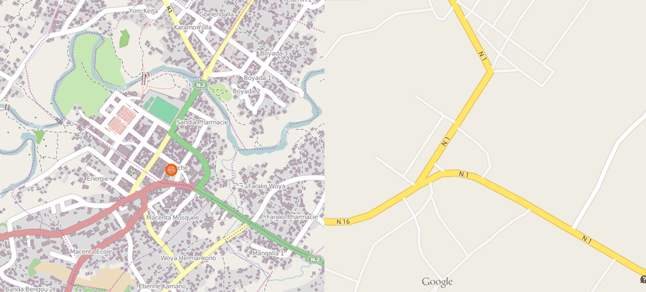
OpenStreetMap (left) and Google Maps of the same area in Guéckédou
For aid workers flying into a foreign country, not having a map means literally not knowing where to start. After Médecins Sans Frontières (MSF) arrived in Guinea last month, they found only topographical maps, which had no information about population density. They then asked the digital mapping organisation Humanitarian OpenStreetMap Team (HOT) to create the first building-by-building maps of the area based on satellite imagery. Here’s how it worked out, as New Scientist reports.
Mathieu Soupart, who leads technical support for MSF operations, says his organisation started using the maps right away to pinpoint where infected people were coming from and work out how the virus, which had killed 95 people in Guinea when New Scientist went to press, is spreading. “Having very detailed maps with most of the buildings is very important, especially when working door to door, house by house,” he says. The maps also let MSF chase down rumours of infection in surrounding hamlets, allowing them to find their way through unfamiliar terrain.
HOT has also helped MSF mapping cholera in the Democratic Republic of Congo. Armed with detailed street maps of cities showing houses and infrastructure, epidemiologists can more easily identify the contaminated water causing the outbreak. In fact, this echoes one of the foundational documents of modern epidemiology: the famous 1854 cholera map of London that Dr. John Snow used to trace an outbreak to a single water pump on Broad Street.
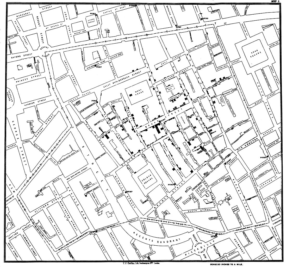
John Snow’s cholera map. Cases in black
Mapping efforts from HOT first proved its worth in humanitarian relief after the destructive earthquake in Haiti in 2010. After Hurricane Haiyan pummelled the Philippines last year, volunteers with HOT quickly annotated damaged buildings and blocked roads in a map used by the Red Cross. It’s easy to see how information from real-time satellite images annotated onto maps is massively useful after a natural disaster.
For disease outbreaks, though, even a simple street map can do wonders. We take our mapped and Street Viewed neighborhoods here for granted, but even the best online cartographic resource is full of holes. Unfortunately, it may take something like Ebola to focus attentions on the less mapped parts of the world. [New Scientist]
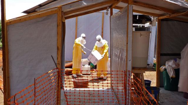
Lead picture: Healthcare workers in Guinea preparing isolation and treatment areas for Ebola. P Photo/Kjell Gunnar Beraas, MSF