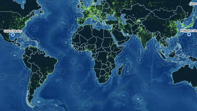
Cool map alert: Doughnut Holes in International Waters is an interactive map that shows which countries have sovereignty over the high seas. It shows how we’ve diced up the waters with international law — and what all the left-over bits and pieces look like.
For the most part, you know what the borders of different countries look like. But you’re probably a lot less familiar with nautical sovereignty, the rights of which were formalized as recently as 1982. A nation can claim rights to the area 200 nautical miles from its coast. As the site points out, this is called an Exclusive Economic Zone.
But where it gets interesting is in the no man’s land — the areas that are too far out for any one nation to claim. These are the so-called doughnut holes — aka international waters. Thanks to the 320km rule that dictates EEZ zones, these little bits of leftover sea take on bizarre and arbitrary shapes — that you can bet pirates know like the back of their hands. [Doughnut Holes via GoogleMapsMania]