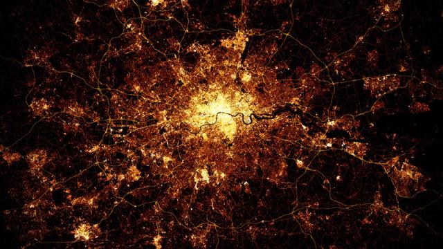
Satellite images of cities at night look wonderful — until you zoom in and realise that they’re a big, blurry mess. These gorgeous city images, made by Marc Khachfe, solve that problem — because they’re actually computer generated from OpenStreetMap data.
Using the open-source mapping data, Khachfe is able to create a simulated map of the light you’d expect to shine into the night sky from urban environments. He explains:
“About a year ago, I came across OpenStreetMap data; public data on road and infrastructure from cities all around the world. I was blown away by the wealth of info and toyed with it for six months, before I came up with the idea of replicating the astronauts photos.
“I had wanted to print a big poster of the London night shot, but found them all to be too blurry to use, so i downloaded the London OSM data and created a “light map” that I then layered and shone through the data layers. No images were used at all in creating the maps — but I did look at the real photos for reference.”
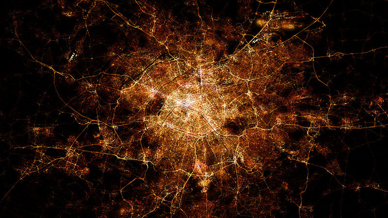
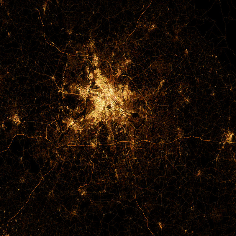
At the top of the post is his take on London at night; below is Paris.
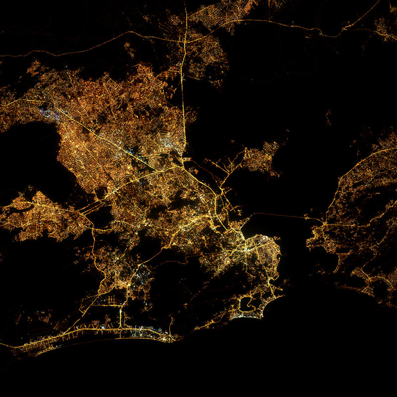
As well as Rio de Janeiro:
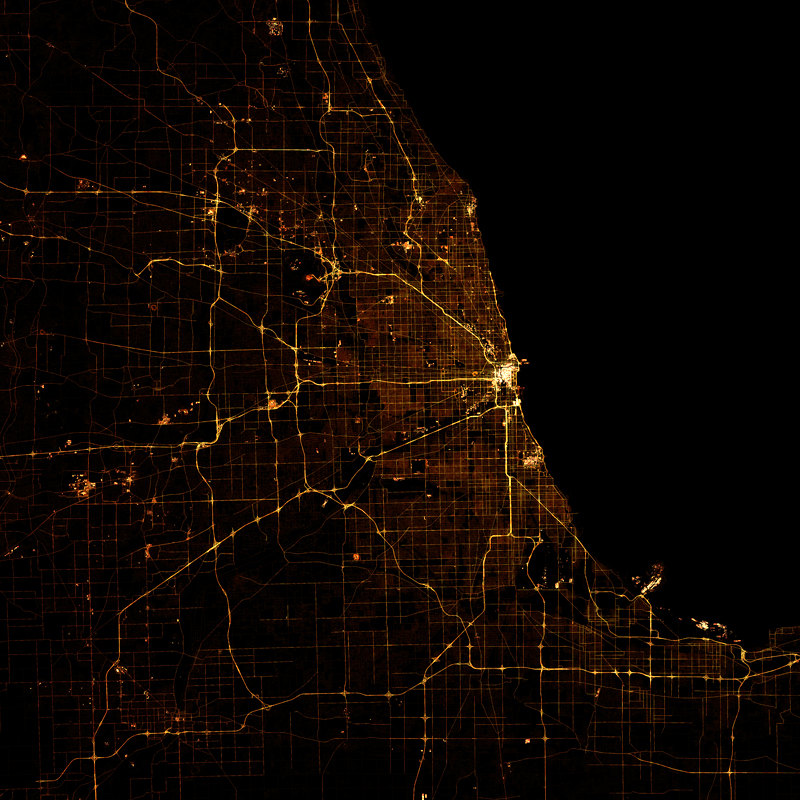
Chicago:
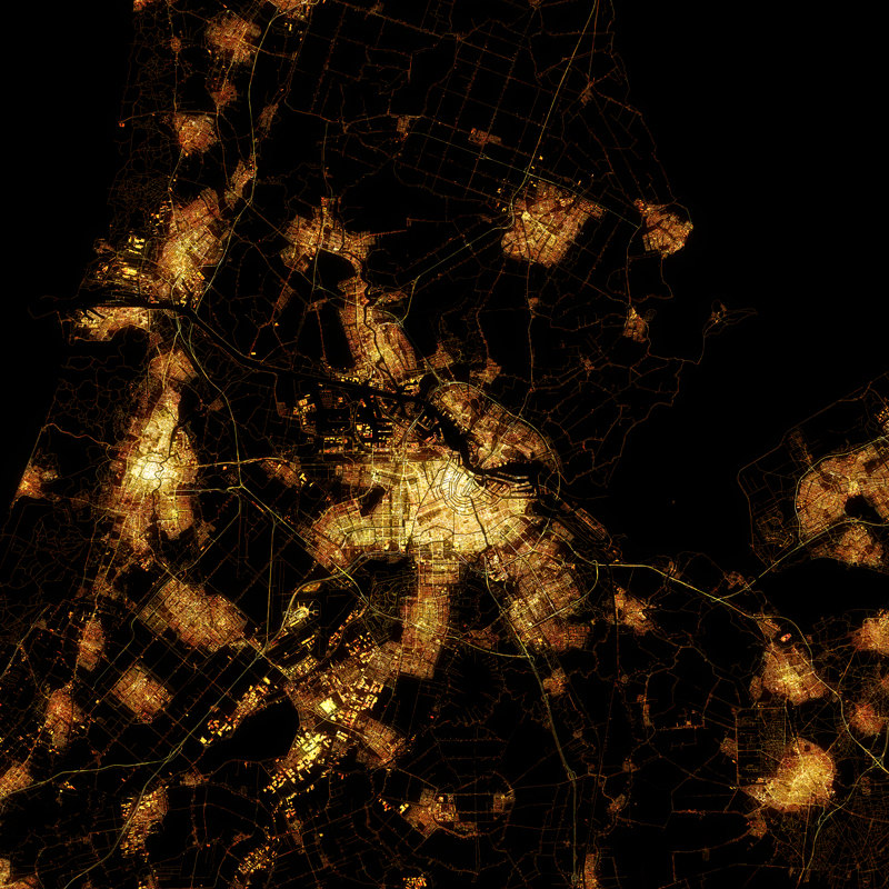
Amsterdam:
Berlin:
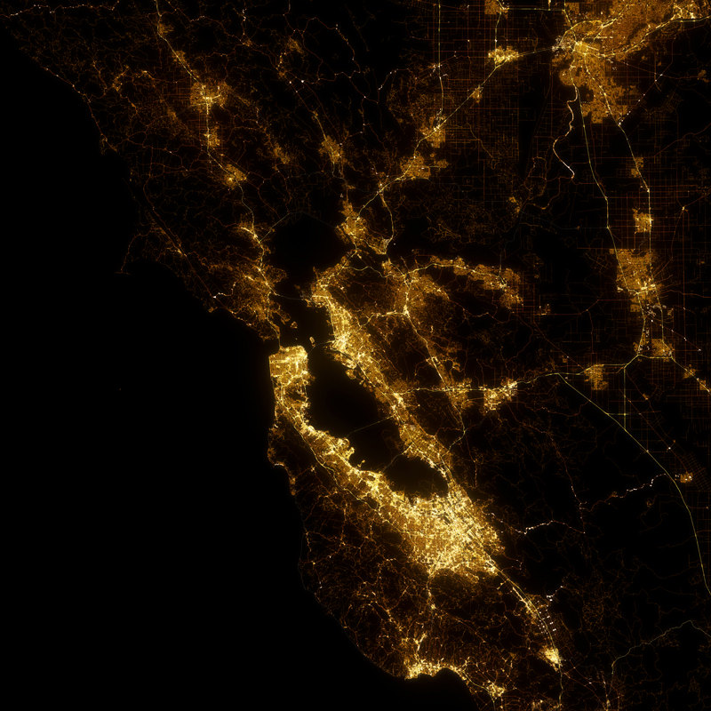
And San Francisco:
If you like what you see, you can in fact buy copies of Khachfe’s Etsy page. You can currently buy London, Paris, Stockholm, Amsterdam, Chicago, San Francisco, Rio de Janeiro and Berlin, but more on the way — including Beijing, Hong Kong, New York and Moscow. [Marc Khachfe]