The island of California. A huge triangle of land called Florida. A great ocean that cut down from the Arctic into the Midwest. As the New World came into focus beginning in the 17th century, explorers and cartographers struggled to measure a massive expanse of land that would take centuries to accurately map.
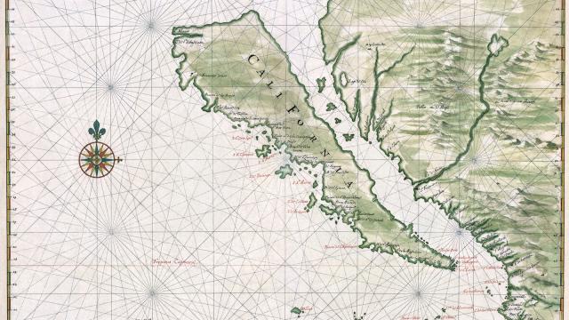
Take the long-accepted idea that California was actually its own island, popularised by explorers who had seen Baja and assumed the inlet was actually a continuous straight separating present-day Cali from the rest of North America. For a number of reasons — including economic and political ones — the myth stuck around for centuries. In fact, there’s even a dedicated collection at Stanford devoted to this geographic non-truth, of which there are at least 800 maps. So what reconnected California to America? In 1747, less than 300 years ago, King Ferdinand VI of Spain cleared up a popular misconception with a royal decree: California, it turned out, wasn’t an island after all.
But that’s far from the only cartographic myth that wound its way into legend during the age of exploration. Some of these maps were drawn for navigation, others were drawn with hidden agendas — to, say, spur a particular monarch to fund new journeys.
Take a look at 12 below, which include the first to use the name “America” and the first map printed in the new world. And please, add any we’ve missed in the comments.
America
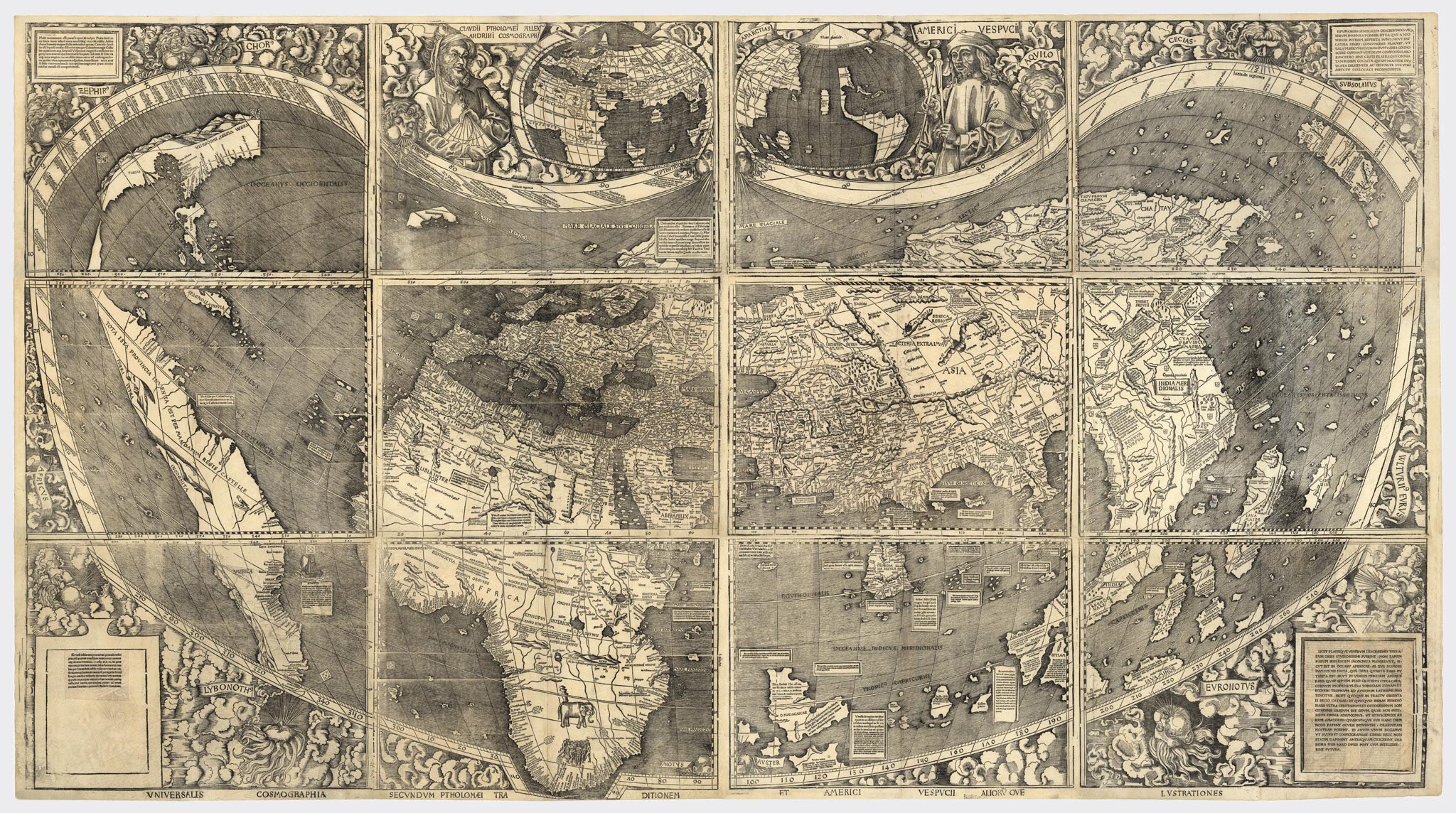
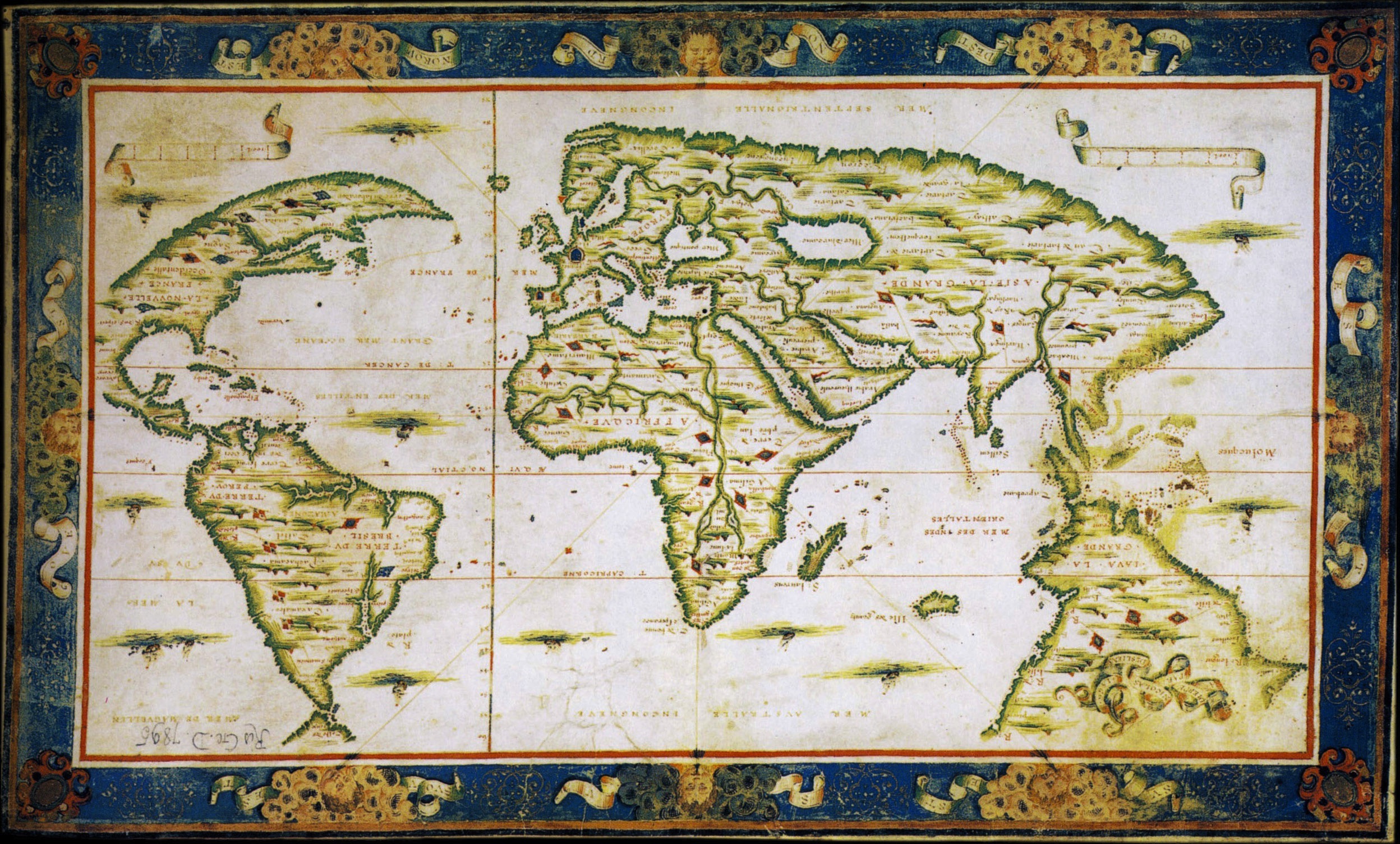
In 1507, Martin Waldesmüller became the first cartographer to draw a map in which America was a free-floating entity — truly a new continent. It was also the first map to even use the name “America,” for the Italian explorer Amerigo Vespucci, the first to prove that the newly-discovered West Indies weren’t actually India. Of course, the map doesn’t show us much, though a pyramid-shaped Florida does make an appearance, pointing down towards Cuba. Beyond the thin landmass of the southeastern seaboard, though? Terra incognita, unknown lands, represented here by more ocean. [LearnNC]
North and South America
This map, drawn in 1540 by by Sebastian Münster, was the very first printed map that called the great body of water to the west of the land by the name Pacific. Orient yourself using the island of “Zipangri,” the name Marco Polo gave to Japan — seemingly just a few hundred miles away from coastal North America. [Princeton Library]
The Eastern Seaboard
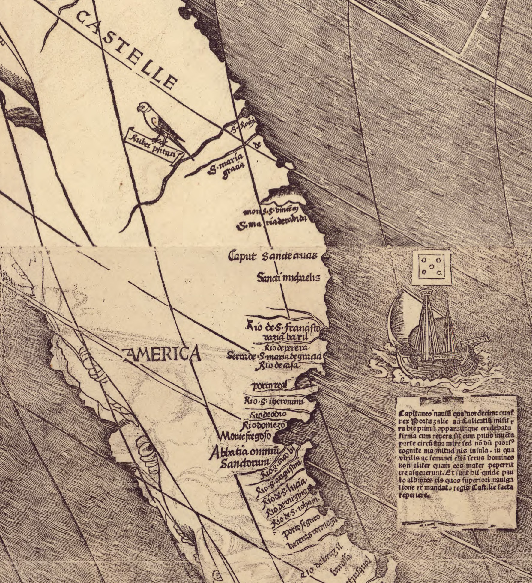
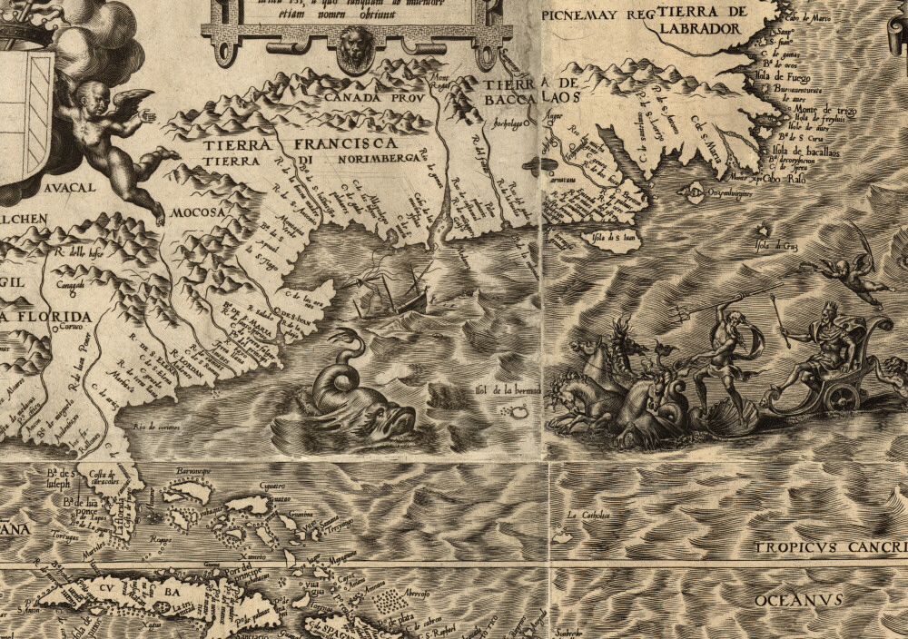
Gigantic fish, mermen, volcanoes, and all manner of other fantastical details illustrate this 1562 map by Diego Gutiérrez, whose intentions were clear: Depict America as a wondrous, resource rich land — and thus convince European monarchs to fund more expeditions. [Library of Congress]
The Eastern Seaboard
This 1566 is fascinating and colourful — the latter, because it was likely commissioned by the aristocracy. It was drawn by French mapmaker Nicolas Desliens, who was part of the famed Dieppe School of mapmaking, and it shows a surprisingly accurate representation of the eastern edge of the Americas (though some postulate that its maker may have fabricated the entire continent to spur the French monarchs to colonize!). What this map so vividly illustrates, with its verdant green boundaries, is that everything east of, say, Iowa, was unknown. Here, it’s represented as more ocean. [DaBrownstein]
California
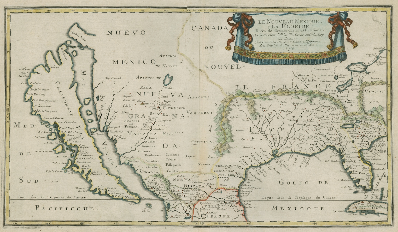
One of the most beautiful and detailed maps of the theoretical Island of California comes courtesy of Nicolas Sanson, a French royal geographer and the hand behind some of earliest maps of America. He drew this one in 1656, giving Europe its first real look at the American Southwest. [The Newberry Digital Collection; Branner Earth Sciences Library and Map Collections]
New England
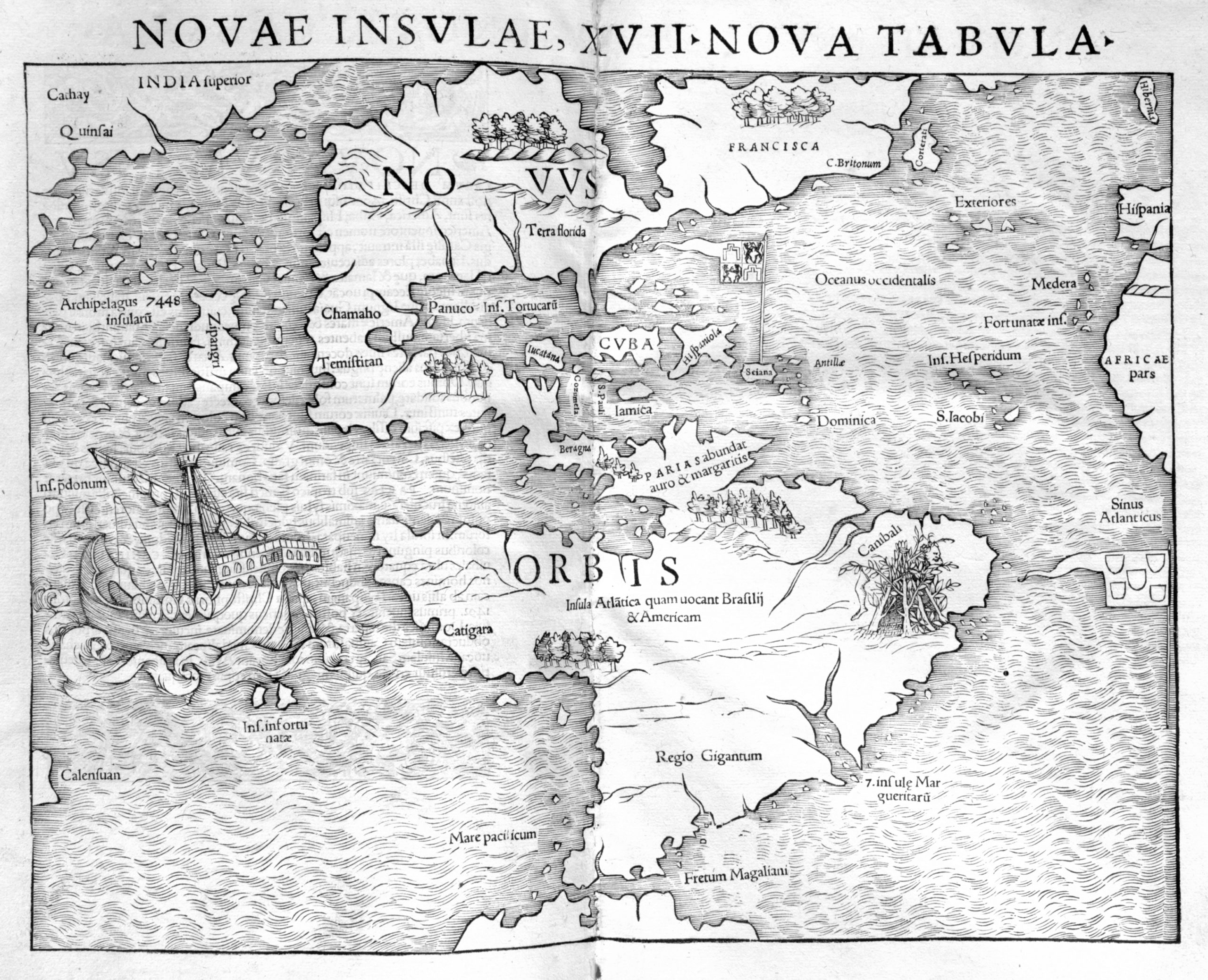
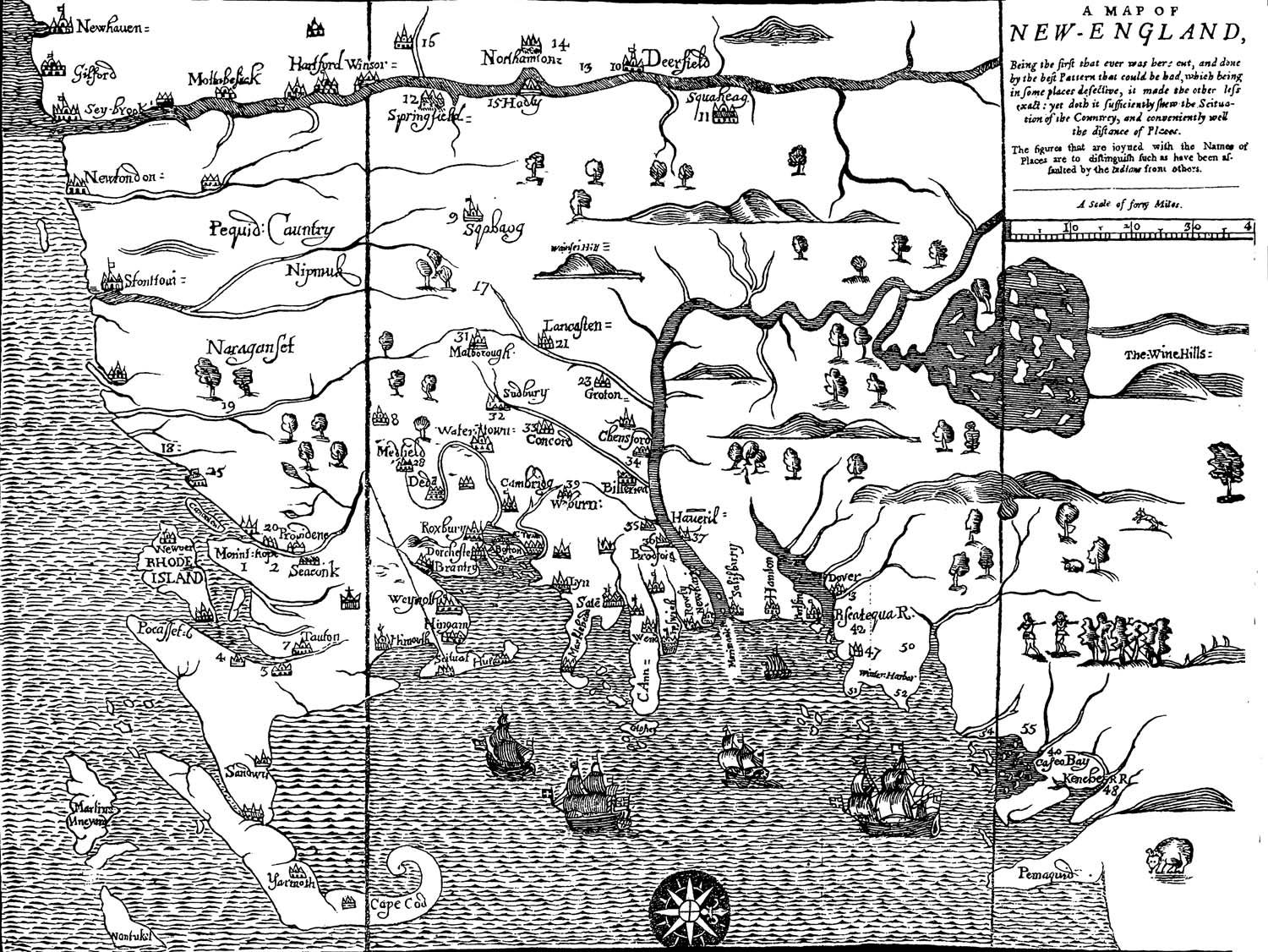
In 1676, a reverend named William Hubbard — who was one of the first historians to write about New England — published this map, the first to ever be printed in America. It shows New England with north oriented to the right, including details like Rhode Island and New Haven. The map’s name speaks of the style of the day: A Map of New-England, Being the First That Ever Was Here Cut, and Done by the Best Pattern That Could Be Had, Which Being in Some Places Defective, It Made the Other Less Exact: Yet Doth It Sufficiently Shew the Scituation of the Country, and Conveniently. [The Newberry Digital Collection; UMASS]
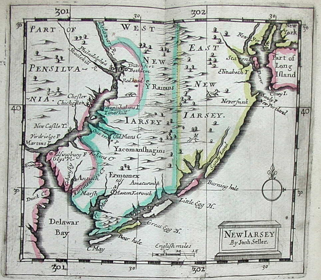
New “Jarsey” and Philadelphia
English mapmaker and “Hydrographer to the King,” John Seller drew this fairly accurate beauty in 1675, as part of his “Atlas Maritimus.” It’s the first time Philadelphia was ever named on a map — and the second time Pennsylvania was — and it shows two separate Jerseys, East and West, along with names like Cape May and Great Egg, still familiar to us today. [MapsofPA]
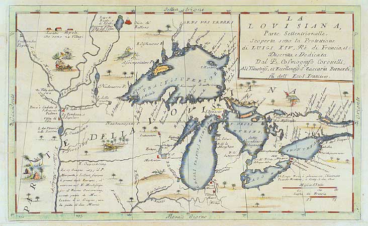
The Great Lakes
Vincenzo Coronelli was a Franciscan Monk and cartographer known in the European courts for making massive, geographically accurate globes. But he was also a mapmaker, and author of the first printed map to show the entire Great Lakes. Of course, they weren’t as perfect as Google Earth’s might be — but for the 1688, this wasn’t half bad. [Great Lakes Maps]
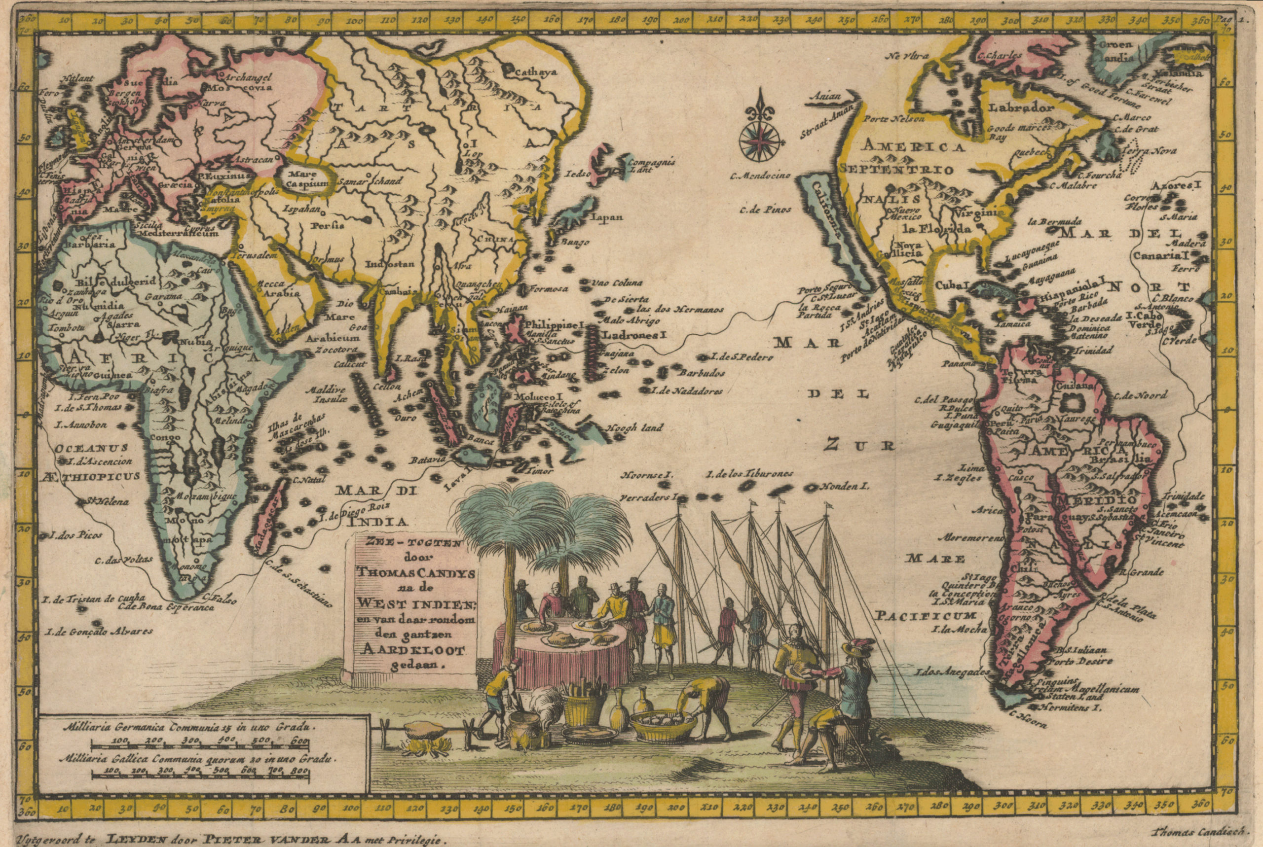
North and South America
A 1707 map by a Dutch cartographer shows, again, the great island of California — as well as some interesting fiction regarding Asia. But pay special attention to America, too, since there are some fascinating details, like how the Great Lakes, here, are one long, massive river that flows through North America from Quebec. [Princeton Library]
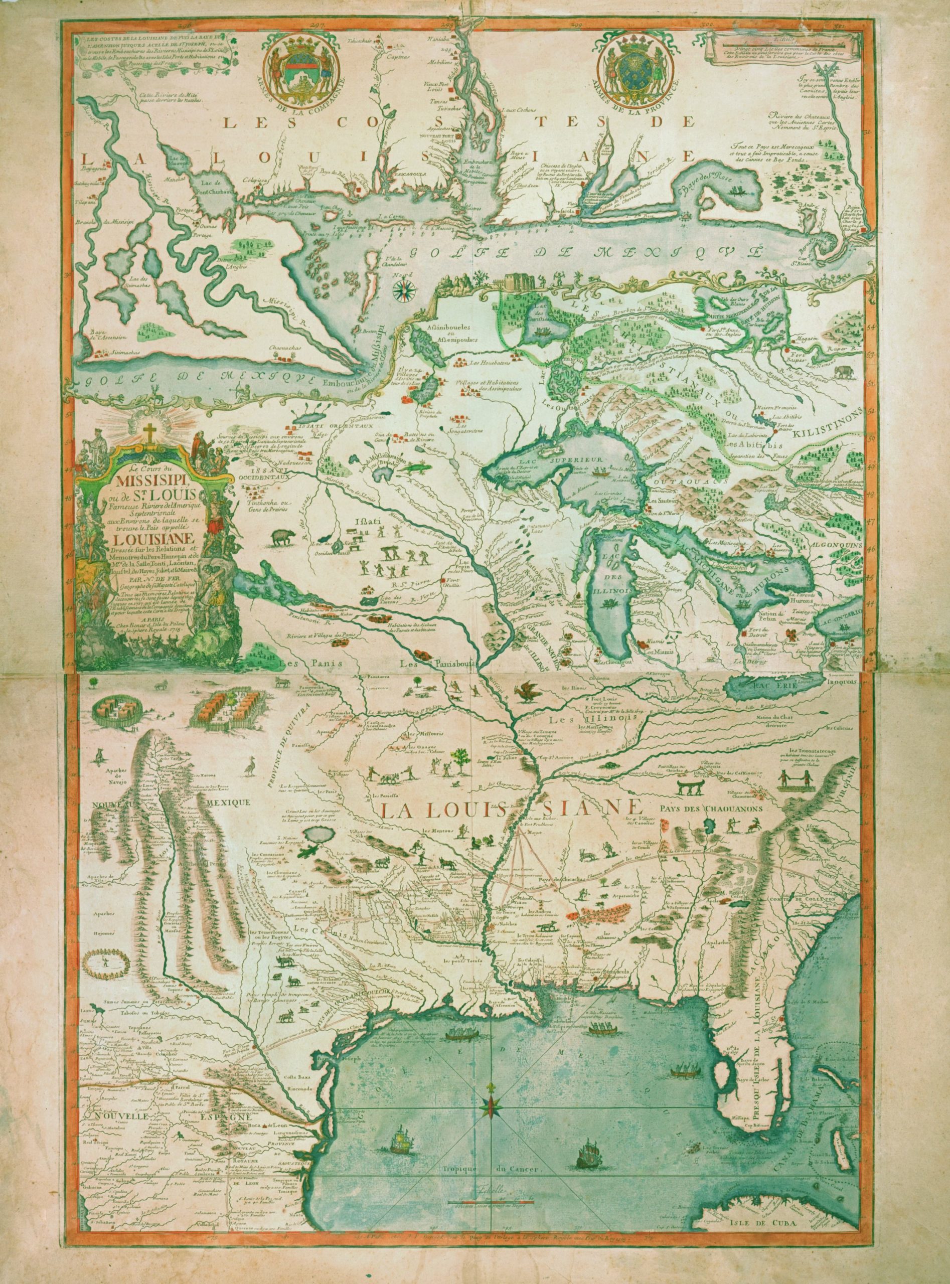
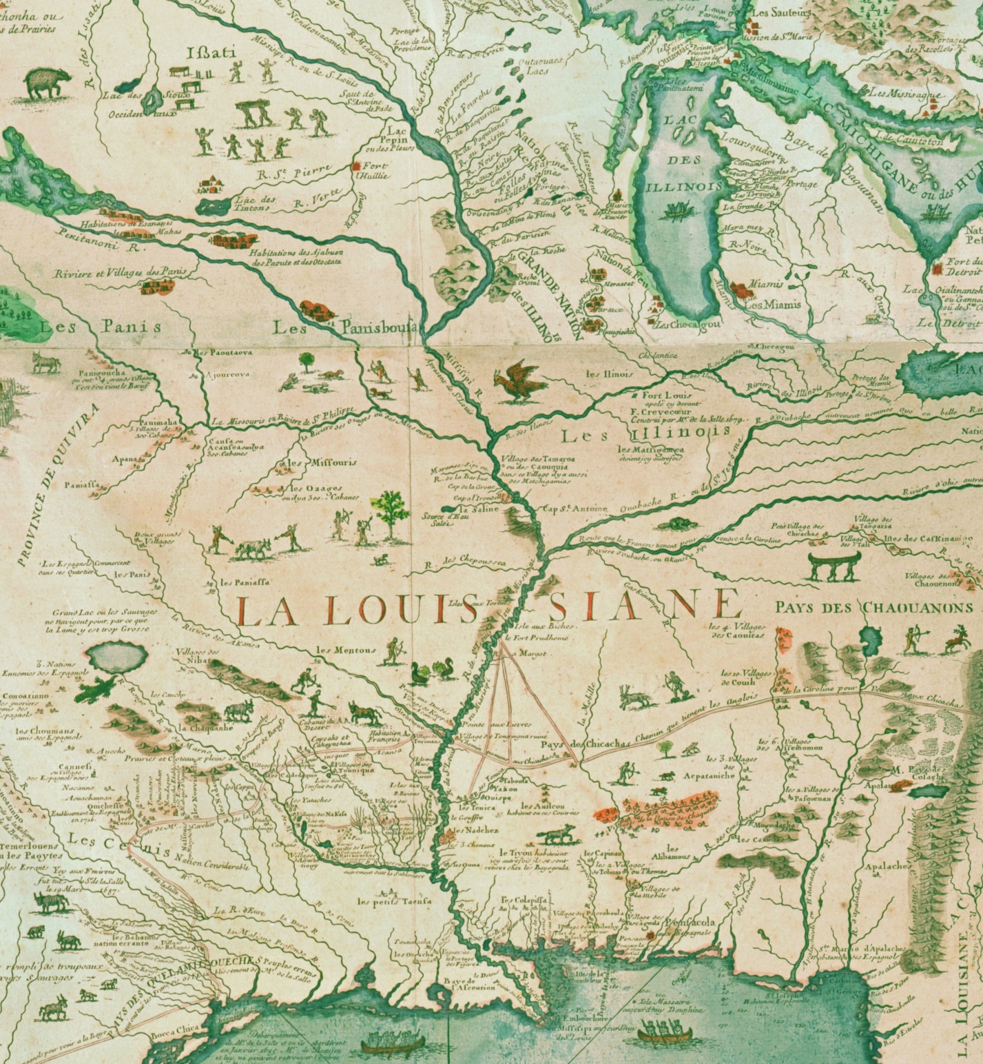
The Great Lakes and Mississippi
A 1718 map called The Course of the Mississippi, or the St. Louis, the famous river of North America shows how one cartographer imagined the Great Lakes and the Mississippi River connecting. This map was made by the Company of the West, which was responsible for the wild economic speculation in the region — in 1720, it became one of the earliest examples of a “burst” economic bubble. This map must’ve been a helpful tool for the company’s attempts at attracting capital. [The Newberry Digital Collection]
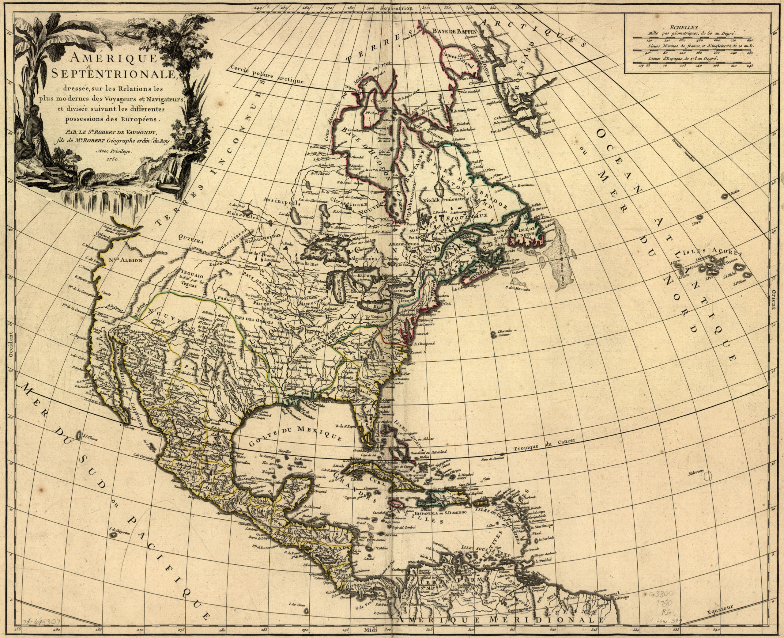
North and Central America
In 1750, California was no longer an island and the true shape of the North American landmass was starting to emerge, though British Columbia and the far north are still uncharted waters. French cartographer Robert de Vaugondy drew this map, which helps to explain the special attention given to modern-day Canada, where the French had special interests. [Princeton Library]
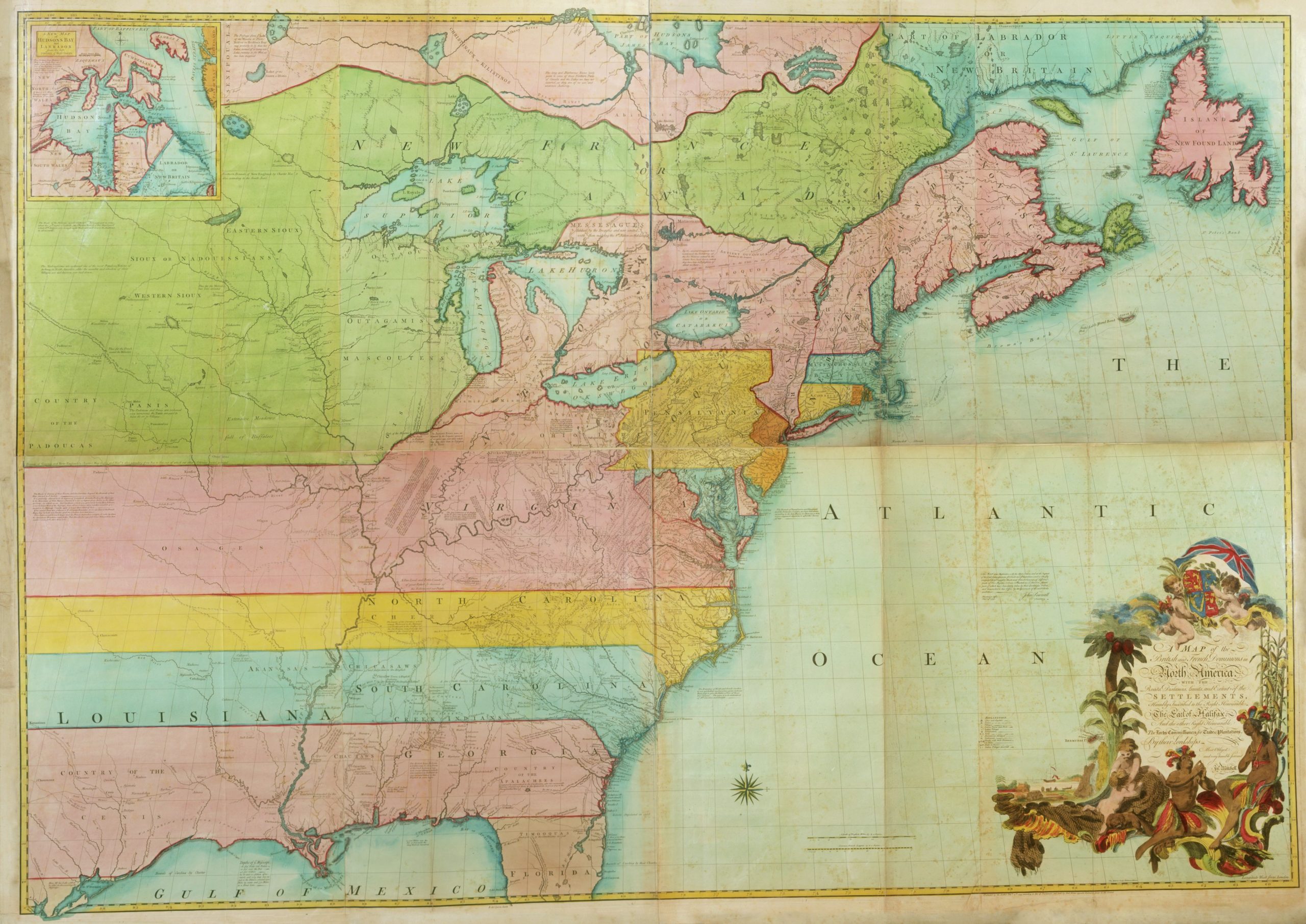
The East Coast
Here’s where things start to look truly modern: A 1755 map of the East Coast, drawn by cartographer John Mitchell, shows the seeds of the modern U.S., including roads and settlements. Of course, the big difference here are the lines that divide it — this map was actually drawn on the eve of the Seven Years’ War with a hidden agenda: To set forth the territorial claims of the British against the French. [The Newberry Digital Collection]
Lead image: Wikimedia Commons.