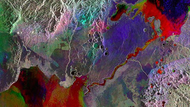
Don’t be fooled by the bright, jovial colours of this satellite image, because it’s hiding a darker truth: the world is being wrenched apart at its seams.
Where the equator runs through Lake George in western Uganda, the the Somali tectonic plate is drifting away from the rest of the African continent, creating the Albertine Rift in the process. This composite satellite images — made up of three radar images taken by the European Space Agency’s Envisat satellite — shows changes of water level in a rainbow of colour. The rift, which forms a valley delivering waters from Lake George in the upper-right-hand corner into Lake Edward, is visible as the bright red streak. [New Scientist]
Picture: ESA
