In the 1880s, San Francisco’s Chinatown was a den of thieves, sin, and debauchery — at least according to the police. To that end, the SFPD set about creating a comprehensive map of the neighbourhood’s vices. But was this effort genuine public service or was it merely an attempt to villainise a rapidly growing minority population?
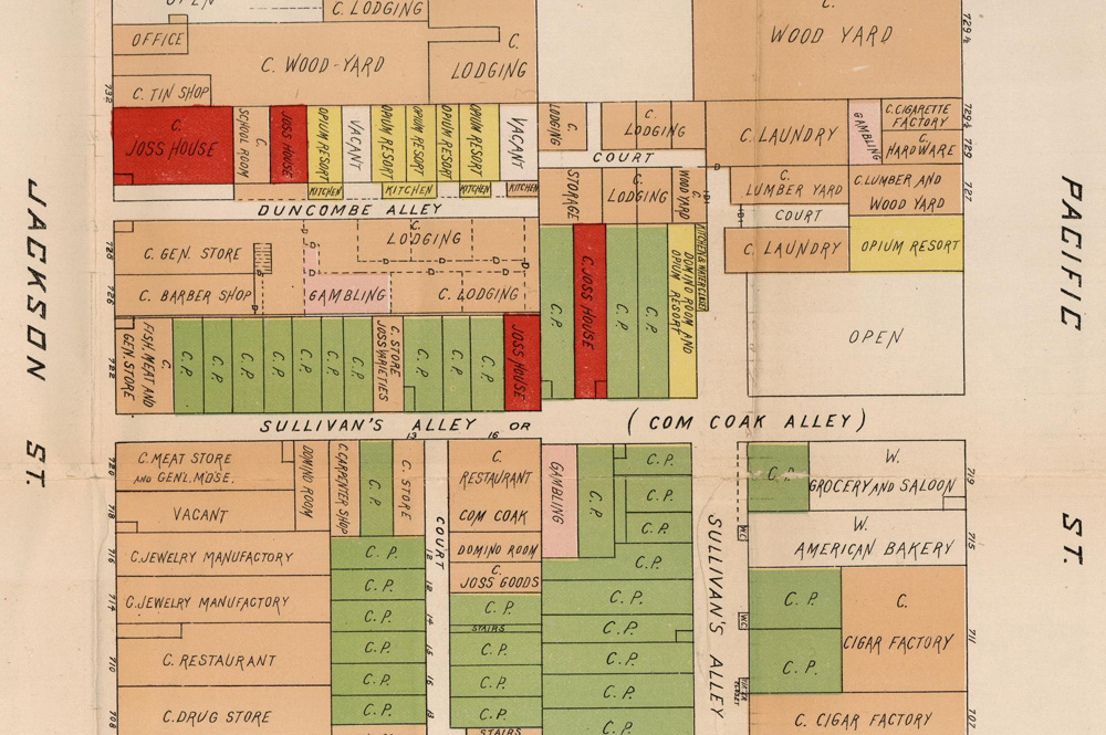
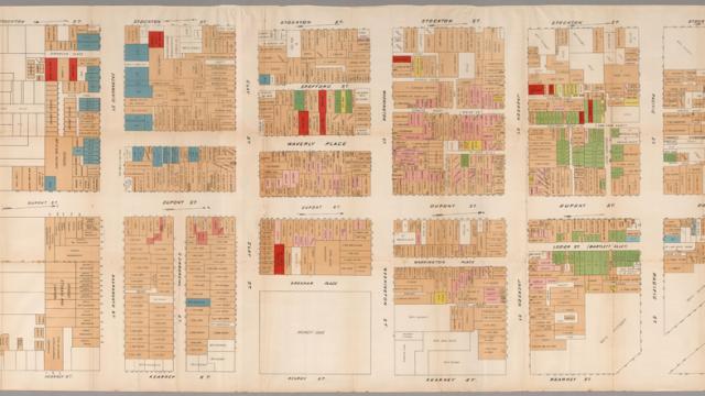
According to historian and map collector David Rumsey, it was far more the latter — a barely concealed attempt by the city’s supervisors to marginalize Chinese immigrants. With the detailed, colour-coded vice map depicting the locations of every opium den, brothel, and gambling parlor, “they were trying to show how depraved the culture was in Chinatown,” Rumsey told Wired. “It’s pretty frightening to read today because it’s so anti-Asian.”
It’s understandable though, in historical context. Anti-asian sentiment ran high during the 1880s, with numerous local ordinances segregating them from white folk as well as the federal Chinese Exclusion Act of 1882 which stopped Chinese laborer immigration outright until 1943. Of course, that doesn’t make it any less reprehensible by today’s standards. Head over to Rumsey’s website to take a closer, zoomable look. [Wired via
SFist]