While the people of Europe bravely set sail during the Age of Discovery — a period stretching from the early 15th century and continuing to the 17th century — it’s easy to forget that very few of the shores onto which they stepped were entirely uninhabited. This map shows the lands that were, until adventurers landed, entirely unexplored by a single human.
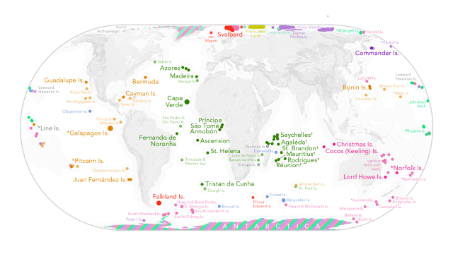
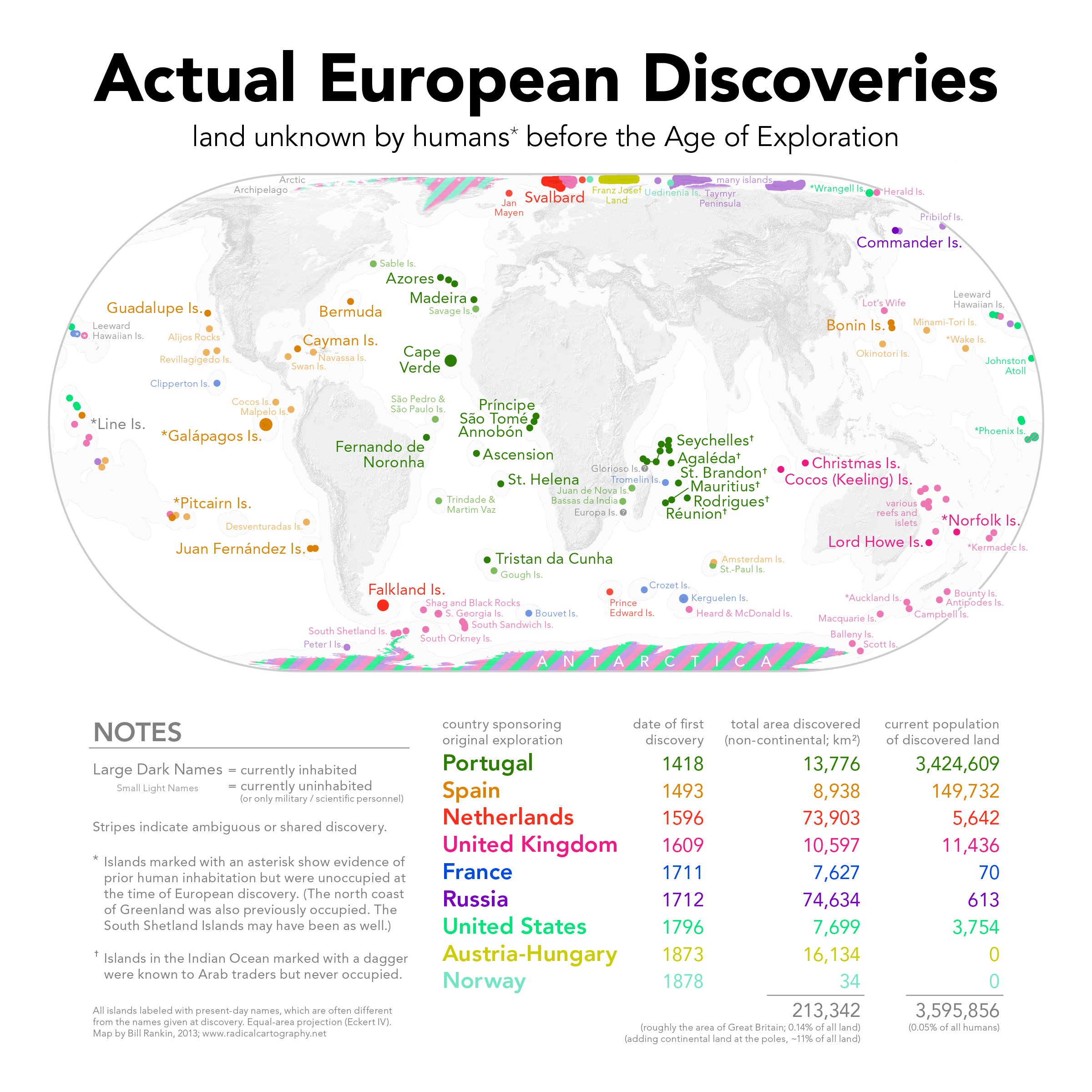
Put together by Bill Rankin over at Radial Cartography, the maps shows the lands that were first seen by human eyes between 1400 and 1900 (you can see the full map, with a full key, below). He explains:
[I]t shows at a glance how the Treaty of Tordesillas split the 16th-century world between the Portuguese and the Spanish; it also shows the dominance of the British in Australasia and south of the Antarctic Convergence. Contrast this with the seemingly random colour patterns in the Arctic, Pacific, and southern Indian Oceans, where aggressive whaling often led to a free-for-all of destructive competition.
Imagine just what it must’ve been like to step off a boat onto truly uncharted land. Amazing. [Radial Cartography via Chart Porn]
